How Wide is Florida?
Florida is the southernmost American state that is surrounded by Georgia, Alabama, the Gulf of Mexico, and Florida Straits. Florida is the third most populous U.S. state with over 21 million inhabitants. It is the eighth most densely populated state (384.3 individuals per square mile). It has the longest shoreline in the U.S. which is about 1,350 miles long minus all its barrier islands. The state has 4,510 islands with ten of them being bigger than an acre.
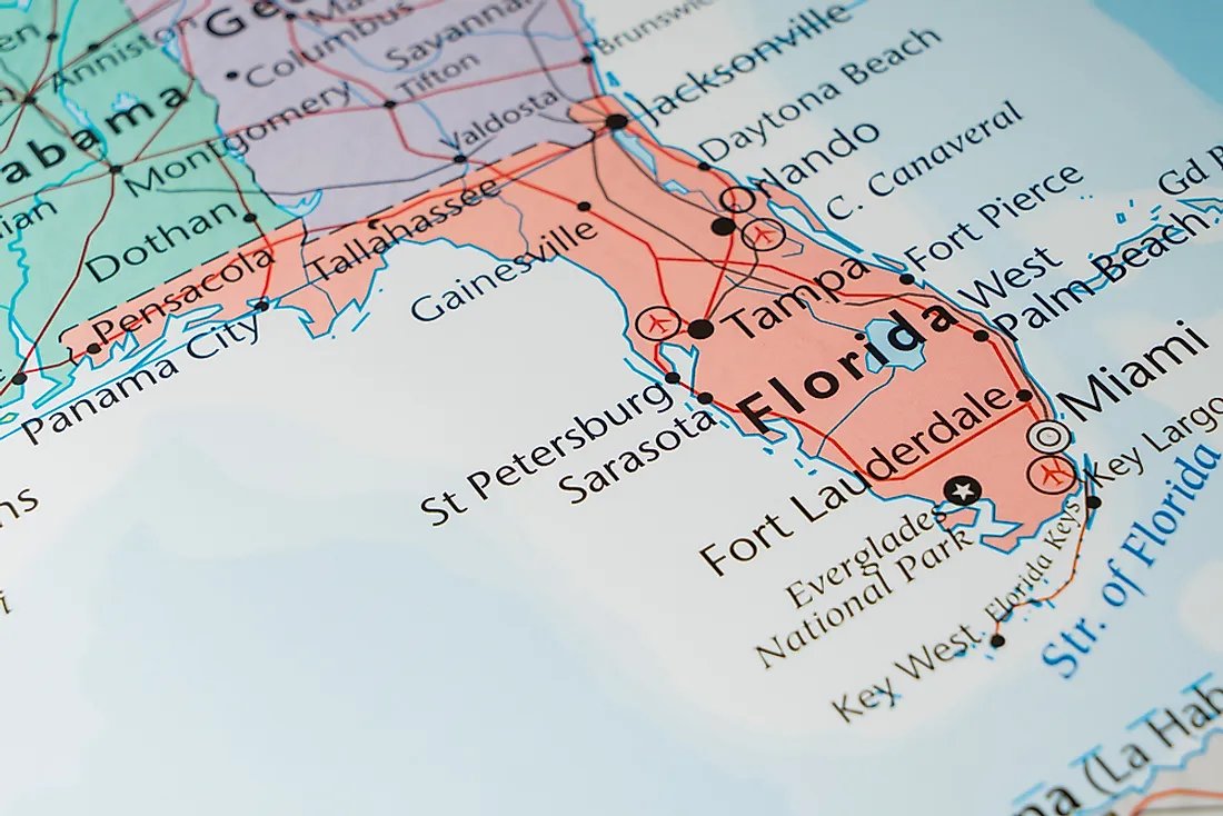
How Wide Is Florida?
Florida is 160 miles wide and 500 miles long at its most distant points. The state line of Florida starts at the Atlantic Ocean and stretches up to the River St Marys. It then extends from the source of St Mary’s River to where river Chattahoochee and River Flint converge. The Florida-Georgia boundary extends through Lake Seminole before merging with the Florida-Alabama boundary. It then stretches due west to River Perdido before running south along River Perdido’s talweg to the gulf.
Geography
Over two-thirds of the state is situated in the peninsula right between Florida Straits and the Mexican Gulf. Florida has two time zones (the Eastern and Central time zones). It is the only American state that borders the Mexican Gulf and the Atlantic Ocean. Florida is the southernmost state of all the forty-eight contiguous American states. It is about 90 miles from Cuba and to the western side of the Bahamas. Florida is the biggest state situated on the east of the Mississippi.
The 345 foot high Britton Hill is the highest mountain in the state, but the lowest highpoint in the United States. A huge percentage of Florida’s terrain is near or at sea level. However numerous cities like Clearwater have some headlands that are about 100 ft above the sea level. The north and central parts of the state have elevations that range in size from 100 ft to 250 ft. The 312 ft Sugarloaf Mountain is the highest point in peninsular Florida. Florida is the flattest state in the United States.
Climate
Even though it is nicknamed the ‘’Sunshine State’’, Florida does experience severe weather. Central Florida is referred to as the American lightning capital. The state has the highest average rainfall per year in the United States. Florida receives afternoon thunderstorms from spring to early autumn. Even though the state has the highest tornadoes per area, the tornadoes which attack Florida don’t reach the intensity of the ones affecting the Great Plains and Midwest.
Hurricanes pose a severe threat in Florida particularly from August to October. It is the most hurricane-prone state in the U.S. especially with the tropical or subtropical water on its long shoreline. The region received 114hurricanes from 1851 to 2006. It is quite rare for a hurricane season to end without at least a tropical storm affecting the state. Florida does not receive measurable snow due to its tropical and subtropical climate, but a combination of freezing temperatures and cold moisture can cause snowfall in the northern parts of Florida including Pensacola, Gainesville, and Jacksonville.


