Maps of Texas
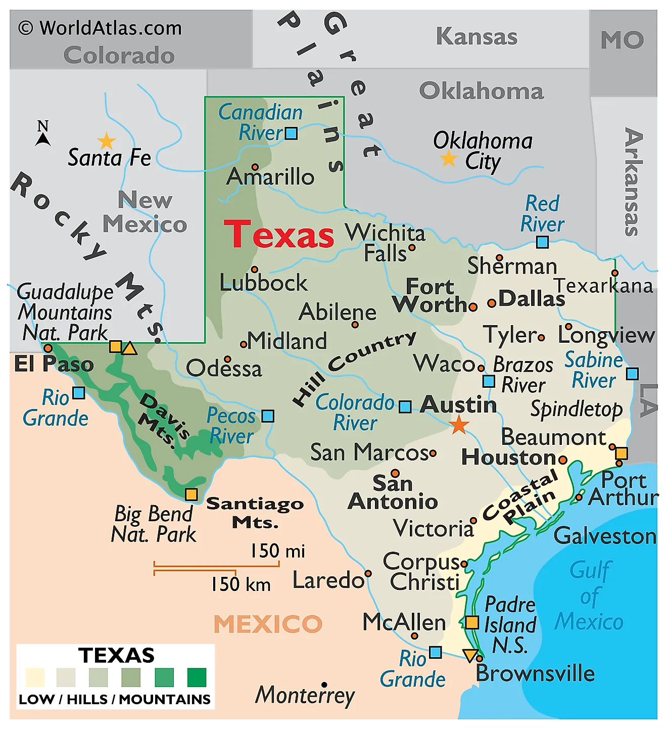
Texas is the second-largest US state in both area and population. It borders New Mexico to the west, Oklahoma to the north, Arkansas to the northeast, and Louisiana to the east. To its southwest lies the country of Mexico, and to the southeast, the Gulf of Mexico. Texas covers a total area of approximately 268,597 square miles (695,662 square kilometers).
Texas is large enough to contain genuinely different worlds. El Paso in the far west sits closer to the Pacific Ocean than to Beaumont on the Louisiana line, and the drive between them crosses desert mountains, high plains, limestone hill country, blackland prairie, and pine forest in turn. The state spans about 800 miles in each direction and covers ten distinct ecological regions. Its geography is best understood as a long ramp tilting down from the northwest — from over 8,700 feet in the Guadalupe Mountains to sea level on the Gulf — interrupted by two great escarpments that divide the state into steps.
Where Is Texas?

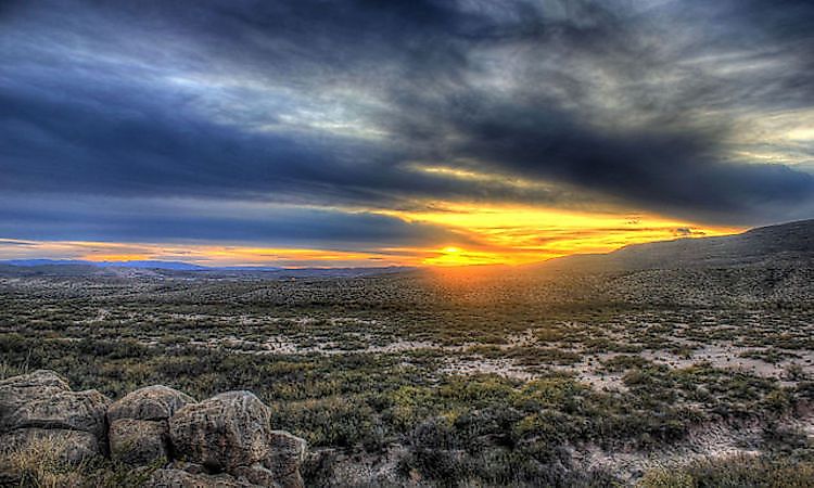
West Texas Landscape near Big Bend.
Texas occupies the south-central United States, where the American South meets the Southwest and the Great Plains meet the Gulf. Its boundaries are a mix of survey lines and rivers: the Red River forms most of the Oklahoma border, the Sabine River most of the Louisiana border, and the Rio Grande the entire 1,254-mile international boundary with Mexico.
With roughly 31.3 million residents, Texas is second only to California in population. It is divided into 254 counties, more than any other state, and its 367 miles of Gulf coastline give it the sixth longest shoreline in the nation.
The Basin and Range Province

The westernmost region, west of the Pecos River and known locally as the Trans-Pecos, is the only genuinely mountainous part of Texas. Isolated fault-block ranges rise abruptly from flat desert basins, a pattern that continues west across New Mexico, Arizona, and Nevada.
Guadalupe Peak, at 8,751 feet (2,667 meters), is the highest point in the state. It and the surrounding Guadalupe Mountains are the exposed portion of an enormous Permian fossil reef, built by sponges and algae in a tropical sea some 265 million years ago and later buried, uplifted, and stripped bare by erosion. Seven Texas summits exceed 8,000 feet, and all of them are in this region.

The Davis Mountains are volcanic in origin and behave as a sky island: high enough to intercept moisture, they carry oak, juniper, and ponderosa pine woodland surrounded on all sides by desert. The clarity and darkness of the night sky here led to the founding of McDonald Observatory.
Everything between the ranges belongs to the Chihuahuan Desert, the largest desert in North America. In the far south, the Rio Grande has cut Santa Elena, Mariscal, and Boquillas canyons up to 1,500 feet deep through limestone, the centerpiece of Big Bend National Park.
The Great Plains

East of the Pecos, the Great Plains province covers the Panhandle and much of west-central Texas. Its northern portion is the High Plains, better known as the Llano Estacado or Staked Plain — one of the largest and flattest tablelands in North America, covering roughly 37,000 square miles with almost no natural relief. Elevations run from about 3,000 to 4,500 feet.
The Llano Estacado ends abruptly on its eastern side at the Caprock Escarpment, a wall of erosion-resistant caliche that stretches some 200 miles south from the Panhandle's northeastern corner and rises as much as 1,000 feet above the country below. This escarpment, not the Cross Timbers, is what separates the Great Plains from the Central Lowland.

Where rivers cut back into the Caprock they have carved dramatic canyons. Palo Duro Canyon, gouged by the Prairie Dog Town Fork of the Red River, runs about 120 miles long and 800 feet deep, making it the second largest canyon in the United States after the Grand Canyon.
The Edwards Plateau and Hill Country

The southern arm of the Great Plains in Texas is the Edwards Plateau, a broad limestone upland covering much of the state's center. It is worth treating separately because it looks nothing like the High Plains above it.
The rock here is Cretaceous limestone, and water has dissolved it into classic karst: caves, sinkholes, disappearing streams, and some of the largest springs in the American Southwest. Beneath it lies the Edwards Aquifer, one of the most productive groundwater systems in the world and the source for San Antonio's water supply. Where streams have cut down into the plateau's eastern and southern margins, the flat upland breaks into the steep, spring-fed valleys known as the Texas Hill Country.

Embedded in the plateau's northeastern corner is the Llano Uplift, a dome of Precambrian granite more than a billion years old exposed where the overlying limestone has eroded away. Enchanted Rock, a pink granite batholith rising 425 feet above the surrounding country, is its best-known landmark and the oldest rock exposed anywhere in Texas.
The Central Lowland

The Central Lowland, also called the North Central Plains, is the Texas end of the interior lowlands that reach north to Canada. It is bounded by the Caprock Escarpment on the west, the Edwards Plateau on the south, the Red River on the north, and the Eastern Cross Timbers on the east. Elevations fall from about 2,200 feet at the Caprock to under 1,000 feet at its eastern edge.
The Cross Timbers are strips of post oak and blackjack oak woodland running north to south through this region, with the open Grand Prairie between them. Note that they mark the Central Lowland's eastern boundary with the Coastal Plain rather than its western boundary with the Great Plains. Early travelers treated the Cross Timbers as the practical edge of settled country, and Fort Worth still bills itself as "where the West begins."
Much of the region is the Rolling Plains, a stairstep landscape of red clay, gypsum, and sandstone cuestas worn into mesquite savanna and rangeland.
The Coastal Plain

The Gulf Coastal Plain is the largest region in Texas, covering roughly the eastern and southeastern third of the state. Its inland boundary is the Balcones Escarpment — a fault zone several miles wide that curves across the state from Del Rio northeast through San Antonio and Austin and on toward the Red River. This escarpment is the Coastal Plain's western edge, separating it from the Edwards Plateau, rather than a feature within it. Near Del Rio it stands about 1,000 feet high; by San Antonio and Austin it has dropped to roughly 300 feet.
The plain is far from uniform. The Blackland Prairie just east of the escarpment has deep, dark, clay-rich soils that made it the state's original cotton belt. Farther east lies the Piney Woods, a southern pine and hardwood forest continuous with those of Louisiana and Arkansas, holding Big Thicket National Preserve. South of San Antonio, the South Texas Plains grade into semi-arid brush country, and the Rio Grande Valley at the state's southern tip is subtropical.

Nearest the shore, the land flattens into marsh, prairie, and a chain of shallow bays — Galveston, Matagorda, San Antonio, Corpus Christi, and the long, hypersaline Laguna Madre. The state's lowest point is sea level along the Gulf.
The Gulf Coast and Barrier Islands

A nearly unbroken chain of barrier islands shelters the Texas coast, separated from the mainland by shallow lagoons. Padre Island is the longest barrier island in the world at about 113 miles, and roughly 70 miles of it are protected as Padre Island National Seashore — the largest undeveloped stretch of barrier island left anywhere.

Behind Padre Island lies the Laguna Madre, one of only a handful of hypersaline lagoons on earth — evaporation exceeds freshwater inflow, so the water is saltier than the open Gulf. Matagorda, Mustang, Galveston, and Bolivar complete the chain. These islands are low and mobile, and they absorb the first force of the hurricanes that regularly strike this coast.
Rivers

Nearly every Texas river runs northwest to southeast, following the state's tilt toward the Gulf. The Rio Grande is the longest, running about 1,900 miles from Colorado to the sea and forming the entire border with Mexico; the Pecos is its major Texas tributary.
The Colorado River of Texas — a completely separate river from the Colorado of the Southwest — runs about 862 miles and is the longest river lying entirely within a single state outside Alaska. The Brazos is comparable in length and drains the largest basin in the state. The Trinity, rising near Dallas and emptying into Galveston Bay, is the longest river with both its source and mouth in Texas.
The Red River, Sabine, Nueces, Guadalupe, San Antonio, and Canadian round out the major systems. Because rainfall drops sharply from east to west, the eastern rivers run year-round while many western streams are intermittent.
Lakes and Reservoirs

Texas has only one significant natural lake. Caddo Lake, on the Louisiana border, formed behind a massive natural log jam on the Red River known as the Great Raft; when the jam was cleared in the 19th century the lake drained, and it is now maintained by a dam. Its flooded bald cypress forest, draped in Spanish moss, is unlike anything else in the state.
Everything else is artificial — roughly 190 major reservoirs, built largely between the 1940s and 1970s for water supply and flood control. Toledo Bend Reservoir, on the Sabine, is the largest at about 185,000 acres, though it is shared with Louisiana and is the biggest reservoir in the American South.

Sam Rayburn Reservoir, on the Angelina River, is the largest lake entirely within Texas at roughly 114,500 acres. Lake Texoma, on the Red River, is shared with Oklahoma, and the Highland Lakes chain on the Colorado — Buchanan, Inks, LBJ, Marble Falls, Travis, and Austin — supplies central Texas.
Climate

Guadalupe Mountains National Park, Texas.
No single climate describes Texas. The state spans humid subtropical conditions in the east, semi-arid steppe through the centre, and true arid desert in the far west. The controlling factor is a rainfall gradient that falls almost perfectly from east to west: over 60 inches a year in the Piney Woods near the Louisiana line, about 32 inches at Dallas, 20 inches at Midland, and under 10 inches at El Paso. That is a sixfold difference within one state.
Texas is also among the most hazard-prone states in the country. It records more tornadoes annually than any other, averaging around 130 to 150, with the northern and central portions falling within Tornado Alley. The Gulf Coast is struck regularly by hurricanes, and Hurricane Harvey in 2017 dropped over 60 inches of rain near Nederland — the greatest total ever recorded from a single tropical system in the continental United States. Drought is the counterweight: the western two-thirds of the state is chronically short of water.
Texas Geography at a Glance
| Feature | Detail |
|---|---|
| Total area | Approx. 268,597 sq mi (695,662 sq km) — 2nd largest state |
| Dimensions | Roughly 800 mi north-south and east-west |
| Highest point | Guadalupe Peak, 8,751 ft (2,667 m) |
| Lowest point | Gulf of Mexico, sea level |
| Bordering states | New Mexico, Oklahoma, Arkansas, Louisiana |
| International border | Mexico, 1,254 mi along the Rio Grande |
| Coastline | Approx. 367 mi on the Gulf of Mexico |
| Major regions | Four, west to east: Basin and Range, Great Plains, Central Lowland, Coastal Plain |
| Key escarpments | Caprock (Great Plains / Central Lowland); Balcones (Edwards Plateau / Coastal Plain) |
| Largest reservoir | Toledo Bend, approx. 185,000 acres (shared with Louisiana) |
| Natural lakes | Caddo Lake only |
| Counties | 254 — most of any state |
Counties Map
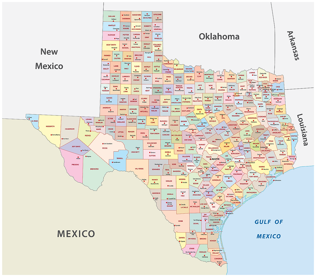
The State of Texas is divided into 254 counties. In alphabetical order, these counties are: Anderson, Andrews, Angelina, Aransas, Archer, Armstrong, Atascosa, Austin, Bailey, Bandera, Bastrop, Baylor, Bee, Bell, Bexar, Blanco, Borden, Bosque, Bowie, Brazoria, Brazos, Brewster, Briscoe, Brooks, Brown, Burleson, Burnet, Caldwell, Calhoun, Callahan, Cameron, Camp, Carson, Cass, Castro, Chambers, Cherokee, Childress, Clay, Cochran, Coke, Coleman, Collin, Collingsworth, Colorado, Comal, Comanche, Concho, Cooke, Coryell, Cottle, Crane, Crockett, Crosby, Culberson, Dallam, Dallas, Dawson, De Witt, Deaf Smith, Delta, Denton, Dickens, Dimmit, Donley, Duval, Eastland, Ector, Edwards, El Paso, Ellis, Erath, Falls, Fannin, Fayette, Fisher, Floyd, Foard, Fort Bend, Franklin, Freestone, Frio, Gaines, Galveston, Garza, Gillespie, Glasscock, Goliad, Gonzales, Gray, Grayson, Gregg, Grimes, Guadalupe, Hale, Hall, Hamilton, Hansford, Hardeman, Hardin, Harris, Harrison, Hartley, Haskell, Hays, Hemphill, Henderson, Hidalgo, Hill, Hockley, Hood, Hopkins, Houston, Howard, Hudspeth, Hunt, Hutchinson, Irion, Jack, Jackson, Jasper, Jeff Davis, Jefferson, Jim Hogg, Jim Wells, Johnson, Jones, Karnes, Kaufman, Kendall, Kenedy, Kent, Kerr, Kimble, King, Kinney, Kleberg, Knox, La Salle, Lamar, Lamb, Lampasas, Lavaca, Lee, Leon, Liberty, Limestone, Lipscomb, Live Oak, Llano, Loving, Lubbock, Lynn, Madison, Marion, Martin, Mason, Matagorda, Maverick, McCulloch, McLennan, McMullen, Medina, Menard, Midland, Milam, Mills, Mitchell, Montague, Montgomery, Moore, Morris, Motley, Nacogdoches, Navarro, Newton, Nolan, Nueces, Ochiltree, Oldham, Orange, Palo Pinto, Panola, Parker, Parmer, Pecos, Polk, Potter, Presidio, Rains, Randall, Reagan, Real, Red River, Reeves, Refugio, Roberts, Robertson, Rockwall, Runnels, Rusk, Sabine, San Augustine, San Jacinto, San Patricio, San Saba, Schleicher, Scurry, Shackelford, Shelby, Sherman, Smith, Somervell, Starr, Stephens, Sterling, Stonewall, Sutton, Swisher, Tarrant, Taylor, Terrell, Terry, Throckmorton, Titus, Tom Green, Travis, Trinity, Tyler, Upshur, Upton, Uvalde, Val Verde, Van Zandt, Victoria, Walker, Waller, Ward, Washington, Webb, Wharton, Wheeler, Wichita, Wilbarger, Willacy, Williamson, Wilson, Winkler, Wise, Wood, Yoakum, Young, Zapata, and Zavala.
With an area of 695,662 sq. km, Texas is the 2nd largest state in the USA by both population and area. Located in central Texas, at the foot of the Balcones Escarpment on the Colorado River, is Austin – the capital city of Texas. It serves as the administrative center of the state and a major cultural and technology hub. Situated in the southeastern part of the state is Houston – the most populous city in Texas and the economic center of the state. One of the most ethnically diverse cities in the United States, it is home to NASA's Johnson Space Center, the agency's hub for human spaceflight training and mission control, alongside its official visitor center, Space Center Houston. Houston is also one of only a few US cities with permanent resident companies in all major performing arts disciplines.
Where is Texas?
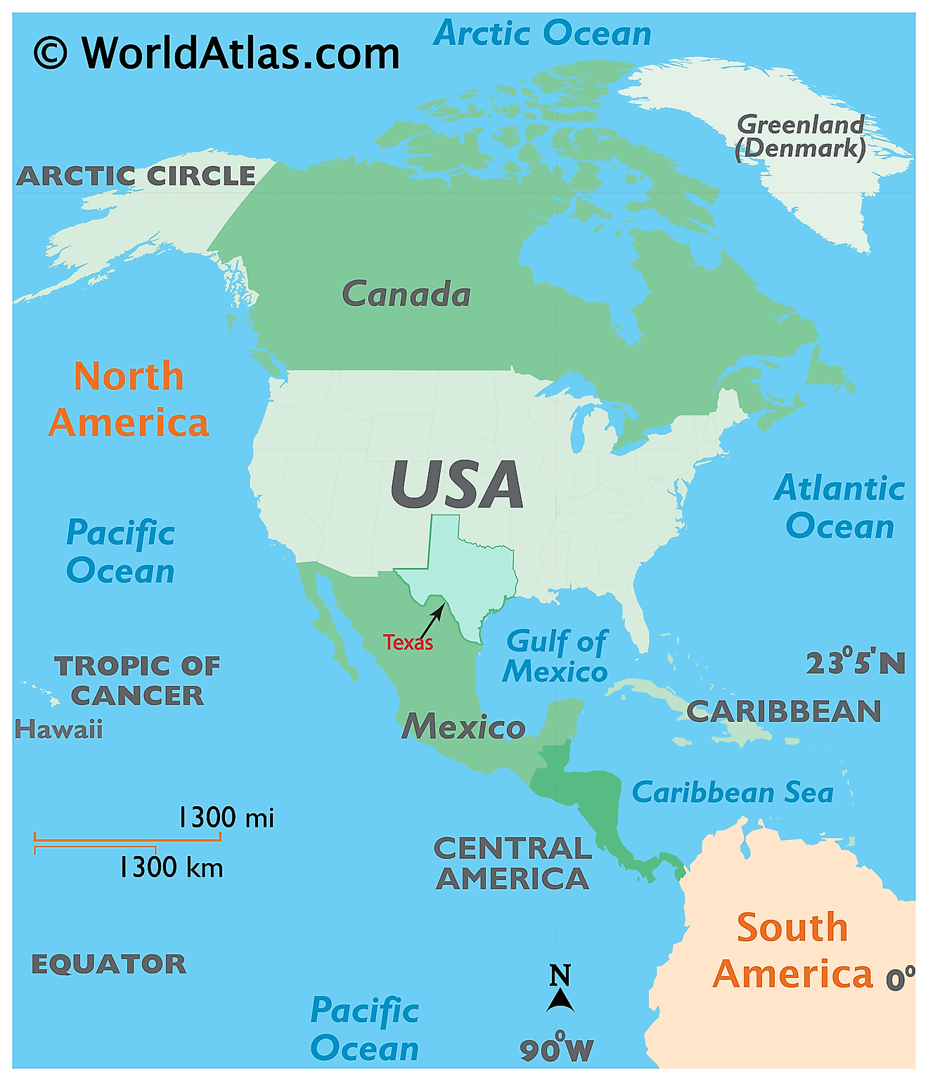
The State of Texas is located in the southern Gulf-coast region of the United States. Texas is bordered by the state of Oklahoma in the north, by Arkansas in the northeast, by Louisiana in the east, by New Mexico in the west, and by the Mexican states (Coahuila, Chihuahua, Nuevo León, and Tamaulipas) in the south and southwest. It is also bounded by the crescent-shaped coastline of the Gulf of Mexico in the southeast.
Regional Maps: Map of North America
Outline Map of Texas
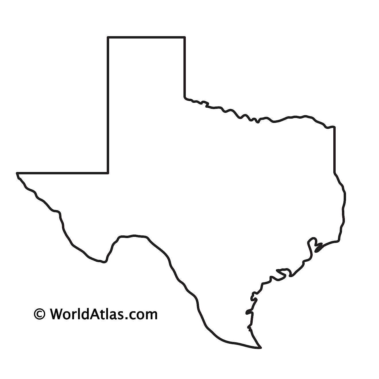
The above blank map represents the State of Texas, located in the southern Gulf-coast region of the United States. The above map can be downloaded, printed and used for geography education purposes like map-pointing and coloring activities.
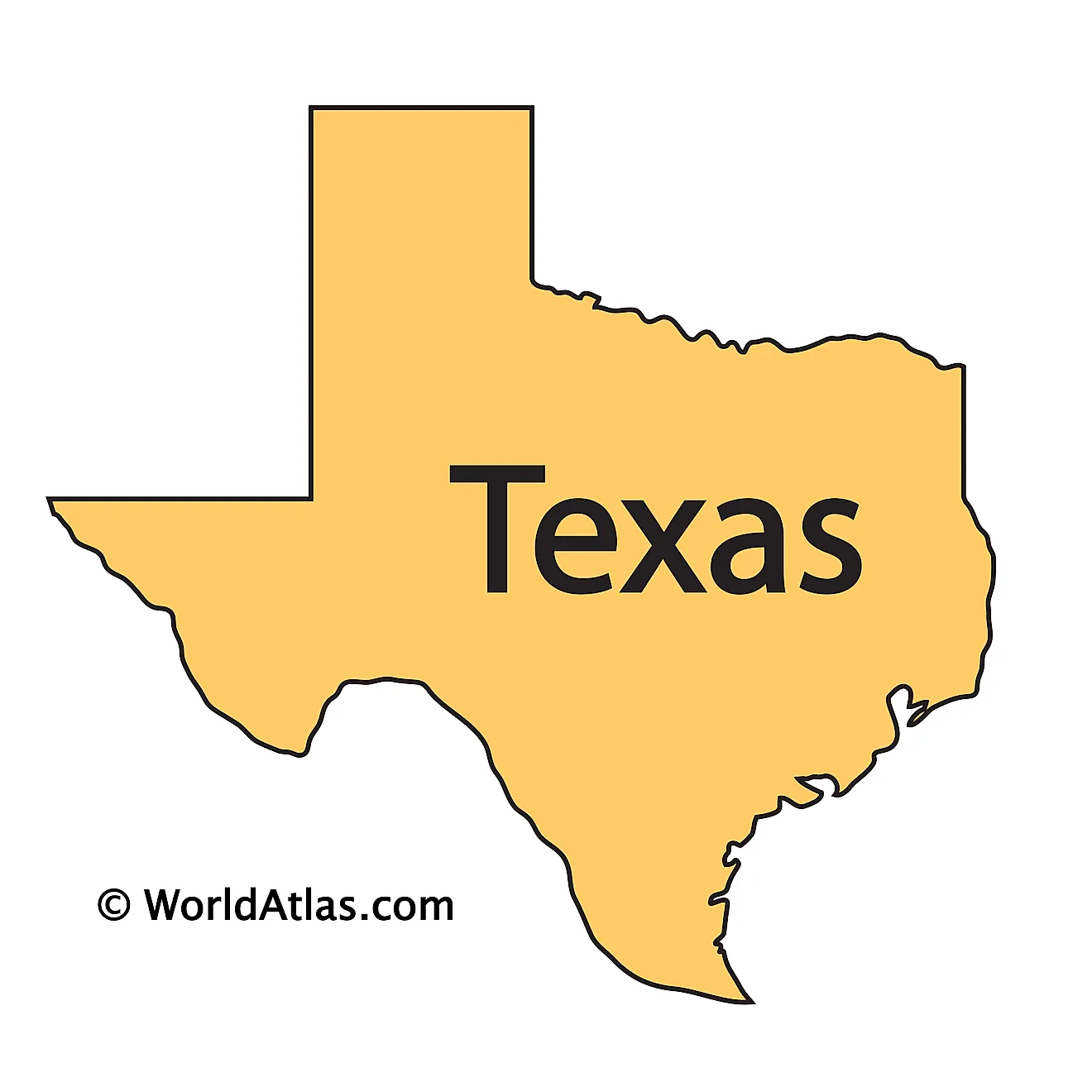
The above outline map represents the State of Texas, located in the southern Gulf-coast region of the United States. Texas has been nicknamed as the "Lone Star State".
Key Facts
| Legal Name | State of Texas |
|---|---|
| ISO 3166 Code | US-TX |
| Capital City | Austin |
| Major Cities |
|
This page was last updated on September 17, 2026