Maps of Vanuatu
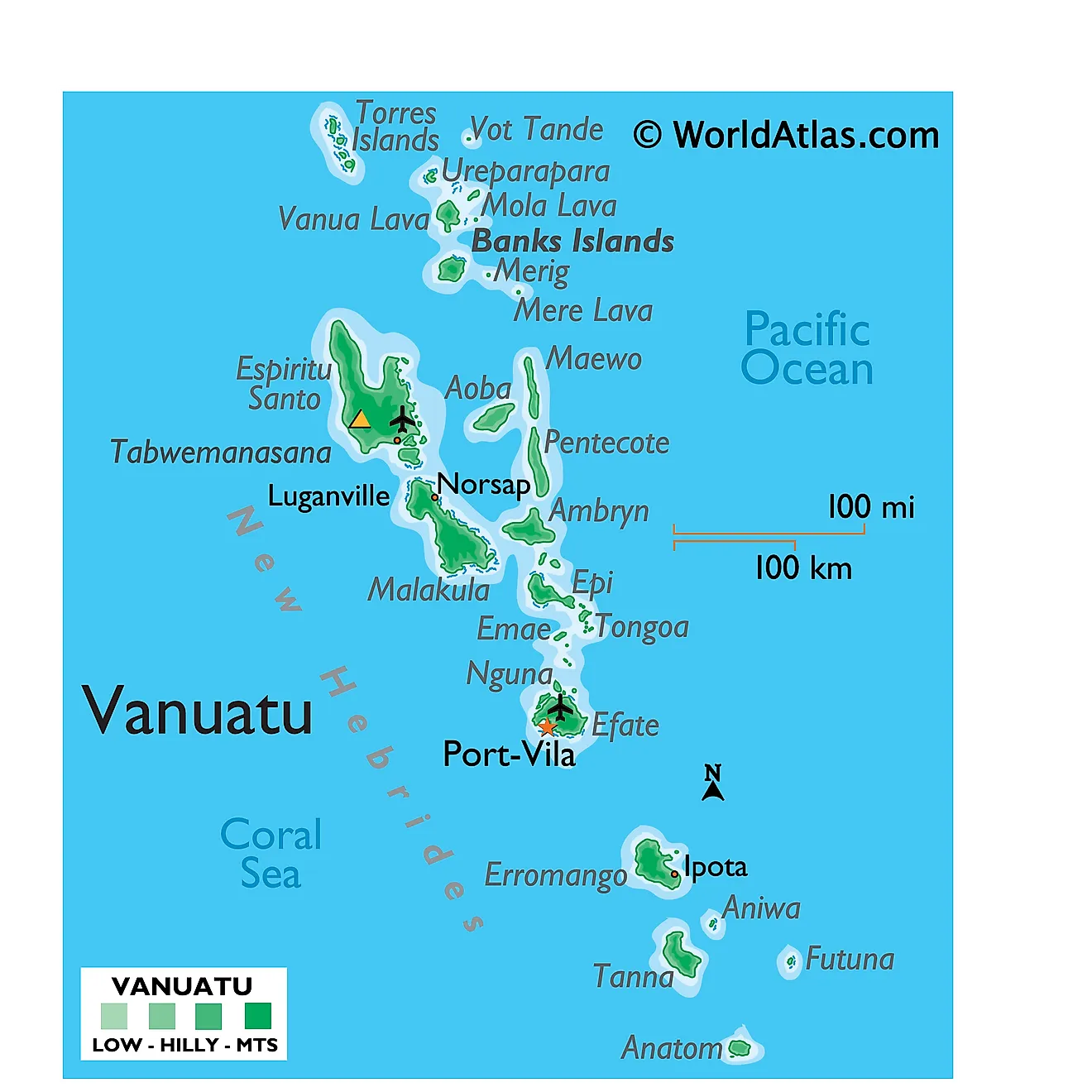
Covering a total land area of 12,189 sq.km (4,706 sq mi), Vanuatu is a Melanesian archipelago comprising of a double chain of 13 principal (larger islands) and about 70 smaller islands located in the South Pacific Ocean as observed on the physical map of Vanuatu above.
The terrain of Vanuatu is diverse and is famed for its gorgeous islands and active volcanoes. Most islands have rugged mountains and are volcanic in origin (some active), mainly covered in lush dense rainforests. Many islands are protected by offshore coral reefs. The highest point is Tabwémasana, located on Espiritu Santo – the largest island, at an elevation of 6,165ft (1,879m). The point is marked on the map above by a yellow triangle. The lowest point is the South Pacific Ocean (0m).
Provinces of Vanuatu Map
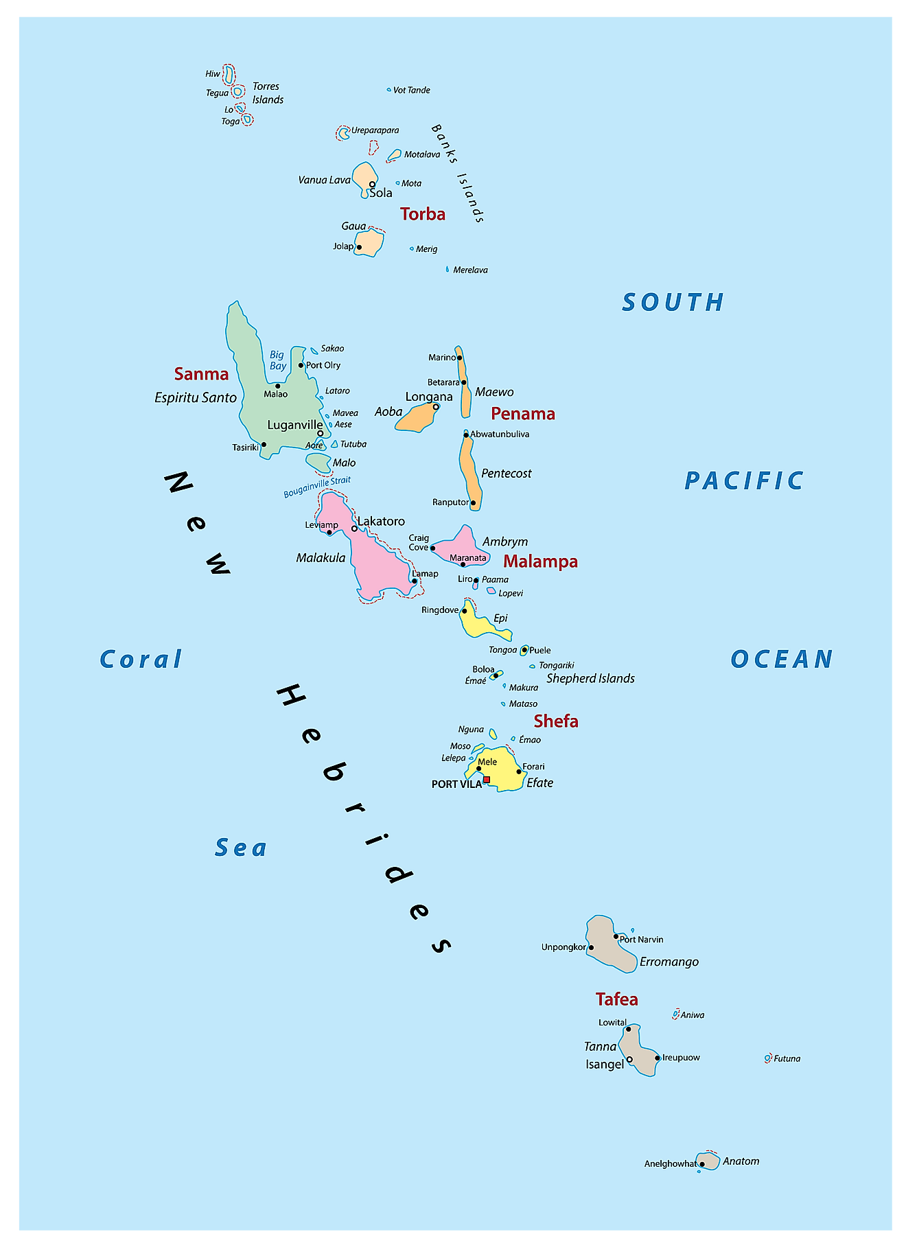
Vanuatu (officially, the Republic of Vanuatu) is divided into 6 provinces. These provinces are: Malampa, Penama, Sanma, Shefa, Tafea and Torba. These provinces are further subdivided into municipalities.
Covering a total land area of 12,189 sq.km, Vanuatu is a Melanesian archipelago comprising of a double chain of 13 principal (larger islands) and about 70 smaller islands located in the South Pacific Ocean. Located on the southern coast of Efate Island in the Shefa province is Port Vila – the capital and the largest city of Vanuatu. It is the administrative, commercial and economic center of Vanuatu. Port Vila also serves as an active commercial port of the island country.
Where is Vanuatu?
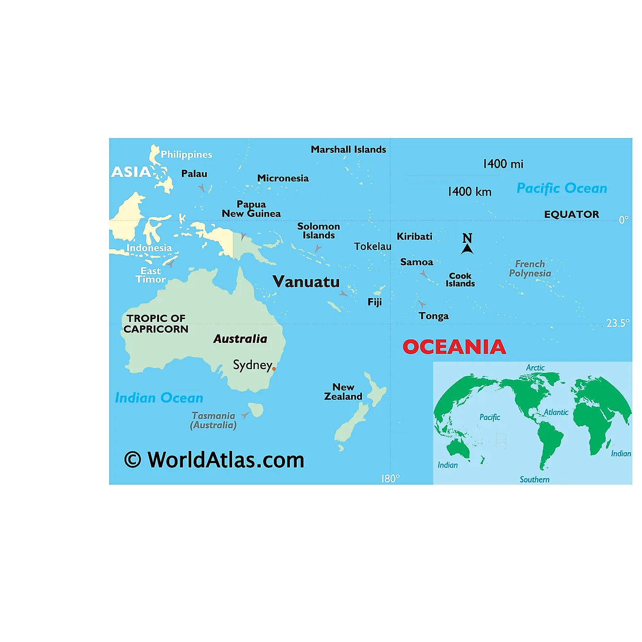
Vanuatu is a sovereign island nation and a Melanesian archipelago comprising of a total of 83 large and small islands, located in the South Pacific Ocean. It is geographically positioned in the Southern and Eastern hemispheres of the Earth. Vanuatu is situated to the east of Northern Australia, to the north-east of New Caledonia, to the west of Fiji and to the south of Solomon Islands.
Regional Maps: Map of
Outline Map of Vanuatu
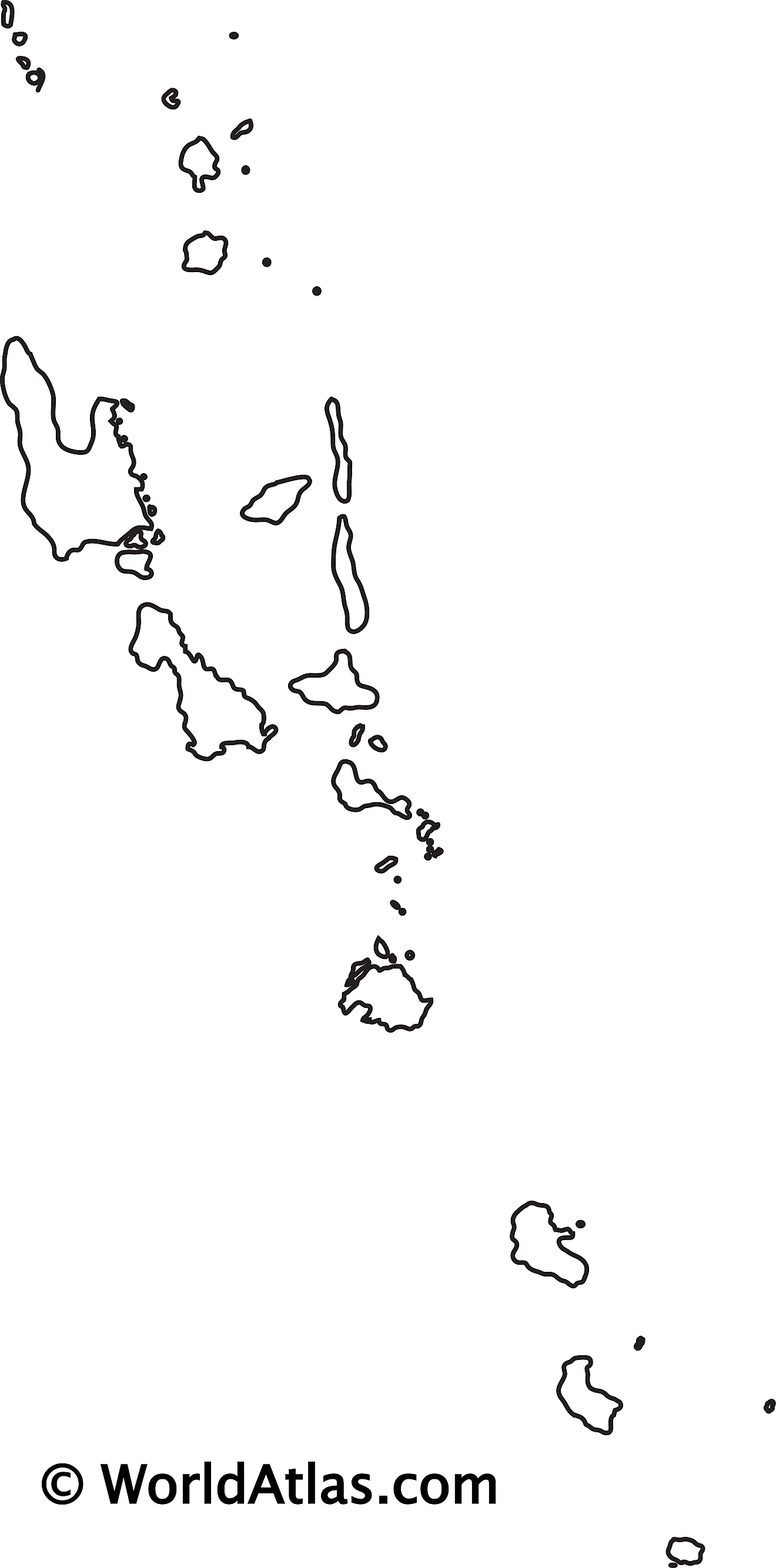
The above blank map represents Vanuatu - a sovereign island nation and a Melanesian archipelago comprising of a total of 83 large and small islands, located in the South Pacific Ocean. The above map can be downloaded, printed and used for geography education purposes like map-pointing and coloring activities.
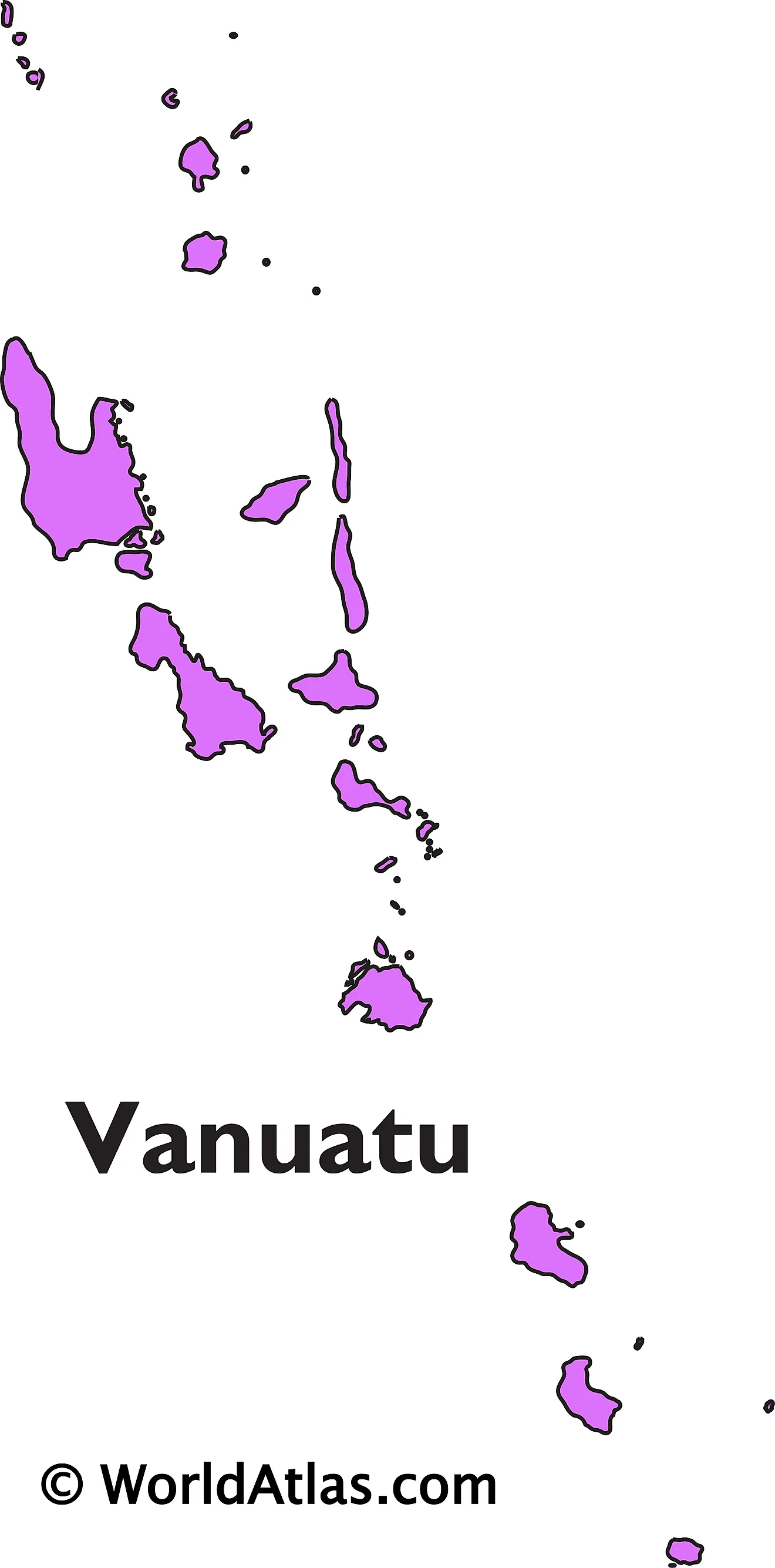
The above outline map represents Vanuatu - a sovereign island nation and a Melanesian archipelago comprising of a total of 83 large and small islands, located in the South Pacific Ocean. The islands extend for 650km north-south in an irregular Y shape.
Key Facts
| Legal Name | Republic of Vanuatu |
|---|---|
| Flag |
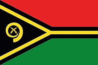
|
| Capital City | Port-Vila (on Efate) |
| 17 44 S, 168 19 E | |
| Total Area | 12,189.00 km2 |
| Land Area | 12,189.00 km2 |
| Water Area | N/A |
| Population | 299,882 |
| Currency | Vatu (VUV) |
| GDP | $917.06 Million |
| GDP Per Capita | $3,058.07 |
This page was last updated on November 23, 2020
