- Coastline:
1,560 miles (2,512 km)
- Land Area:
(land) 87,806 sq miles (227,416 sq km)
(water) 3,943 sq miles (10,213 sq km)
(TOTAL) 91,749 sq miles (237,629 sq km)
To convert sq km (kilometers) to sq mi (miles)
use our converter - Land Area: (all countries)
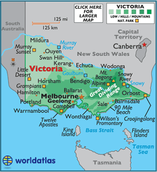
- Land Divisions: There are 37 counties in Victoria.
- Horizontal Width: 354.91 miles (571.17 km) from Hamilton east to Orbost
- Vertical Length: 215.73 miles (347.19 km) from Swan Hill south to Warnambool
Note: Lengths and widths are point-to-point,
straight-line measurements from a Mercator map projection, and will vary
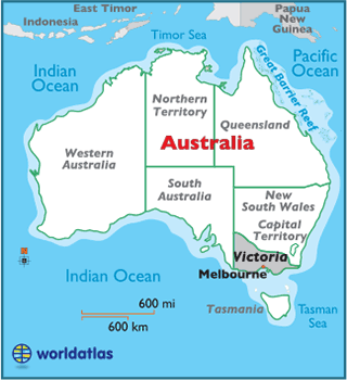
some using other map projections - Bordering States/Territories: (2) South Australia, New South Wales
- Geographic Center: About 52.38 miles (84.29 km) southeast of Bendigo
- Highest Point: Mount Bogong 6,516 ft (1,986 m)
- Lowest Point: Bass Strait 0 m
- Latitude and Longitude
- Relative Location