Victoria
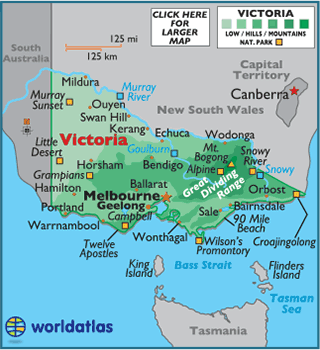
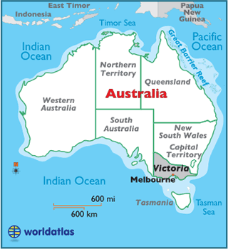
Victoria is the southernmost mainland state of Australia, and is comparable in size to the U.S. state of Utah.
The Great Dividing Range and surrounding uplands dominate the eastern half of the state, while the western and northwest portions are mostly flat with extensive semi-arid plains.
Major rivers of Victoria include the Goulburn, Snowy and Murray Rivers, with the Murray making up almost the entire northern border of the state, separating it from New South Wales.
The Murray rises in the Australian Alps and flows 1,200 miles (1,930 km) to the Spencer Gulf, directly west of Adelaide. It's the longest river in Australia and is a vital source of irrigation for the country's major agricultural industries.
Within the Great Dividing Range stands Mount Bogong, Victoria's highest peak at 6,516 ft (1,986 m).
In a part of Port Campbell National Park, just off the coastline, stands a collection of limestone stacks known as the Twelve Apostles. Created by years of erosion, the tallest stack now measures some 147 ft. (45 m) in height. Unfortunately, a few have collasped over time so today there are only nine stacks remaining.
The lowest point of Victoria is the Bass Strait (0 m).


