Maps of Maryland
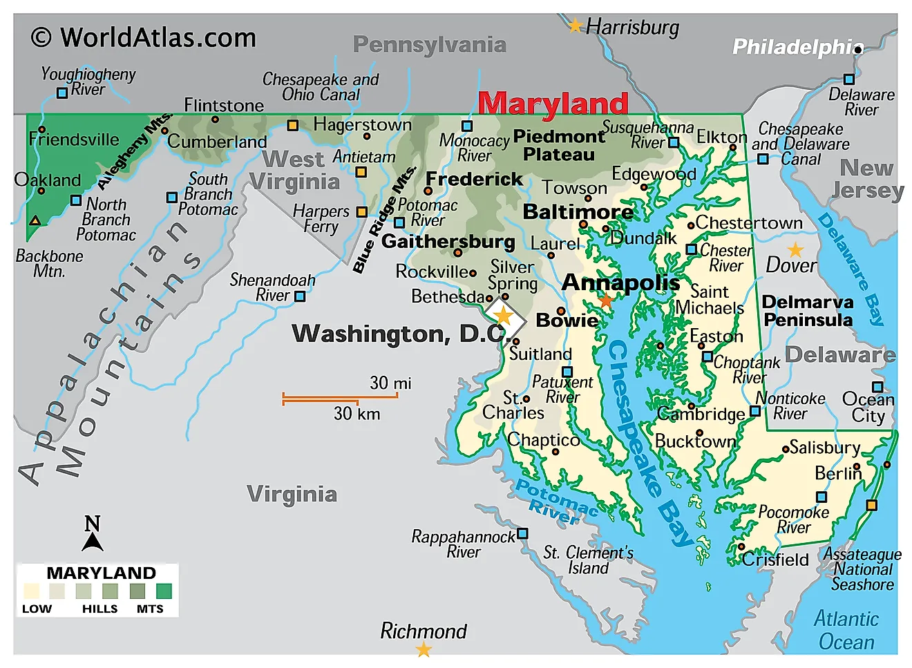
Maryland is a state on the Atlantic seaboard of the eastern United States. It shares borders with Pennsylvania to the north along the Mason-Dixon Line, Delaware to the east, Virginia to the south and southwest across the Potomac River, and West Virginia to the west and southwest. It also wraps around Washington, D.C. on three sides, with the Atlantic Ocean at its southeastern corner. The state's total area is 12,407 square miles (32,133 square kilometers), making it the 42nd largest state and the ninth smallest.

Maryland is sometimes called "America in Miniature," and the nickname is earned. In roughly 200 miles from west to east, the state crosses five distinct physiographic provinces — from Appalachian highlands above 3,000 feet, through folded ridges and rolling piedmont, down to tidal marsh and barrier beach. Few states compress so much variety into so little ground, and the Chesapeake Bay nearly cuts the whole thing in half.
Where Is Maryland?

Maryland stretches about 200 miles east to west but only about 120 miles north to south at its widest. Its shape is famously irregular. Near the town of Hancock in the west, the distance between the Pennsylvania line and the Potomac River narrows to under two miles — the state's slimmest point, and a near-miss that almost split Maryland into two disconnected pieces when Mason and Dixon ran their survey in the 1760s.
With roughly 6.27 million residents, Maryland is the 19th most populous state and the fifth most densely settled. Annapolis, on the western shore of the Chesapeake, is the capital and home to the United States Naval Academy; Baltimore is by far the largest city. The state is divided into 23 counties plus the independent Baltimore City.
The Appalachian Plateaus

Westernmost Maryland sits on the Allegheny Mountain section of the Appalachian Plateaus, a high tableland that streams have dissected into steep-sided ridges and deep hollows. Despite the rugged appearance, the underlying rock layers were lifted almost flat rather than folded, which is what distinguishes a plateau from a true mountain range.
Hoye-Crest, on Backbone Mountain in Garrett County near the West Virginia line, is the highest point in Maryland at 3,360 feet (1,024 meters). Garrett County is also the only county in the state lying west of the Eastern Continental Divide, meaning its streams drain toward the Mississippi and the Gulf of Mexico rather than the Atlantic. Winters here are long and snowy, and the spruce-and-hardwood forest has more in common with West Virginia than with the Chesapeake.
The Ridge and Valley

East of the plateau lies the Ridge and Valley, made up of the Folded Appalachians section and the Great Valley section. Long, narrow sandstone ridges alternate with broad limestone valleys, all running parallel on a northeast-southwest axis. The pattern is the eroded remnant of rock layers buckled during continental collisions some 300 million years ago; resistant sandstone now stands as ridges while softer shale and limestone have worn down into farmland.
The Sideling Hill road cut on Interstate 68 slices 340 feet through one of these ridges and exposes a textbook syncline — a downward fold in the rock, with the layers visibly dipping toward the center. It is among the best roadside geological exposures in the eastern United States.

Cumberland, set in a natural gap where the Potomac cuts through Wills Mountain, became the historic gateway to the west and the starting point of the National Road. Hagerstown, in the Great Valley, anchors the region's most productive farmland — the Maryland segment of the same limestone valley that runs from Pennsylvania down into Virginia as the Shenandoah.
The Blue Ridge

Maryland's slice of the Blue Ridge is narrow but distinct, consisting of two parallel ridges — Catoctin Mountain on the east and South Mountain on the west — separated by the Middletown Valley. Both ridges are held up by Lower Cambrian quartzite, an exceptionally erosion-resistant rock, wrapped around a core of much older Precambrian gneiss and volcanic rock.
The blue haze that gives the range its name comes from isoprene, a compound released by the forest canopy that scatters light toward the blue end of the spectrum. South Mountain carries the Appalachian Trail across Maryland, and Catoctin Mountain Park contains the presidential retreat at Camp David.
The Piedmont

The Piedmont is a belt of rolling hills and low valleys running across north-central Maryland through Frederick, Montgomery, Carroll, Howard, Baltimore, Harford, and Cecil counties. The Maryland Geological Survey divides it into two sections, and their positions are the reverse of what the names might suggest.
The Lowland Section is the western part — chiefly the Frederick Valley, a broad, gently rolling trough floored by Cambrian and Ordovician limestone and dolomite. The limestone weathers easily, producing deep fertile soil, slow-moving streams, and scattered sinkholes. The Upland Section is the eastern part, underlain by hard Precambrian crystalline rock, with low ridges cut by streams in narrow valleys. Baltimore sits in this eastern Upland Section, not the Lowland.

Rising unexpectedly from the Piedmont near the Montgomery-Frederick border is Sugarloaf Mountain, a 1,282-foot monadnock — an isolated remnant of quartzite left standing after the softer rock around it eroded away.
The Coastal Plain and Chesapeake Bay

The Coastal Plain covers roughly half of Maryland and is separated from the Piedmont by the Fall Line, the boundary where hard crystalline bedrock gives way to unconsolidated sand, gravel, silt, and clay. Rivers drop over rapids and falls at this contact, which is why Baltimore, Washington, and a string of other East Coast cities grew up along it: the Fall Line marked both the head of navigation and a ready source of water power. The sediment wedge thickens eastward to more than 8,000 feet beneath Ocean City.
The Chesapeake Bay dominates this province. It is the largest estuary in the United States and the third largest in the world, formed when rising post-glacial seas drowned the ancient valley of the Susquehanna River. The bay gives Maryland roughly 3,190 miles of tidal shoreline — more than any East Coast state except Florida — and creates the marshes, wetlands, and low islands that define the Eastern Shore.
The bay splits the Coastal Plain into the Western Shore, with its uplands and lowlands and its concentration of population, and the Eastern Shore, which forms the Maryland portion of the Delmarva Peninsula. Water accounts for about 21% of Maryland's total area, one of the highest proportions of any state.
The Atlantic Coast

Maryland's outer Atlantic shore is surprisingly short: the general coastline measures only about 31 miles, the briefest stretch of open ocean frontage of any Atlantic state apart from New Hampshire. Nearly all of the state's vast shoreline figure comes from the Chesapeake and its tributaries rather than the ocean itself.
Ocean City occupies the southern end of Fenwick Island, a barrier island shared with Delaware. Immediately south, across the Ocean City Inlet, lies Assateague Island, a 37-mile barrier island running into Virginia and best known for its free-roaming horses.

These barrier islands migrate constantly under wave and storm action. The Ocean City Inlet itself did not exist until a hurricane cut it open in August 1933; it was subsequently stabilized with jetties and turned into a permanent harbor entrance. Maryland's lowest point is sea level along this coast.
Rivers

The Potomac River defines nearly the whole of Maryland's southern boundary with Virginia and West Virginia, running about 405 miles from the Allegheny highlands to the Chesapeake. Unusually among American boundary rivers, Maryland owns the Potomac outright to the low-water mark on the Virginia bank rather than to the midpoint — a quirk of the 1632 colonial charter that has generated litigation into the modern era. At Great Falls, just upstream of Washington, the river drops about 76 feet through a series of cascades where it crosses the Fall Line.
The Susquehanna River rises in New York, crosses Pennsylvania, and enters Maryland only for its final stretch before emptying into the head of the Chesapeake at Havre de Grace. Despite that brief passage, it supplies roughly half of the bay's fresh water, and the Conowingo Dam near its mouth is a major hydroelectric station and sediment trap.
Other significant rivers include the Patapsco, which forms Baltimore's harbor; the Patuxent, the longest river entirely within Maryland; and the Choptank, Nanticoke, and Pocomoke draining the Eastern Shore. The Youghiogheny in Garrett County is the state's only major river flowing north and west toward the Mississippi system.
Lakes and Reservoirs

Maryland has no large natural lakes. The last continental ice sheet stopped well north of the state, so it left none of the glacial basins that dot New England and the Great Lakes region. Every sizable inland body of water in Maryland is artificial.
Deep Creek Lake in Garrett County is the largest, covering about 3,900 acres. It was created in 1925 when the Youghiogheny Hydroelectric Company dammed Deep Creek, and it now anchors a year-round recreation area alongside the nearby Wisp ski resort and Swallow Falls State Park. Other important reservoirs include Liberty, Prettyboy, and Loch Raven, which together supply drinking water to the Baltimore region, and Triadelphia and Rocky Gorge on the Patuxent.

Muddy Creek Falls at Swallow Falls, at 53 feet, is the tallest free-falling waterfall in Maryland.
Climate

Maryland's climate splits along the same west-east gradient as its geology. The Eastern Shore, the Western Shore, and the Piedmont have a humid subtropical climate with hot, humid summers and mild winters, moderated near the water by the Chesapeake. Western Maryland, above roughly 1,500 feet, is humid continental, with markedly colder winters and a growing season several weeks shorter.
Statewide precipitation averages around 40 to 45 inches a year, distributed fairly evenly across the seasons. Snowfall ranges from under 10 inches on the lower Eastern Shore to more than 100 inches in the Garrett County highlands, where westerly winds crossing the Alleghenies produce genuine mountain snowpack. The Atlantic and Gulf coasts both feed tropical systems into the region; the bay's low-lying shores and Ocean City's barrier beaches are the most exposed to storm surge and coastal flooding.
Maryland Geography at a Glance
| Feature | Detail |
|---|---|
| Total area | 12,407 sq mi (32,133 sq km) — 42nd largest state |
| Land / water | 9,774 sq mi land; 2,633 sq mi water (about 21% water) |
| Highest point | Hoye-Crest, Backbone Mountain, 3,360 ft (1,024 m) |
| Lowest point | Atlantic Ocean, sea level |
| Bordering states | Pennsylvania, Delaware, Virginia, West Virginia |
| Narrowest point | Under 2 mi, near Hancock |
| Coastline | Approx. 31 mi Atlantic; approx. 3,190 mi tidal shoreline |
| Physiographic provinces | Five on land, west to east: Appalachian Plateaus, Ridge and Valley, Blue Ridge, Piedmont, Coastal Plain |
| Largest inland water body | Deep Creek Lake, approx. 3,900 acres (reservoir) |
| Capital / largest city | Annapolis / Baltimore |
Counties Map
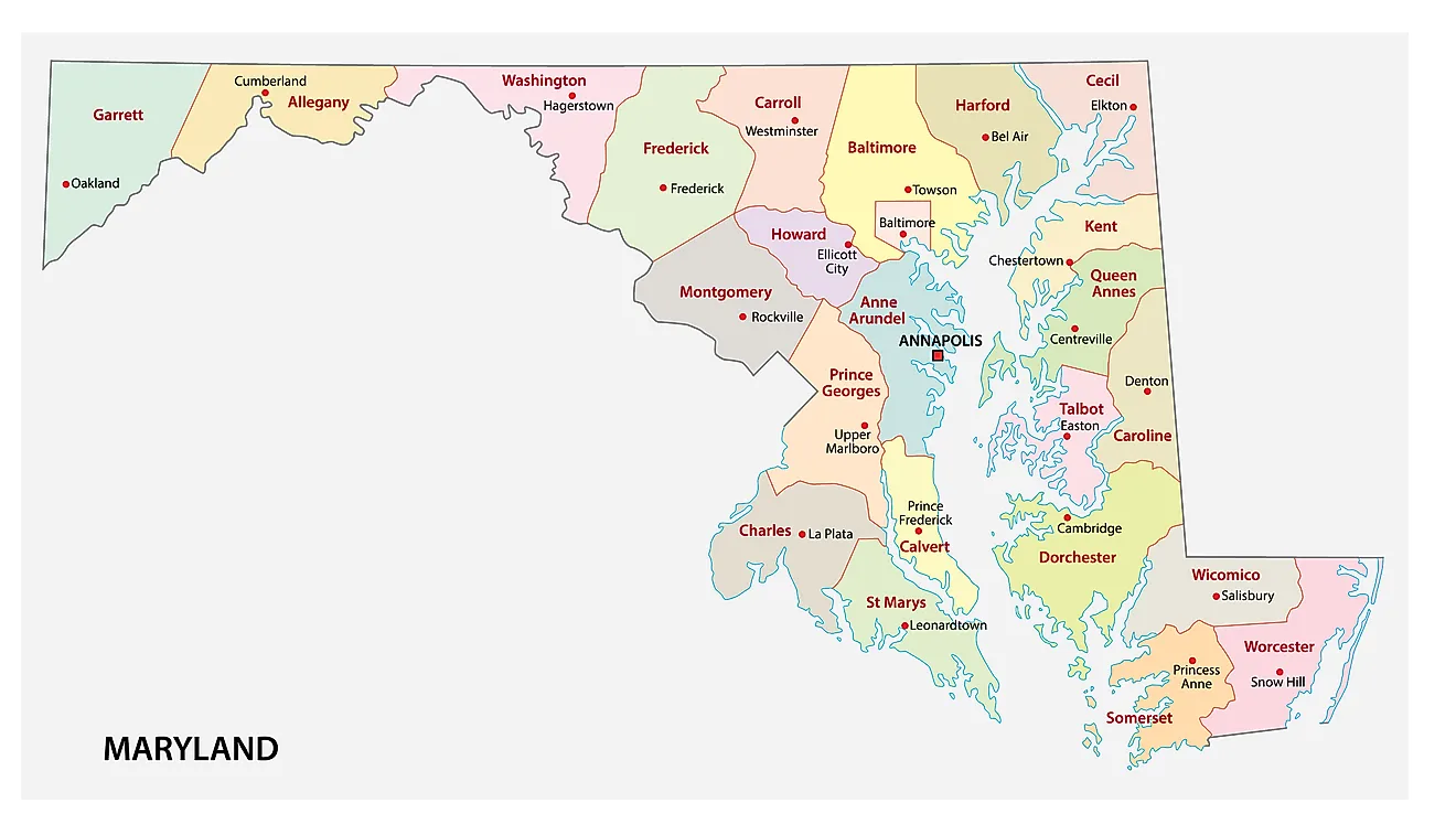
The State of Maryland is divided into 23 counties, along with the independent city of Baltimore, which is not part of any county but functions as a county equivalent. In alphabetical order, the counties are: Allegany, Anne Arundel, Baltimore, Calvert, Caroline, Carroll, Cecil, Charles, Dorchester, Frederick, Garrett, Harford, Howard, Kent, Montgomery, Prince George's, Queen Anne's, St. Mary's, Somerset, Talbot, Washington, Wicomico, and Worcester.
With an area of 32,133.2 sq. km, Maryland is the 42nd largest state in the US and the 9th smallest. Despite its modest size, it is the 5th most densely populated state, with roughly 6.27 million residents. Located in Anne Arundel County, at the mouth of the Severn River on the western shore of the Chesapeake Bay, is Annapolis – the capital city of Maryland and home to the United States Naval Academy. Situated in the north-central part of the state is Baltimore – the most populous city of Maryland. Baltimore also serves as a major seaport and the economic center of the state.
Where is Maryland?
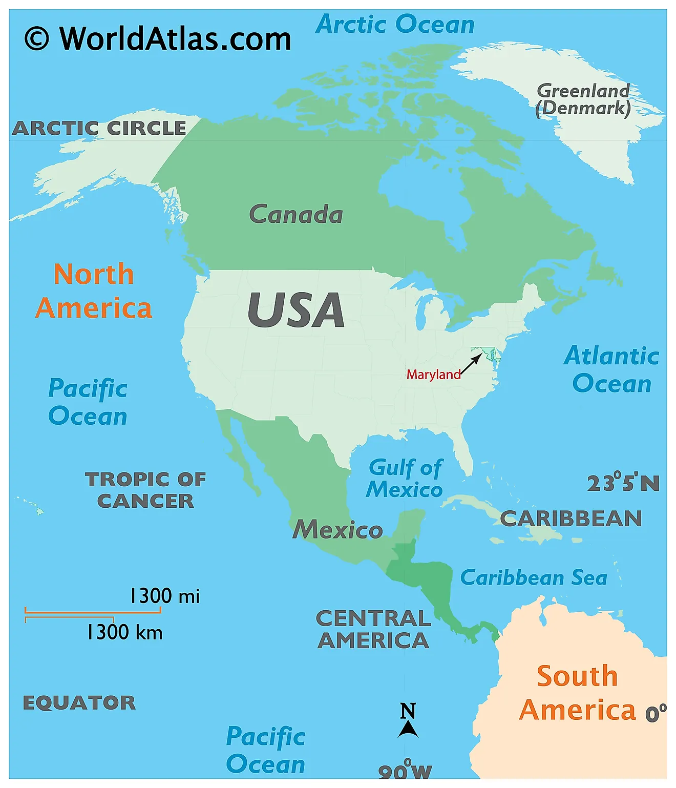
The State of Maryland is located in the Mid-Atlantic region of the United States. Maryland is bordered by Pennsylvania in the north, by Virginia, West Virginia, and Washington D.C. in the west and south, and by Delaware and the Atlantic Ocean in the east.
Regional Maps: Map of North America
Outline Map of Maryland
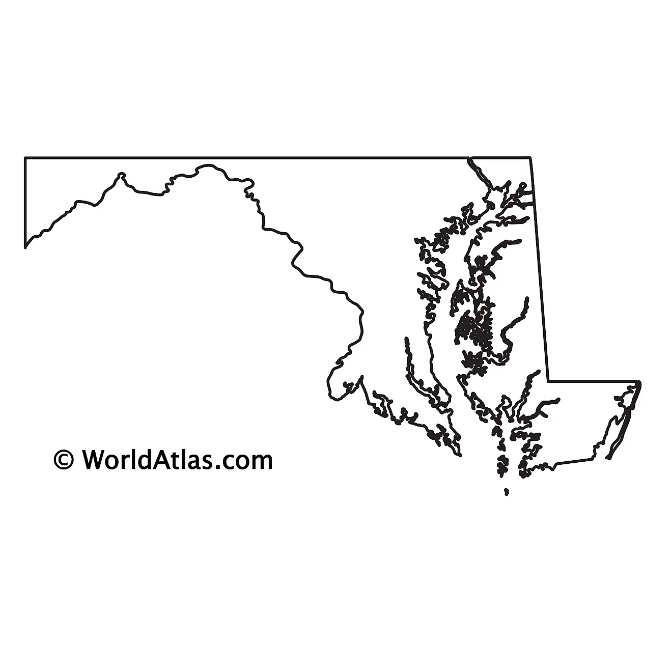
The above blank map represents the State of Maryland, located in the Mid-Atlantic region of the United States. The above map can be downloaded, printed and used for geography education purposes like map-pointing and coloring activities.
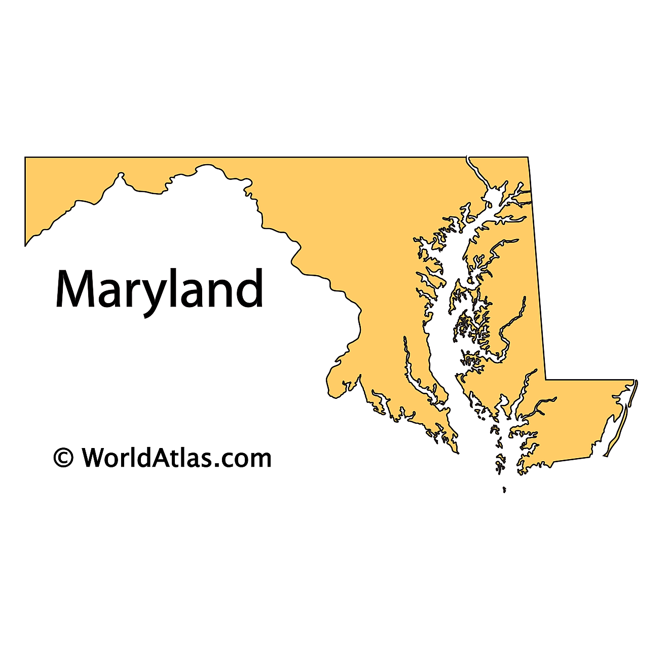
The above outline map represents the State of Maryland, located in the Mid-Atlantic region of the United States.
Key Facts
| Legal Name | State of Maryland |
|---|---|
| ISO 3166 Code | US-MD |
| Capital City | Annapolis |
| Largest City |
Baltimore (2,354,936) |
This page was last updated on September 15, 2026