1. Home
  2. North America
  3. United States
  4. Massachusetts

Maps of Massachusetts
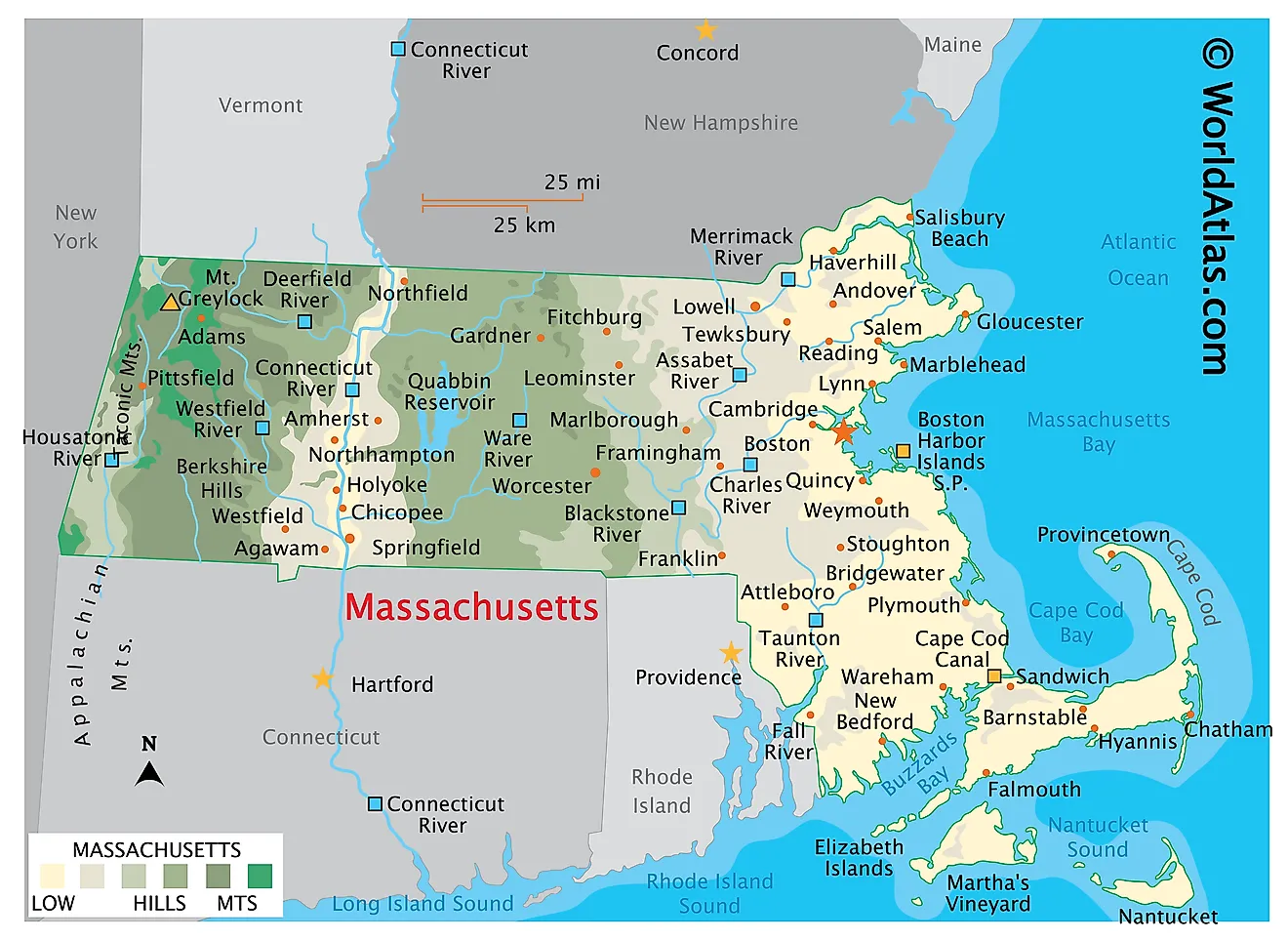
Physical Map of Massachusetts. It shows the physical features of Massachusetts including its mountain ranges, major rivers and lakes.

Massachusetts is a state in the northeastern United States, within the region known as New England. Officially styled a commonwealth rather than a state, it covers approximately 10,554 square miles, making it the 44th largest state in the country and the seventh smallest. Roughly a quarter of that total is water.

Massachusetts, Berkshires West Stockbridge, Olivia's Overlook.

Despite its modest size, Massachusetts contains a remarkable range of terrain. In a drive of under three hours, a traveler can cross barrier beaches and salt marshes on the Atlantic shore, climb through wooded uplands, descend into a broad river valley of tobacco and farm fields, and finish on a mountain summit near the New York line. The last Ice Age is largely responsible for that variety, and its fingerprints are visible almost everywhere in the state.

Where Is Massachusetts?

Boston Lighthouse on Little Brewster Island in Boston Harbor, Boston, Massachusetts.

Massachusetts borders five states. Vermont and New Hampshire lie to the north, New York to the west, and Connecticut and Rhode Island to the south. The entire eastern edge of the state faces the Atlantic Ocean.

The state measures about 184 miles east to west and 114 miles north to south. With roughly 7.15 million residents as of 2025, it is the 16th most populous state, the most populous in New England, and the third most densely settled in the nation. Boston, on Massachusetts Bay, is both the capital and the largest city, and Greater Boston holds a substantial majority of the state's population.

The Atlantic Coast

Coastal Views in Nantucket, Massachusetts.
Coastal Views in Nantucket, Massachusetts. 

Massachusetts has a general coastline of about 192 miles, but its deeply indented tidal shoreline — counting every bay, harbor, estuary, and island — runs close to 1,980 miles. The character of that shore changes dramatically from north to south.

North of Boston, Cape Ann presents the state's most rugged coast: hard granite headlands and ledges around Gloucester and Rockport, quarried for generations and shipped across the country as building stone. Farther north still, the shore softens into the barrier beaches and dunes of Plum Island and Salisbury. South of Boston the coast turns sandy and low, wrapping around Cape Cod Bay before opening into Buzzards Bay, Vineyard Sound, Nantucket Sound, and Rhode Island Sound.

Bird Island Lighthouse in Buzzards Bay, Massachusetts
Bird Island Lighthouse on Bird Island in Buzzards Bay, Massachusetts.

Extensive salt marshes back much of the shoreline, particularly around Plum Island Sound and the Cape. These marshes are among the most biologically productive habitats in the state, serving as nurseries for fish and shellfish and as critical stopover ground for migrating shorebirds.

Cape Cod and the Islands

Cape Cod National Seashore, Massachusetts
Cape Cod National Seashore, Massachusetts.

Cape Cod is the hooked, arm-shaped peninsula reaching into the Atlantic from the state's southeastern corner. It is entirely a glacial construction, built of moraine ridges and outwash plains left by the retreating Laurentide Ice Sheet, and it contains no bedrock outcrops at all. Because it is made of loose sand and gravel rather than rock, the Cape is constantly being reworked by waves and currents; the outer shore near Truro and Wellfleet retreats by roughly three feet a year.

Cape Cod National Seashore, established in 1961, protects about 40 miles of that outer shore along with its dunes, kettle ponds, and marshes. Note that the National Seashore is a federally protected portion of the Cape rather than the peninsula as a whole.

An aerial view of a long empty beach on the island of Marthas Vineyard.

South of the Cape lie Martha's Vineyard and Nantucket, both fragments of the same terminal moraine system, separated from the mainland when rising seas flooded the lowlands after the ice withdrew. The smaller Elizabeth Islands trail southwest from Woods Hole, dividing Buzzards Bay from Vineyard Sound.

A Landscape Shaped by Ice

The Gay Head Cliffs near Aquinnah on Martha's Vineyard, Massachusetts
The Gay Head Cliffs near Aquinnah on Martha's Vineyard, where glacial deformation exposed bands of colored clay.

Nearly every distinctive feature of the Massachusetts landscape traces back to the last glaciation, when ice more than a mile thick covered the entire state and reached its southern limit at what are now Martha's Vineyard and Nantucket. The ice began retreating roughly 18,000 years ago and was gone from the region by about 15,000 years ago.

The evidence is everywhere. Boston Harbor's islands and hills such as Bunker Hill are drumlins, streamlined mounds of glacial debris. The state's thousands of small ponds are kettle holes, formed where buried ice blocks melted out. Long ridges of till and boulders across the interior are moraines, and the Cape's sandy plains are meltwater outwash. Even the Gay Head Cliffs on Martha's Vineyard owe their banded appearance to sediment layers that were shoved and folded upward by the advancing ice.

The Eastern Lowlands

Aerial view of Great Blue Hill, Massachusetts.
Aerial view of Great Blue Hill, Massachusetts. 

Eastern Massachusetts is a low, gently rolling coastal plain broken by scattered hills, small lakes, and short rivers. Boston sits within a structural depression known as the Boston Basin, floored by softer sedimentary rock and ringed by more resistant highlands. The Blue Hills, just south of the city, mark the basin's southern rim; Great Blue Hill rises to 635 feet, the highest point on the Atlantic coastal plain south of Maine.

Moving inland from Boston, the land climbs gradually through wooded, hilly terrain toward the center of the state. Much of this ground was farmed in the 18th and 19th centuries and has since reverted to forest — Massachusetts is now roughly 60% wooded, a higher share than two centuries ago.

The Central Uplands and the Connecticut River Valley

View of the Connecticut River Valley from the Mount Holyoke summit, Skinner State Park, Hadley, Massachusetts
The Connecticut River Valley seen from the Mount Holyoke summit, Skinner State Park, Hadley, Massachusetts.

Central Massachusetts is a plateau of forested hills and shallow valleys, generally between 800 and 1,300 feet in elevation, with Wachusett Mountain reaching 2,006 feet near Princeton. This upland is cut through by the Connecticut River Valley, a broad lowland running north to south across the western third of the state.

Locally called the Pioneer Valley, this trough follows an ancient rift basin filled with soft sandstone and shale, later blanketed by silt from a glacial lake. The resulting soils are the most fertile in New England and still support intensive farming. Volcanic rock that resisted erosion forms the abrupt ridges rising from the valley floor, including the Holyoke Range and Mount Tom.

The Connecticut River flows through the Pioneer Valley in Western Massachusetts.

Springfield, Northampton, Holyoke, and Greenfield all developed along this corridor, taking advantage of both the farmland and the water power available at the river's falls.

The Berkshires and the Western Highlands

The Berkshires in western Massachusetts
The Berkshires, Massachusetts. Image credit: Michael Steven Burns via Shutterstock

West of the Connecticut Valley the land rises into the Berkshire Hills, a dissected plateau of metamorphic rock forming part of the broader Appalachian system. The Berkshires continue north into Vermont as the Green Mountains and south into Connecticut, rather than extending eastward into New Hampshire. Between the Berkshires and the New York border lie the Taconic Mountains, a separate range of older rock thrust into place during ancient continental collisions, and the narrow Housatonic and Hoosic valleys that separate the two.

Scenic summit view at Mount Greylock State Reservation, Massachusetts
Scenic summit view at Mount Greylock State Reservation, Massachusetts.

Mount Greylock, in the state's northwestern corner near Adams and Williamstown, is the highest point in Massachusetts at 3,489 feet. Its upper slopes support a boreal spruce-fir forest found nowhere else in the state, a relict community more typical of northern New England and eastern Canada. Neighboring summits along the same ridge include Saddle Ball Mountain, Mount Fitch, and Mount Williams. The Appalachian Trail crosses Greylock's summit on its way through the Berkshires. The state's lowest point, by contrast, is sea level on the Atlantic coast.

Rivers

The mouth of the Merrimack River where it meets the Atlantic Ocean in Massachusetts
The mouth of the Merrimack River where it meets the Atlantic Ocean, Massachusetts. Image credit: Wangkun Jia via Shutterstock

The Connecticut River is the longest river in New England at roughly 410 miles. It enters Massachusetts from Vermont near Northfield and flows south through the middle of the state past Greenfield, Northampton, Holyoke, and Springfield before continuing into Connecticut and emptying into Long Island Sound. It does not form any part of the Massachusetts boundary; the stretch that separates Vermont from New Hampshire lies well to the north.

The Merrimack rises in New Hampshire and enters Massachusetts near Tyngsborough, then swings northeast through Lowell, Lawrence, and Haverhill and reaches the Atlantic at Newburyport. Its falls powered the textile mills that made Lowell and Lawrence early centers of American industry.

The Charles River runs about 80 miles from Hopkinton through Boston and Cambridge to Boston Harbor, following a famously winding course. In the west, the Housatonic drains the southern Berkshires toward Connecticut, while the Hoosic flows north into Vermont and eventually the Hudson. Other notable rivers include the Deerfield and Westfield in the west, the Blackstone and Nashua in the center, and the Taunton in the southeast.

Lakes and Reservoirs

Quabbin Reservoir, the largest body of water in Massachusetts
Quabbin Reservoir, the largest body of water in Massachusetts.

Massachusetts has thousands of lakes and ponds, nearly all of them glacial in origin and most of them small. Its largest bodies of water, however, are artificial.

The Quabbin Reservoir, covering about 38.6 square miles and holding 412 billion gallons, is the largest inland body of water in the state. It was created by damming the Swift River behind Winsor Dam and the Goodnough Dike to supply drinking water to Greater Boston, 65 miles east. Four towns — Dana, Enfield, Greenwich, and Prescott — were disincorporated on April 28, 1938 to make way for it, displacing roughly 2,500 residents and requiring the relocation of some 7,500 graves. Filling began in August 1939 and the reservoir did not reach capacity until June 22, 1946, at which point it was the largest man-made reservoir in the world built solely for drinking water. It remains one of the largest unfiltered public water supplies in the United States.

Salt marshes and estuaries in Cape Cod, Massachusetts
Salt marshes and estuaries are found throughout Cape Cod, providing nesting and feeding habitat for birds, fish, and marine invertebrates.

Water travels from Quabbin to the Wachusett Reservoir through a 25-mile aqueduct. Wachusett, near Clinton, is the state's second largest reservoir. Other notable water bodies include Lake Chargoggagoggmanchauggagoggchaubunagungamaugg in Webster — commonly shortened to Lake Chaubunagungamaug or simply Webster Lake, and at 45 letters the longest place name in the United States — along with Onota Lake and Pontoosuc Lake near Pittsfield and the many kettle ponds scattered across Cape Cod.

Climate

Iced lake at sunset in Massachusetts.
Iced lake at sunset in Massachusetts. 

Massachusetts has a humid continental climate with four sharply defined seasons and no dry season. Boston averages roughly 44 inches of precipitation and about 49 inches of snow a year. The Atlantic moderates coastal temperatures, so Cape Cod and the islands see milder winters, cooler summers, and considerably less snow than the interior.

The Berkshires are the coldest and snowiest part of the state, with a growing season several weeks shorter than Boston's. Nor'easters — intense coastal storms that draw moisture off the Atlantic — deliver much of the region's heaviest snow and its most damaging coastal flooding and erosion. The state's record high temperature of 107 °F was set at New Bedford on August 2, 1975.

Massachusetts Geography at a Glance

Feature Detail
Total area Approx. 10,554 sq mi (44th largest state)
Land / water 7,801 sq mi land; 2,753 sq mi water (26% water)
Highest point Mount Greylock, 3,489 ft
Lowest point Atlantic Ocean, sea level
Bordering states Vermont, New Hampshire, New York, Connecticut, Rhode Island
Coastline Approx. 192 mi general; approx. 1,980 mi tidal shoreline
Longest river Connecticut River, approx. 410 mi (longest in New England)
Largest inland water body Quabbin Reservoir, approx. 38.6 sq mi
Capital and largest city Boston

Where is Massachusetts?

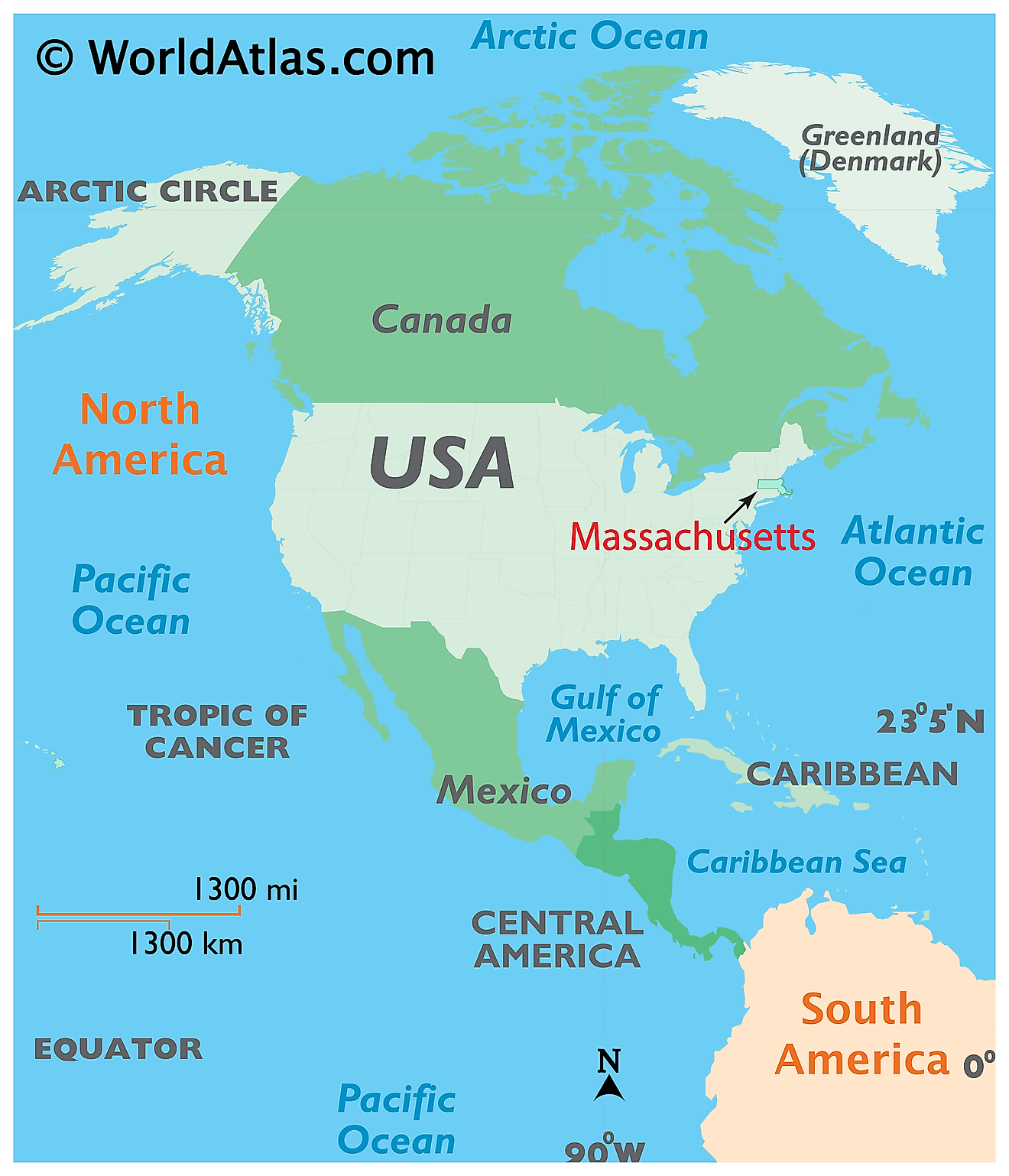
Map showing location of Massachusetts in the world.

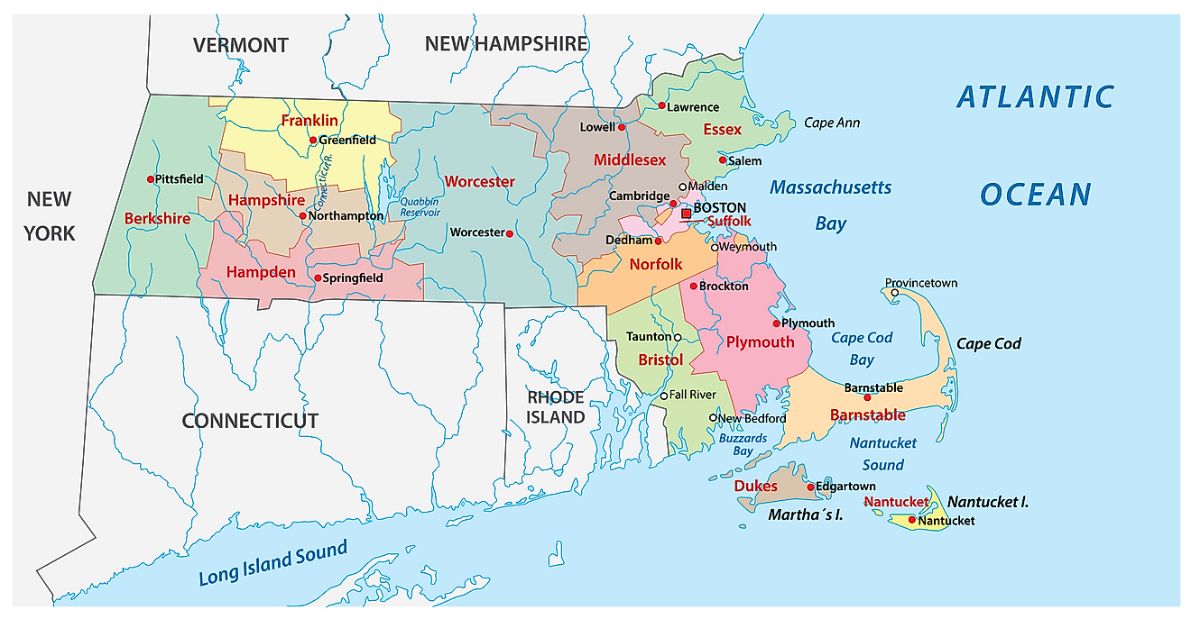
The state of Massachusetts is located in the northeastern (New England) region of the United States. Massachusetts is bordered by the states of New York in the west; by Vermont and New Hampshire in the north; and by Rhode Island and Connecticut in the south. It is also bounded by the Atlantic Ocean in the east and southeast.

Regional Maps: Map of North America

Outline Map of Massachusetts
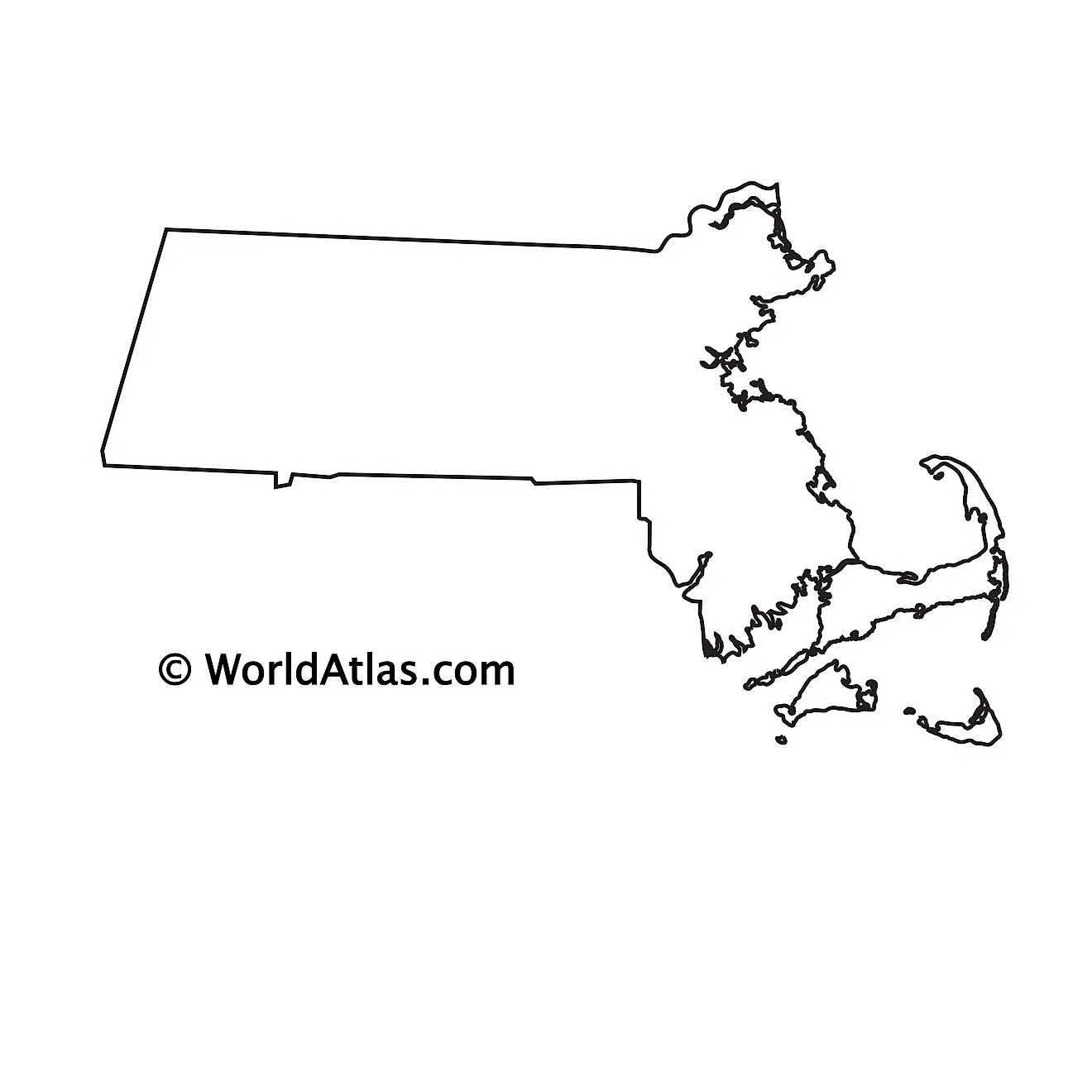
The above blank map represents the state of Massachusetts, located in the northeastern (New England) region of the United States.
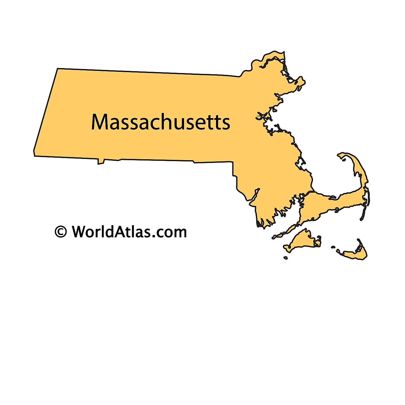
The above outline map represents the state of Massachusetts, located in the northeastern (New England) region of the United States. Massachusetts has been nicknamed as "The Bay State". 

Key Facts

Legal Name State of Massachusetts
ISO 3166 Code US-MA
Capital City Boston
Major Cities
  1. Boston (4,344,081)
  2. Springfield, Massachusett, Connecticut (680,452)
  3. Worcester (561,791)

This page was last updated on September 10, 2026

Latest by WorldAtlas