2025's 8 Most Scenic South Carolina Towns
South Carolina packs three very different landscapes, coast, forested midlands, and mountains, into a quick morning drive. You can watch the sun rise over shrimp boats in Port Royal Sound and set behind the Blue Ridge above Lake Jocassee without ever leaving the state.
These eight scenic towns show how the land still shapes daily life. There’s a barrier-island village with turtle-friendly streetlights, a river town whose skyline is shrimp boats, and a mountain hamlet that tells time by waterfall flow, not traffic lights. Think of it as a tasting menu: salt-marsh creeks, emerald plantations, sandy horse tracks, and granite-rimmed lakes, each served up in a small-town setting. Ready to see why “Smiling Faces, Beautiful Places” really fits? Let’s start where the Spanish moss first drapes the docks.
Clemson

Clemson’s town clock sits less than a mile from the edge of a 56,000-acre lake and just twenty minutes from the Blue Ridge front, an unusual pairing of geography that defines the town’s layout and economy. Clemson University, the largest employer and landowner, occupies ground once held by John C. Calhoun and later Thomas Green Clemson, whose estate became the university’s foundation. The Fort Hill Plantation house remains intact and is open for tours, preserving both antebellum architecture and archived state papers.

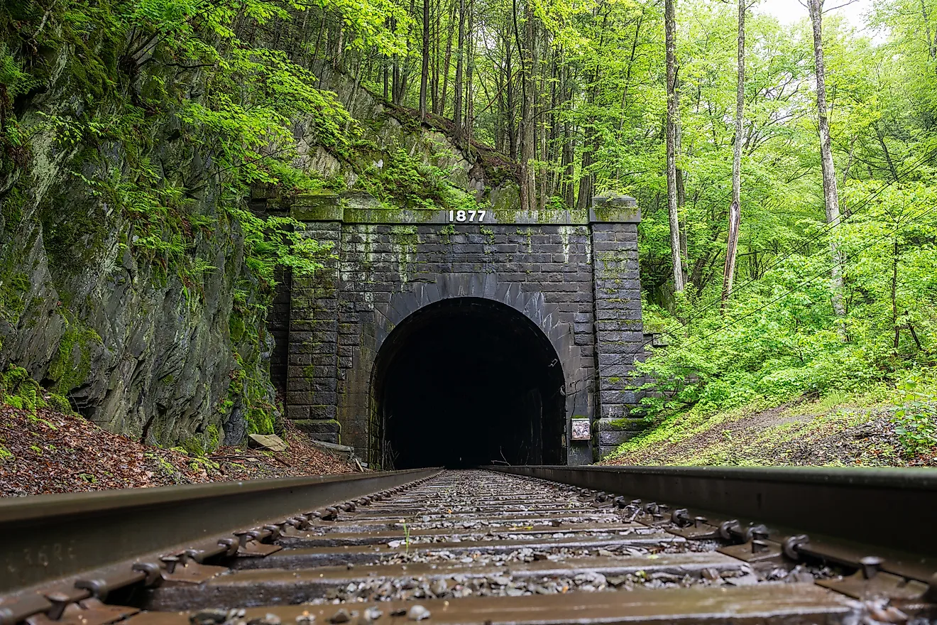
The South Carolina Botanical Garden covers 295 acres of wooded hillside and native flora, with footpaths connecting directly to the Bob Campbell Geology Museum, home to a rare amethyst crystal formation and dozens of Appalachian mineral samples. At the shore of Lake Hartwell, the Snow Family Outdoor Fitness Center allows public access to kayak rentals, a small amphitheater, and the long walking path known as The Dikes. Just beyond town limits, the Clemson Experimental Forest contains marked trails and gravel fire roads. The Waldrop Stone Falls trail leads to a waterfall surrounded by hardwood forest. For food, Moe Joe Coffee Company near College Avenue serves espresso with Cuban toast and offers a second-floor balcony view over campus traffic.
Aiken

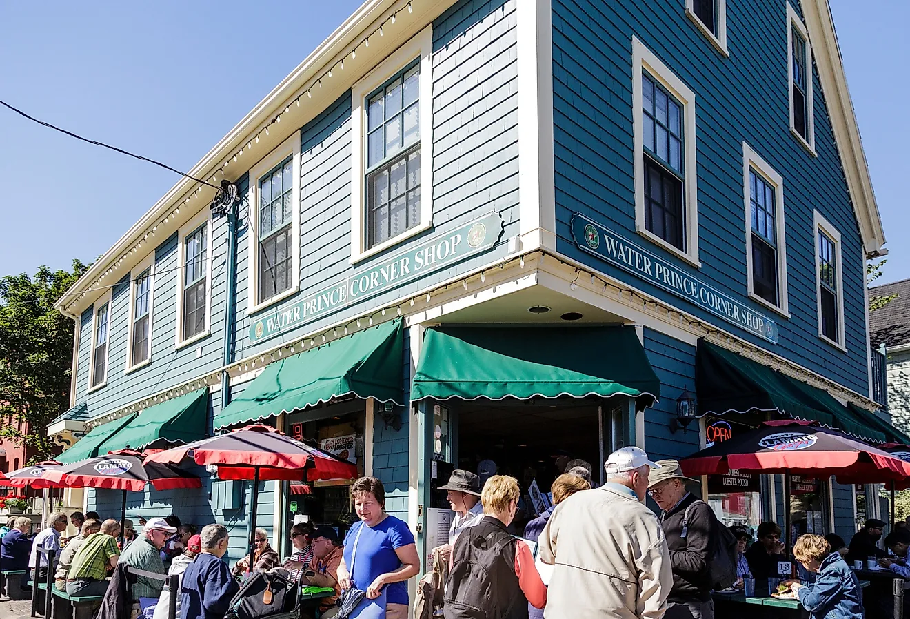
Aiken’s original streets were laid out wide enough for two horse-drawn carriages to turn around without backing up, a detail that still shapes the grid of downtown. The town developed as a winter colony for wealthy Northerners in the late 19th century, many of whom built stables before homes. That equestrian infrastructure still defines the town’s footprint. Hitchcock Woods, one of the largest urban forests in the country, includes over 70 miles of trails and is accessible by horseback or foot from downtown. The Aiken Training Track nearby remains in seasonal use for thoroughbred conditioning.

Hopelands Gardens, once the estate grounds of the Iselin family, contains a reflection pool, magnolia alleys, and the Aiken Thoroughbred Racing Hall of Fame, which documents the careers of champion flat racers and steeplechasers. The Aiken County Historical Museum, located inside a converted 1930s mansion on Newberry Street, includes exhibits on the Savannah River Plant and the town’s railroad beginnings. On Laurens Street, New Moon Café offers pimento cheese BLTs and South Carolina-roasted coffee, often packed on race mornings. The Willcox, an early 20th-century hotel, continues to serve a formal dinner menu in its paneled dining room, drawing both locals and seasonal riders in boots and jackets.
Travelers Rest

Travelers Rest got its name from 19th-century livestock drovers and traders who stopped at the foot of the Blue Ridge before ascending to North Carolina. That same geography still governs the town’s layout; situated at the base of Paris Mountain and bordering the North Saluda River watershed. The Swamp Rabbit Trail, a 22-mile greenway that runs from downtown Greenville through Travelers Rest, passes directly behind the town’s main strip and has turned the area into a cycling waypoint. Paris Mountain State Park, just ten minutes south, includes trails like Sulphur Springs Loop and overlooks of the Reedy River valley.
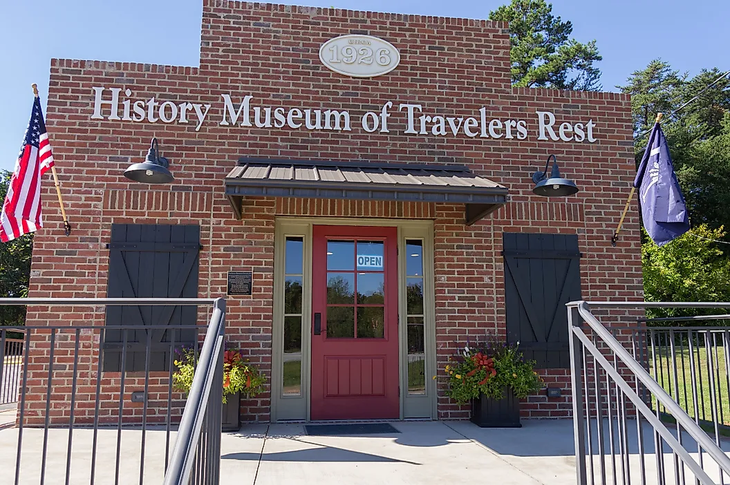
Tandem Creperie and Coffeehouse on Main Street serves espresso and ham-egg-Gruyère crepes in a converted bike shop, popular with cyclists coming off the trail. Farmhouse Tacos, next door, offers brisket tacos with poblano slaw and a rotating list of local draft beer. The Travelers Rest History Museum on McElhaney Road documents the town’s trading-post origins and textile past using maps, 19th-century tools, and oral histories from local mill families. Trailblazer Park, just west of Main Street, includes a pavilion, amphitheater, and open green where the town hosts its seasonal farmers market with direct views of the foothills beyond U.S. Route 25.
Folly Beach

Folly Beach is the last barrier island south of Charleston accessible by road, and its geography, flanked by the Atlantic Ocean on one side and the Folly River on the other, creates a tight, narrow corridor of land with water in view from nearly every block. The town’s street grid runs parallel to the shoreline, but the best vantage point is at the end of Center Street, where the Edwin S. Taylor Fishing Pier extends 1,049 feet into the ocean. The pier was rebuilt and reopened in 2023 after a complete structural replacement and includes fixed observation areas and an upper-level shade deck.
The Lighthouse Inlet Heritage Preserve on the island’s northeast tip offers a direct view of the Morris Island Lighthouse across the channel, accessible by a 0.6-mile walk through former Coast Guard land. Nearby, Chico Feo on East Ashley Avenue serves ginger beer and Guatemalan pork tacos in an open-lot setup with communal benches and a rotating live music calendar. Lost Dog Café, open daily by 6:30 a.m., serves shrimp and grits and cold brew under framed photos of regulars’ dogs. The Folly River Park off Center Street hosts a Thursday Art Market and includes a boardwalk where bottlenose dolphins surface regularly near sunset.
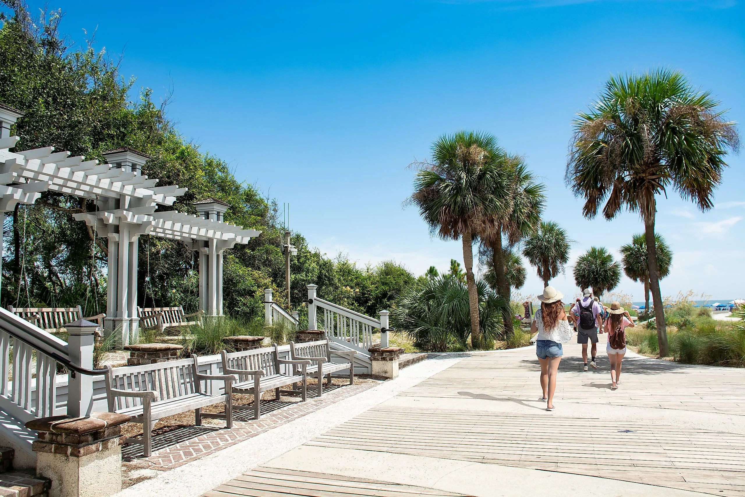
Hilton Head Island

Hilton Head Island’s development followed strict visual and ecological codes laid out by Charles Fraser in the 1950s, resulting in low signage, tree cover preserved over roadways, and commercial buildings painted to blend with pine and palmetto. This approach created a visual uniformity across the island’s 12 miles of beachfront, which remains unobstructed by high-rise hotels. The most recognizable landmark is the Harbour Town Lighthouse in Sea Pines Resort, built in 1970 and now functioning as both observation deck and museum, with displays covering island history and maritime navigation.

The Coastal Discovery Museum on Honey Horn Drive operates on 68 acres of marshland and includes walking trails through live oak groves, a native butterfly enclosure, and exhibits on the Gullah culture. The Shelter Cove Harbour area offers direct Broad Creek access and is anchored by Scott’s Fish Market, known for local flounder and dockside seating. At the southern end, Coligny Beach Park includes boardwalk access, shaded swings, and a fountain plaza. Java Burrito Company, located in the Village at Wexford, serves espresso, Mexican rice bowls, and South Carolina craft beer under exposed beam ceilings.
Georgetown

Georgetown is the third-oldest city in South Carolina and sits at the confluence of five rivers, Waccamaw, Pee Dee, Black, Sampit, and Santee, feeding directly into Winyah Bay. This riverfront geography made the town one of the largest rice exporters in the 18th century. Many of the warehouses along Front Street still stand, now repurposed into restaurants and museums with direct views across the Sampit River. The Harborwalk, a wooden boardwalk parallel to Front Street, runs for four blocks and includes fixed platforms for mooring shrimp boats and charter vessels.
The Kaminski House Museum, built in 1769, overlooks the water and holds a collection of pre-Revolutionary furniture and decorative arts. The Rice Museum, located inside the Old Market Building with its 1842 clocktower, documents plantation-era agriculture using dioramas and slave records from local estates. The town’s skyline remains low and intact, with unobstructed water views along every block from Fraser to St. James streets.
Bluffton

Bluffton sits on a natural bluff above the May River, one of the few high-ground locations along South Carolina’s tidal plain. That elevated position gave it strategic importance during the Civil War and continues to define the town’s riverfront layout. Old Town Bluffton remains the focal point, where Church of the Cross, built in 1857, overlooks oyster beds and winding estuaries. The streets are laid out around Calhoun Street, which runs from the riverfront inland, lined with preserved cottages, metal-roof shops, and galleries in former garages.
The Bluffton Oyster Factory Park sits along Wharf Street and includes a public dock, shaded pavilion, and river access directly behind the last remaining hand-shucking oyster operation in the state. Nearby, the Heyward House Museum, built in 1841, offers house and walking tours that document Bluffton’s antebellum and Reconstruction-era history. For food, FARM Bluffton on May River Road serves seasonal plates like triggerfish and field pea stew, with a fixed chalkboard menu. Corner Perk, at the Calhoun Street intersection, roasts its own beans on-site and offers pour-overs and iced lavender lattes served in glass jars. At low tide, the exposed marsh extends across the river channel, with visible oyster clusters and anchored shrimp boats along the horizon.
Beaufort

Beaufort is built around water, positioned on Port Royal Island and threaded with tidal rivers, creeks, and salt marsh. What distinguishes it from other coastal towns is the density of preserved antebellum homes within walking distance of open water. The town’s Historic District, designated a National Historic Landmark, is laid out around Bay Street and Craven Street, with narrow lanes framed by live oaks and cast-iron fences. The Henry C. Chambers Waterfront Park sits directly on the Beaufort River and offers an uninterrupted view across the marsh to Lady’s Island. From the park’s seawall, shrimp boats pass by twice daily with visible trawl nets.

Inside the Historic District, the John Mark Verdier House on Bay Street offers public tours of an 1804 Federal-style residence that includes period furnishings and commercial history. Just a few blocks away, the Pat Conroy Literary Center preserves first editions, drafts, and correspondence from the author’s decades in Beaufort. Blackstone’s Café on Craven Street serves crab cake benedicts and stone-ground grits in a storefront that dates to the 19th century. Outside of downtown, Hunting Island State Park includes a climbable lighthouse, five miles of beach, and marsh boardwalks, offering one of the most direct barrier island experiences on the South Carolina coast.
From shrimp-net skylines in Georgetown to waterfall hush in Clemson, each town proves South Carolina’s scenery is not a postcard cliché but a functioning daily backdrop. Miles of rail-trail asphalt, marsh piers, equestrian sand, and oyster shell crunch all deliver distinct textures within a half-day drive. Plan one base or eight separate layovers; either way, the state’s compact topography guarantees new horizons before the coffee thermos empties on the return.