Maps of Kuwait

Kuwait occupies an area of 17,818 sq. km on the Arabian Peninsula at the head of the Persian Gulf.
As observed on the physical map of Kuwait above, the country also has several islands like Warbah, Bubiyan, and Failakah Islands.
Marked on the map is the Kuwait Bay which a major geographic feature in the country. It covers nearly 50% of the country's shoreline and shelters the port of Kuwait.
Most of Kuwait is an entirely flat and dry barren desert of sandy plains broken by occasional shallow depressions and low hills. The land (desert) begins to rise slightly in the southwest, along the border with Saudi Arabia.
The country's highest point is an unnamed hill that peaks at 1,003 ft. (306 m). The yellow upright triangle on the map represents this point.
There are no perennial lakes or rivers. Instead, there are wadis or transient watercourses that end in inland basins.
The lowest point in the country is the Persian Gulf at 0 m.
Governorates of Kuwait Map

Kuwait (officially, the State of Kuwait) is divided into 6 governorates. In alphabetical order, these governorates are: Ahmadi, Al Asimah, Farwaniya, Hawalli, Mubarak Al-Kabeer and Jahra. These governorates are further subdivided into areas.
With an area of 17,818 sq. km, Kuwait is one of the smallest countries in the world. Kuwait City is the capital and largest city of Kuwait. It is located at the heart of the country on the southern shores of Kuwait Bay on the Persian Gulf. Kuwait City is the country’s political, cultural and economic center.
Where is Kuwait?

Kuwait is a country in Western Asia, situated in the northern edge of Eastern Arabia at the tip of the Persian Gulf. It is located in the Northern and Eastern hemispheres of the Earth. It is bordered by two countries. It is bounded by Persian Gulf in the east, Iraq in the north and west, and Saudi Arabia in the south. Most parts of Kuwait are covered by the Arabian Desert.
Kuwait Bordering Countries: Saudi Arabia, Iraq.
Regional Maps: Map of Asia
Outline Map of Kuwait


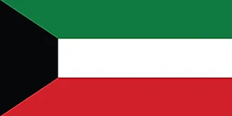
Key Facts
| Legal Name | State of Kuwait |
|---|---|
| Flag |
|
| Capital City | Kuwait City |
| 29 22 N, 47 58 E | |
| Total Area | 17,818.00 km2 |
| Land Area | 17,818.00 km2 |
| Water Area | N/A |
| Population | 4,207,083 |
| Largest City |
Al Kuwayt (Kuwait City) (3,297,759) |
| Currency | Kuwaiti dinars (KD) |
| GDP | $134.76 Billion |
| GDP Per Capita | $32,031.98 |
This page was last updated on December 7, 2022