Maps of Guinea

The coastal country of Guinea in West Africa covers an area of 245,857 sq. km.
The country has been divided into four geographic regions. The Lower Guinea or the coastal plain that runs north to south along the coast of the country on the Gulf of Guinea. It features many drowned river valleys or rias and there are tidal estuaries and offshore islands.
The second region is the Fouta Djallon Highlands in Middle Guinea. The third region is Upper Guinea covered by savanna and finally Forest Guinea which is located to the southeast of the country and is covered by rainforests.
As visible on the physical map above, several rivers originate in the highlands of Guinea like the Niger and its tributaries, Bafing River, Milo River, Konkoure, and others.
Guinea's highest point is Mont Nimba at 1,752 m and marked on the map by a yellow upright triangle in southern Guinea. The lowest point is the Atlantic Ocean at 0m.
Regions of Guinea Map

Guinea has seven regions which are Boke, Conakry*, Faranah, Kankan, Kindia, Labe, Mamou, and N'Zerekore. The national capital of Conakry is ranked as a special zone. The regions of Guinea are subdivided into 33 prefectures which, in turn, are divided into sub-prefectures.
With an area of 72,145 sq. km, Kankan is the largest region of Guinea and the most populous one as well.
Where is Guinea?

Guinea is located in West Africa where it borders six countries. These are Senegal to the north, Mali to the northeast, Ivory Coast to the east, Liberia to the south, Sierra Leone to the southwest, and Guinea-Bissau to the northwest. The country has a coastline along the Atlantic Ocean to the southwest. It is located in the Northern and Western Hemispheres.
Guinea Bordering Countries: Mali, Senegal, Guinea-Bissau, Liberia, Cote D'Ivoire, Sierra Leone.
Regional Maps: Map of Africa
Outline Map of Guinea


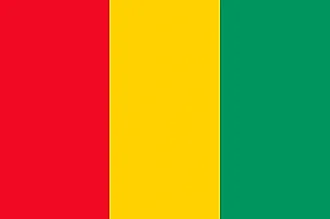
Key Facts
| Legal Name | Republic of Guinea |
|---|---|
| Flag |
|
| Capital City | Conakry |
| 9 30 N, 13 42 W | |
| Total Area | 245,857.00 km2 |
| Land Area | 245,717.00 km2 |
| Water Area | 140.00 km2 |
| Population | 12,771,246 |
| Largest City |
Conakry (2,110,937) |
| Currency | Guinean francs (GNF) |
| GDP | $13.59 Billion |
| GDP Per Capita | $1,064.13 |
This page was last updated on February 24, 2021