9 Overlooked Towns In The Great Lakes Worth Visiting
Think of the Great Lakes and visions of beach towns or freighters destined for big-city ports probably spring to mind. Or perhaps your mind drifts to the northern reaches of already sparsely populated states, where swaths of evergreens are as impenetrable as the fresh waters they surround. But in between, there are all sorts of lightly developed shoreline communities, isolated (but accessible) timber towns, and serviced island enclaves worth exploring. These are nine such overlooked (and underrated) towns in the Great Lakes Region.
Ashland, Wisconsin

Typically, Bayfield is the major tourist draw in Northern Wisconsin. But at the base of the very same peninsula, you'll find the other "Gateway to Apostle Islands National Lakeshore:" Ashland. This laid-back lake town sits on the southeast shore of Chequamegon Bay (i.e., an extension of southwestern Lake Superior), with a quaint public beach and waterfront walkway to satisfy summertime visitors. Along Main Street, you'll find out why Ashland has also adopted the crown of "Historic Mural Capital of Wisconsin." Taking some time to appreciate the 20 building-sized representations of important local events and figures from the past 170 years is a great way to break up the shopping and dining excursion. Afterward, to get a sense of the community in a cozy atmosphere, I recommend sitting down for a cup of coffee (and maybe a hearty breakfast burrito) at Black Cat Coffeehouse. And of course, if you're itching to see some of the sea caves and lighthouses of the Apostle Islands cluster, then Bayfield's cruise and kayak operators are less than a half-hour drive up the coast.
Empire, Michigan

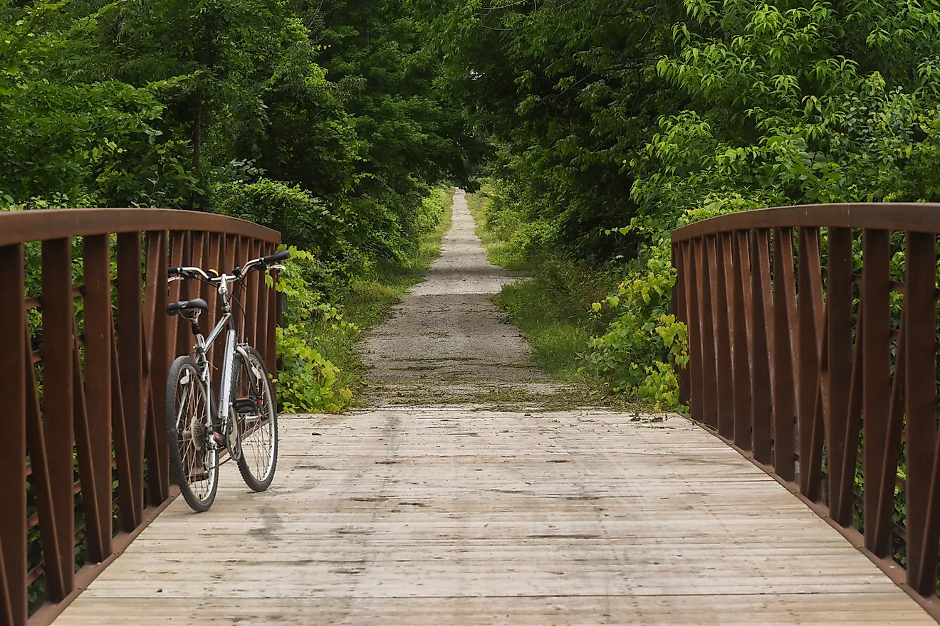
Speaking of national lakeshores, Michigan's Lower Peninsula harbors a monumental and historic stretch of its own. Sleeping Bear Dunes National Lakeshore highlights the largest sand dunes found anywhere on Lake Michigan (even surpassing those at Warren Dunes State Park), as well as Anishinaabek culture, the shipwrecks of Manitou Passage, and the 19th-century European settlements peppered along the western extent of the Leelanau Peninsula. One such settlement is Empire - the southern terminus of Sleeping Bear Dunes and a tranquil destination unto itself. Here, you'll find the Philip A. Hart Visitor Center (where maps and day-passes can be obtained), the Empire Area Museum (including the old one-room schoolhouse), a charming, no-frills village center, and the namesake beach that skirts between Lake Michigan and South Bar Lake, ending with the Robert H. Manning Memorial Lighthouse. To the south of town, you can hike the Empire Bluff Trail, or if you brought your bike, ride the Sleeping Bear Heritage Trail beginning just north of town.
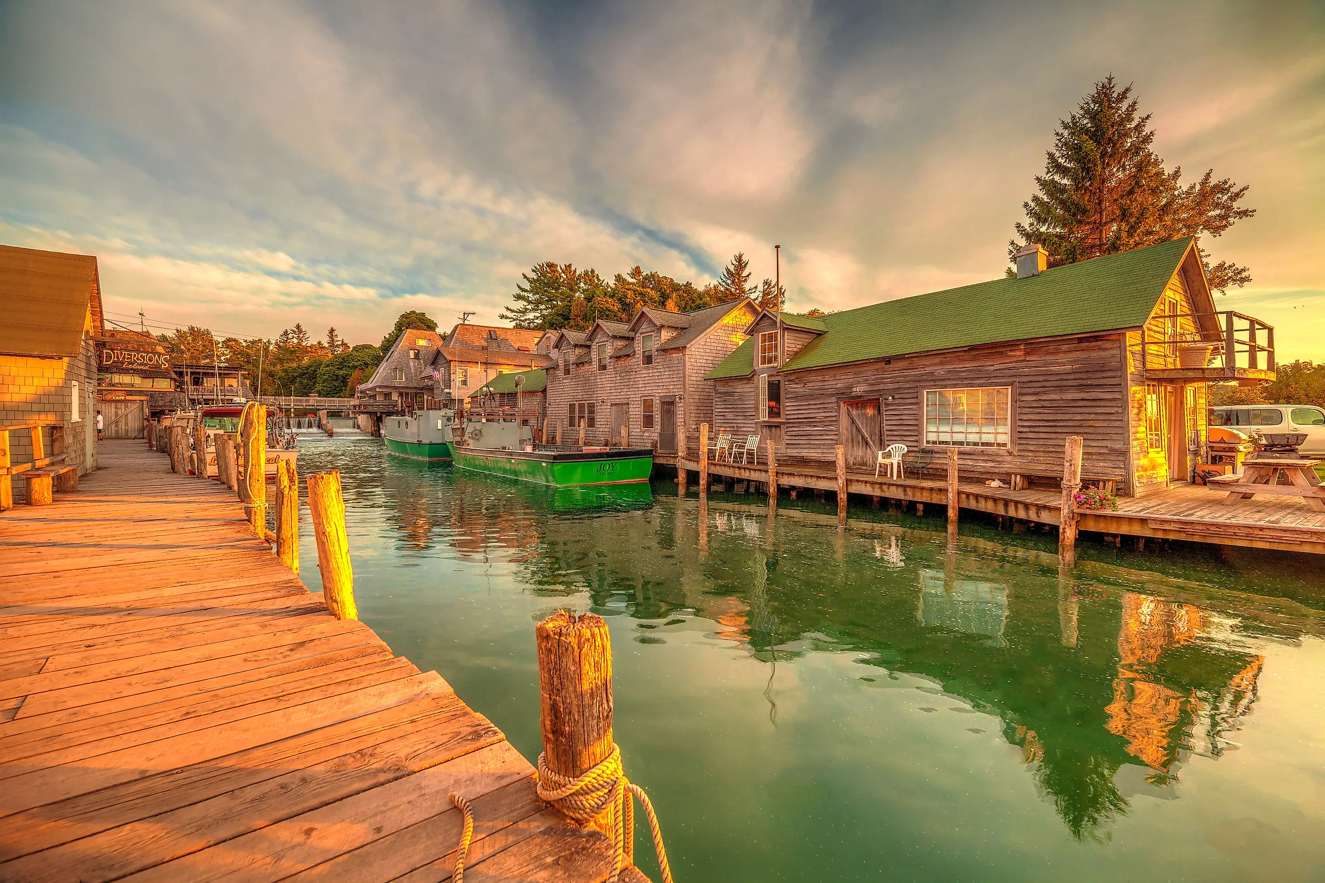
Leland, Michigan

After soaking in Empire's assets and stopping by the 450-foot marquee mound of Sleeping Bear Dunes National Lakeshore, consider tacking on a visit to Leland before exiting the Leelanau Peninsula. This idyllic community is easy to miss, but it rewards motorists who make the northbound turnoff onto the Pure Michigan Byway. For starters, Leland acts as a ferry port for the Manitou Islands (i.e., scenic additions to Sleeping Bear and icons of the Indigenous lore). It is also home to the Verterra Winery - one of 20 such wineries along the revered Leelanau Peninsula Wine Trail. And last but not least, lining the Leland River on its way between Lake Michigan and Lake Leelanau are the shanties, smokehouses, overhanging docks, commercial fishing vessels, and other living artifacts of Lake Michigan's maritime culture in a tourist-friendly enclave known as Historic Fishtown.
Port Franks, Ontario

Another blink-and-you’ll-miss-it Great-Lake community at the base of dune-strewn beaches is that of Port Franks, Ontario. Growing up in the border town of Sarnia, I took every opportunity to drive up the southern shore of Lake Huron to reach this sandy and forested playground in the heart of Lambton Shores. As you progress along Lakeshore Road, a massive dune suddenly fills your windshield — a sure sign that you’ve reached the turnoff for Port Franks Road. It also makes for an ideal refueling stop, thanks to a gas station paired with a classic country diner, MacPherson’s Restaurant.
Just a short drive along the main road brings you to the Port Franks Community Center (trail access on the left) and the Karner Blue Sanctuary (on the right), both offering easy hikes or quiet horseback rides under the pines. Continuing north toward Northville Crescent leads to the area’s campgrounds and the dune-lined trails of the Ausable River Cut Conservation Area, where a kayak launch, patio fire pits, live music nights, and hearty pub fare await at Grogs Pub & Grill.
South Baymouth, Ontario

Continuing on the Ontario track, any Great Lake wanderer would be remiss to skip over Manitoulin Island - the largest freshwater island on the planet. A two-hour sailing aboard the MS Chi-Cheemaun from Tobermory brings you across the narrow divide between Lake Huron and Georgian Bay, before docking at the tiny ferry town of South Baymouth on the island’s south side.
When the drawbridge drops, most cars immediately shoot north onto Highway 6, but it’s well worth slowing down before heading deeper across the island. The marina offers a peaceful stroll with views of the harbor, and a short path leads to the South Baymouth Range Front Lighthouse, a perfect place to watch the ferry glide back toward the mainland. A stop at the South Baymouth Museum and Schoolhouse adds historical context to the crossing, preserving stories of early settlement and island life. If the unhurried rhythm of the place convinces you to linger, South Baymouth has a couple of welcoming lodges tucked along its little ring road, as well as the beachside South Bay Resort & Campground just a minute or two north of the docks
Providence Bay, Ontario

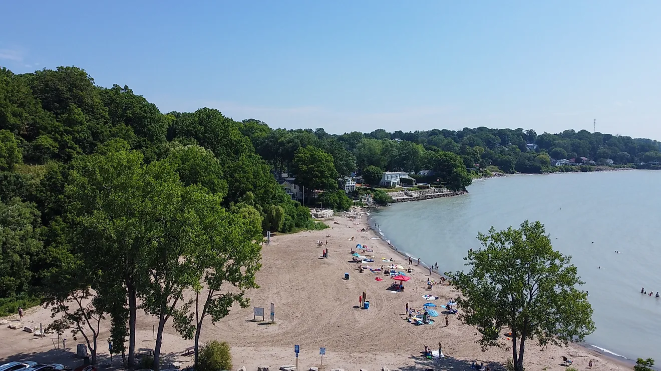
Let's cap off this Ontario trifecta with another stop on Manitoulin Island. From South Baymouth, work your way 30 minutes west along the forested Government Road to the quiet slice of paradise that is Providence Bay. Perched on the shallow body of water by the same name, this little beach community provides just the right amount of amenities to support a weekend getaway, without detracting from the natural surroundings. The two-kilometer-long Providence Bay Beach provides ample room for families to sprawl out in the sun, and splash around in the clean (and relatively warm) waters flowing in from Lake Huron. A lengthy boardwalk parallels the sand and the coniferous forest while also protecting the underrated dune vegetation from being trampled. Back at the parking lot, there is a playground, community center, and oversized cottage chair to keep young families occupied. And in town, you'll find a lovely cafe, a tasty fish & chips joint, and a handful of country-style accommodations spread amongst the few square blocks.
Copper Harbor, Michigan

Making our way back to Michigan, the Upper Peninsula specializes in remote and therefore overlooked towns. In particular, Copper Harbor, situated atop the Keweenaw Peninsula, maintains a permanent population of only about 100 and receives far less tourism than it would if located along a more popular route. Those willing to make the trip will be rewarded with panoramic views atop Brockway Mountain, groves of 100-foot old-growth white pines at Estivant Pines Nature Sanctuary, 50+ miles of mountain biking trails, the circa-1844 barracks (and corresponding lighthouse) at Fort Wilkins Historic State Park, and a kooky little timber town filled with waterfront accommodations and some one-of-a-kind shopping and dining establishments. Copper Harbor also runs ferries to one of the wildest and least-visited national parks in the country: Isle Royale.
Eagle Harbor/Eagle River, Michigan

On your way up to or back from Copper Harbor, take the westbound scenic tour along Sand Dune Drive (M-26), and you'll be rewarded with two timeless waterfront communities: Eagle Harbor and Eagle River. The former is built around a body of water by the same name. On the west wing, visitors will find the Eagle Harbor Light Station - one of around a dozen sites enshrined by the Keweenaw County Historical Society and a spectacular place to breathe in the majesty of Lake Superior. Looking across to the east side, the Eagle Harbor Life-Saving Station and Museum prods into the largest Great Lake's capricious maritime history. In between, orbiting around Front Street, the modest Eagle Harbor Beach, Agate Shop, and a handful of inns are more than happy to patronize out-of-towners.
Over at Eagle River, which was also established on its namesake water body, be sure to stop for a photo break at the Eagle River Falls & Dam. Here, your gaze will naturally be directed to the Eagle River Museum - yet another of the Keweenaw County Historical Society's beloved and informative landmarks.
Put-in-Bay, Ohio

Ohio snatched up much of the southern shore of Lake Erie (i.e., the shallowest and southernmost, and therefore warmest of the Great Lakes), and shares the Lake Erie Islands with Ontario, Canada. Kelleys Island, with its enigmatic glacial grooves and island-wide developments, tends to get the most attention, but over on South Bass Island, the village of Put-In-Bay is also worth the ferry ride over - ports operate out of Kelleys Island or Catawba Island (which, despite its name, is connected to the mainland). This lovely little rock possesses a surprisingly dense series of attractions - and half the fun is getting to them via golf cart, moped, or bicycle. There are two state parks on the west side of the island, two nature preserves to the north, and a variety of wineries, caves, tourist centers, and historical structures (such as the 352-foot-tall Perry's Victory & International Peace Memorial) scattered throughout. Put-In-Bay tailors to aquatic and terrestrial adventurers, but also anyone who wants to kick back with a plate of freshly caught seafood and simply enjoy the island vibes.
Hidden Gems In The Great Lakes Region
In the gaps between the Midwest's metropolises and its popular Great Lakes vacation spots, hidden gems are waiting to be uncovered. Sometimes, these alternatives require a concerted road trip to reach, but often, it is just a matter of shifting up the shoreline or hopping on a brief and scenic ferry. So as you concoct your upcoming summer plans (or perhaps even an off-season mission), take a closer look at these nine overlooked towns.