Lake Leelanau, Michigan
Lake Leelanau is a big lake situated in the roughly-triangular shaped Leelanau Peninsula in the northwestern portion of the Lower Peninsula of the US State of Michigan. The Native Americans who initially inhabited the area named the lake “lee-lan-au,” which meant “delight of life.” Covering a total area of 13.44 square miles and placed entirely within Leelanau County, Lake Leelanau includes two water bodies: North Lake Leelanau and South Lake Leelanau. The lake and its surrounding area attract several vacationers during the summer season to enjoy its serenity and engage in activities such as boating, fishing, shopping, and dining in restaurants along the narrows. The lake area also serves as a gateway to nearby locales like Leland, Glen Arbor, Sleeping Bear Dunes National Lakeshore, Northport, and Suttons Bay.
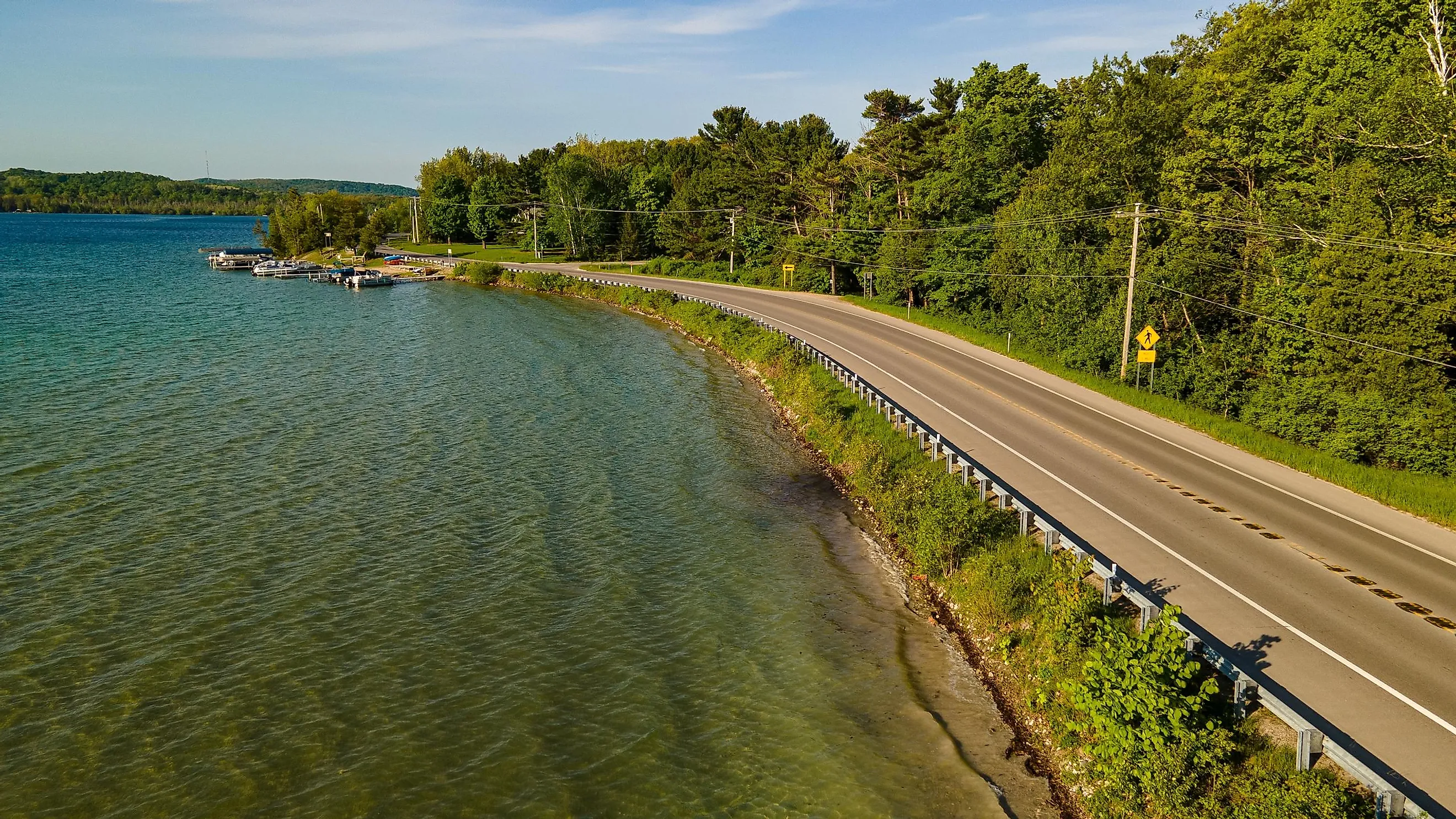
Geography Of Lake Leelanau

Lake Leelanau, which includes North Lake Leelanau and South Lake Leelanau, flows 21 miles through the heart of the Leelanau Peninsula and has a maximum width of about 1.5 miles. Covering 8.89 square miles, South Lake Leelanau measures 8 miles in length and has 25 miles of shoreline. It reaches an average depth of 24 ft and a maximum depth of 62 ft. North Lake Leelanau, which covers 4.55 square miles, reaches an average depth of 40 ft and a maximum depth of 121 ft. A channel called the Narrows hydrologically connects South and North Lake Leelanau.
Approximately 75% of Lake Leelanau's total surface runoff comes from the Cedar River or Victoria Creek and Cedar Run Creek. Between the North and South Lake Leelanau, the water narrows for about a mile close to M-204, the state trunkline highway in the unincorporated community of Lake Leelanau. On its southwestern corner, South Lake Leelanau ends in a marshy area that is fed by many small creeks. The 0.9-mile-long Leland River connects Lake Leelanau with Lake Michigan.
The Michigan Department of Environmental Quality has characterized South Lake Leelanau as an oligotrophic lake. However, it has been found that the lake shows both oligotrophic and eutrophic characteristics and hence can be described best as a mesotrophic lake. Besides two marinas and several campgrounds, South Lake Leelanau also has three public access sites with boat launches.
Climate Of Lake Leelanau
According to Köppen Climate Classification, Lake Leelanau experiences a humid continental climate with hot, humid summers and severely cold winters. The warm season lasts from June 7 to September 18, where July is the hottest month, having an average high temperature between 75°F and 60°F. The cold season lasts from December 3 to March 16, where January is the coolest month, having an average low temperature between 20°F and 30°F. June, July, and August are the most pleasant months in Lake Leelanau, while December and January are the least comfortable months. With 165 sunny days per year, Lake Leelanau receives an average of 33 inches of rain and 116 inches of snowfall annually.
Brief History Of Lake Leelanau

The indigenous people who initially inhabited the area named it “ke-ski-bi-ag,” which meant “narrow body of water,” and the lake “lee-lan-au,” which meant “delight of life.” The well-known American geographer Henry Rowe Schoolcraft, who also served as the territory’s Indian agent, officially named the county “Leelinau.” However, scholars have ascertained that “Leelinau” was originally one of the first pen names used by Jane Johnston Schoolcraft for her writings in the Literary Voyager magazine.
In the mid-19th century, French settlers started arriving in the area from Canada. They named their settlement “Le Naro” due to its location close to the narrows. These settlers also called the lake “Carp Lake,” a name that some locals use even today. Close to Lake Leelanau’s northwestern end, a dam was constructed on the Leland River in 1854. The dam helped raise the water level by 12 ft, thereby increasing the lake's size and inhibiting the upstream migration of fish from Lake Michigan to Lake Leelanau. In 1855, the Schaub family came to the area and planted the County’s first vineyard. The village and the post office officially adopted the name “Lake Leelanau” on March 31, 1924.
Attractions In And Around Lake Leelanau

Fountain Point Resort
Located on South Lake Leelanau’s eastern shore in Michigan’s Suttons Bay Township, this historic landmark has been named after an artesian spring that has been continuously gushing since 1867. The Fountain Point Resort is one of Michigan’s oldest recreational hotel complexes spread over 54 acres, including a half-mile lakefront and a fountain. The resort offers indoor and outdoor recreational activities, such as swimming, boating, fishing, rowing, tennis, etc. The Fountain Point Resort also hosts many community events throughout the year.
Boathouse Vineyards
Placed on the Narrows that connect North Lake Leelanau with South Lake Leelanau, Boathouse Vineyards is a perfect place to enjoy breathtaking views of the lake and sip a glass of wine. The Boathouse Vineyards serve award-winning wines from grapes grown at the 25-acre Leelanau County Vineyard. The Boathouse Vineyards offer live music entertainment on Wednesday evenings and Sunday afternoons in July and August.
Besides the above-mentioned tourist attractions, Lake Leelanau draws hordes of vacationers, especially during the summer months, to enjoy its magnificent vistas and participate in various recreational activities. Therefore, if you are searching for one of the Mitten State's popular vacation spots, then Lake Leelanau is your perfect destination.


