The Best State Parks In The American Southwest
Red sandstone glows like embers at sunset here. That alone is reason enough to drive a few hours. You can get the same views as the national parks without the crowds. At Valley of Fire in Nevada, you can stand in front of petroglyphs older than two thousand years. give me aAt Slide Rock in Arizona, swimmers ride an 80-foot natural chute of creek water. City of Rocks in New Mexico is a maze of volcanic columns on an empty desert plain. You get strange geology at each stop below, plus real trails and dark night skies.
Valley of Fire State Park, Nevada

Nevada opened its first state park here in 1935, and nothing has topped it since. Valley of Fire covers more than 45,000 acres of Aztec sandstone that formed roughly 150 million years ago, about 46 miles northeast of Las Vegas. The rock turns a hot orange-red at sunrise and sunset, which is exactly when photographers set up their tripods. More than 20 miles of trails run to the canyons, arches, and domes. The Basketmaker people carved petroglyphs into some of these rocks over two thousand years ago, and Ancestral Puebloans passed through the area between 300 BC and 1150 AD. The Fire Wave Trail is the one most people come for, a 1.3-mile walk to a swirl of red, pink, and white striped sandstone. The one-mile White Domes loop adds a slot canyon, a few caves, and the leftover set from a 1965 movie shot on-site. Summer heat here is no joke, and rangers close some trails when it spikes, so check conditions before you go. Two campgrounds handle overnight stays, and you may spot desert bighorn sheep, jackrabbits, or a coyote working the scrub.
Snow Canyon State Park, Utah

The name throws people off, since the park was named for Utah pioneers Lorenzo and Erastus Snow rather than for any weather. Snow Canyon sits minutes from downtown St. George and covers 7,400 acres of red and white Navajo sandstone, old lava flows, and petrified dunes. It draws a fraction of the crowds you hit at Zion an hour up the road. Over 38 miles of trails cross the place, and the Petrified Dunes Trail is the easy highlight, a 1.2-mile round trip over frozen waves of sandstone with the whole basin in view. The Whiptail Trail runs closer to six miles out and back for anyone wanting a longer day. Rock climbers work the cliffs, campers fill dozens of sites, and golden eagles ride the thermals overhead. If you would rather stay in the car, the seven-mile Snow Canyon Drive has pullouts over the lava fields and slot canyons.
Dead Horse Point State Park, Utah

The overlook at Dead Horse Point stands 2,000 feet straight above a gooseneck bend in the Colorado River. Over millions of years the river carved the sandstone canyons that fill the view toward neighboring Canyonlands National Park. The main viewpoint is a 200-foot walk from the parking lot, which makes it one of the best payoffs per step in Utah. Sunrise and sunset light the cliffs best, and the state park stays far quieter than the national park next door. The East and West Rim trails run about two miles one-way along the cliff edges for more overlooks. Campgrounds have hookups, and mule deer and coyotes move through the sage. It is also a certified International Dark Sky Park, and mountain bikers have 17 miles of the Intrepid Trail System to themselves.
Slide Rock State Park, Arizona

Frank Pendley filed a homestead claim on this stretch of Oak Creek Canyon in 1910 and planted his first apple orchard two years later. The irrigation system he built still waters the trees, and the 43-acre park is named for him. What draws the summer crowds is the slide itself, an 80-foot chute worn into the creek bed about 10 miles north of Sedona. Algae makes the sandstone slick enough to carry you down into a series of cold pools. The short Slide Rock Trail gets you there with red-rock views along the way. The quarter-mile Pendley Homestead Trail loops past the restored farm buildings and orchards from the early 1900s. Whitetail deer, javelina, black bears, coyotes, and more than 140 bird species live in and around the canyon.
Lake Havasu State Park, Arizona

This is the rare Southwest park where the main event is water, and plenty of it. Lake Havasu State Park runs along the shoreline with more than a dozen beachside cabins and several boat ramps for kayaking, waterskiing, and fishing. Swimmers get real beaches, which are rare in this stretch of desert. Dozens of campsites come with power and water hookups, picnic tables, and fire rings. Birders do well here, especially in winter, when great blue herons, ospreys, and bald eagles work the water. The 1.75-mile Mohave Sunset Trail is paved and follows the shoreline through pockets of desert plants and wildlife.
Red Rock State Park, Arizona

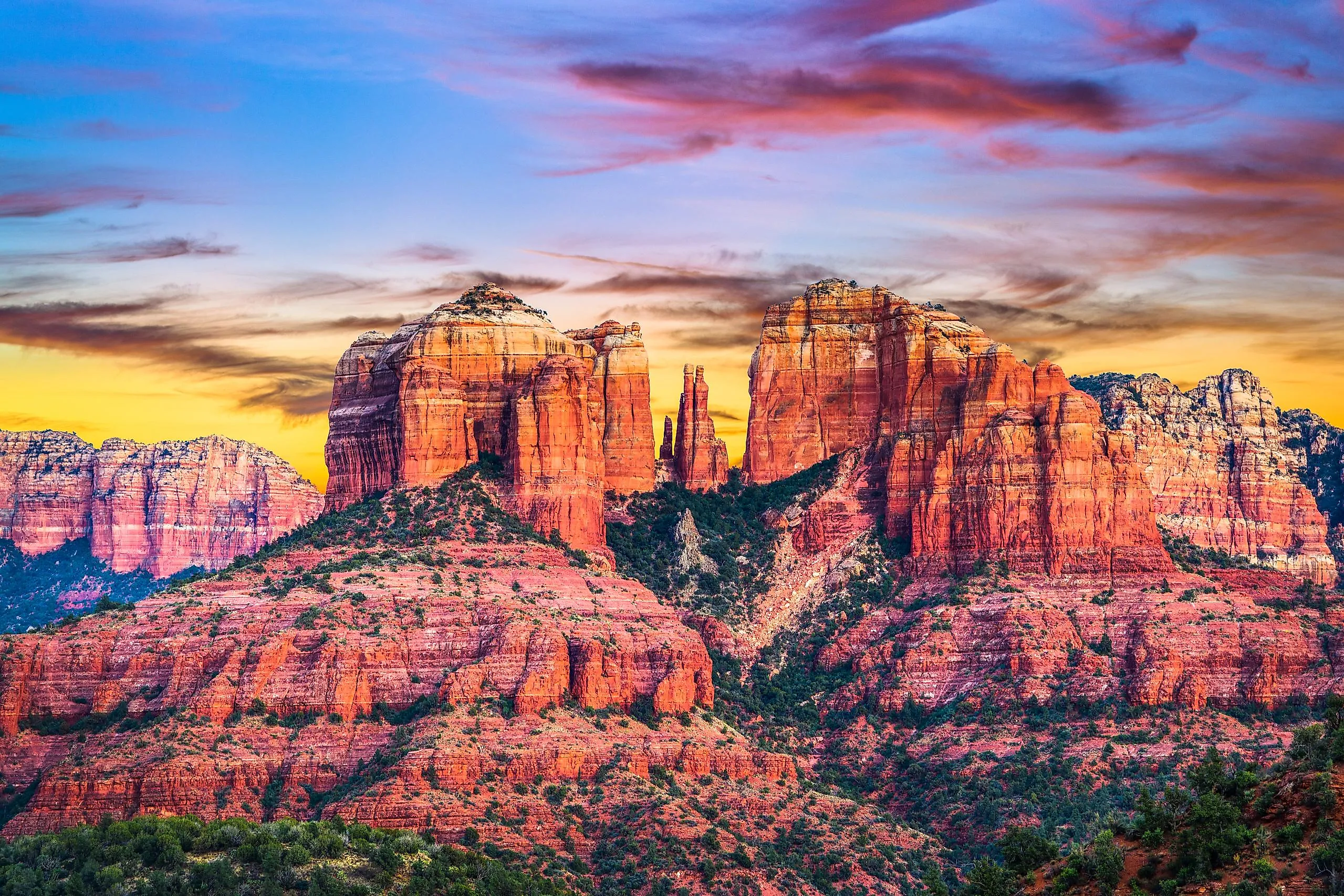
Just outside Sedona, Red Rock State Park is the quiet option when the famous trailheads are packed. The park covers nearly 300 acres of red sandstone along the banks of Oak Creek, threaded by a five-mile trail network. The Eagle's Nest Loop is the pick of the bunch, a 2.5-mile round trip that climbs gently to one of the park's best overlooks above the forest and rock. Picnic shelters dot the grounds, and visitors regularly spot river otters, reptiles, and a long list of birds along the creek. The Miller Visitor Center is worth a stop first, with hands-on exhibits on the local habitats, wildlife, and the people who lived here long before the town did.
City of Rocks State Park, New Mexico

The name is literal. About 30 miles from Deming, in the middle of a flat grass plain, stand rows of rock columns that look like the streets of a small city. A volcanic eruption laid down the rock nearly 35 million years ago, and wind and water spent the time since sculpting the pinnacles you walk between today. The three-mile Hydra Trail leads out to campsites and wide views of the formations and the surrounding Chihuahuan Desert. The Table Mountain Trail is the longer option, a roughly three-mile climb to a mesa-top panorama. Dozens of developed campsites are scattered through the park, and some sit right among the boulders for a night of unusual privacy. There is a desert botanical garden on-site, and the remote location and an on-site observatory make this one of the better stargazing spots in the state.
Palo Duro Canyon State Park, Texas

People call Palo Duro the Grand Canyon of Texas, and the numbers back up the nickname. The canyon runs about 120 miles long, spreads 20 miles at its widest, and drops more than 800 feet, which makes it the second-largest in the country. Water erosion cut it over millions of years, leaving behind the caves, hoodoos, and banded rock walls you see from the rim. Lighthouse Rock is the signature formation, a 310-foot hoodoo shaped like a beacon that you reach on a six-mile round-trip hike. In all, more than 30 miles of multi-use trails cross the park. Campsites come with water and electric hookups, glamping cabins sit on the canyon floor and rim, and the wildlife runs from wild turkey to coyotes and bobcats.
Trading Crowds For Canyon Country
The lesson across all eight parks is a simple one. You do not need a national-park gate and a two-hour line to stand under 300-foot rock towers or swim in a desert creek. At Dead Horse Point and City of Rocks you get the same scale of scenery with a fraction of the traffic, plus some of the darkest skies in the West after sundown. Summer is the one thing to plan around. Wear light colors and a hat, carry more water than you think you need, and start early, since heat closes trails at places like Valley of Fire on the worst days. Check for park alerts before you drive out. Fall, winter, and spring are the easy seasons, and any of them will treat you better than a July afternoon on exposed sandstone.