Coeroeni River
The Coeroeni River can be found in Southern Suriname, a country in the northern portion of South America. Considered a large Surinamese river, the Coeroeni River is a tributary to the Corantijin River, a water body that spans between Suriname and Guyana's eastern areas. The Coeroeni River is fed and connected by several other rivers in Suriname. For decades, researchers have studied the Coeroeni River, particularly for its geography and wildlife, prompting several significant findings in and around the water body. The river is also part of a boundary conflict between Suriname and Guyana, a dispute that has been around for decades.
Where Is The Coeroeni River?

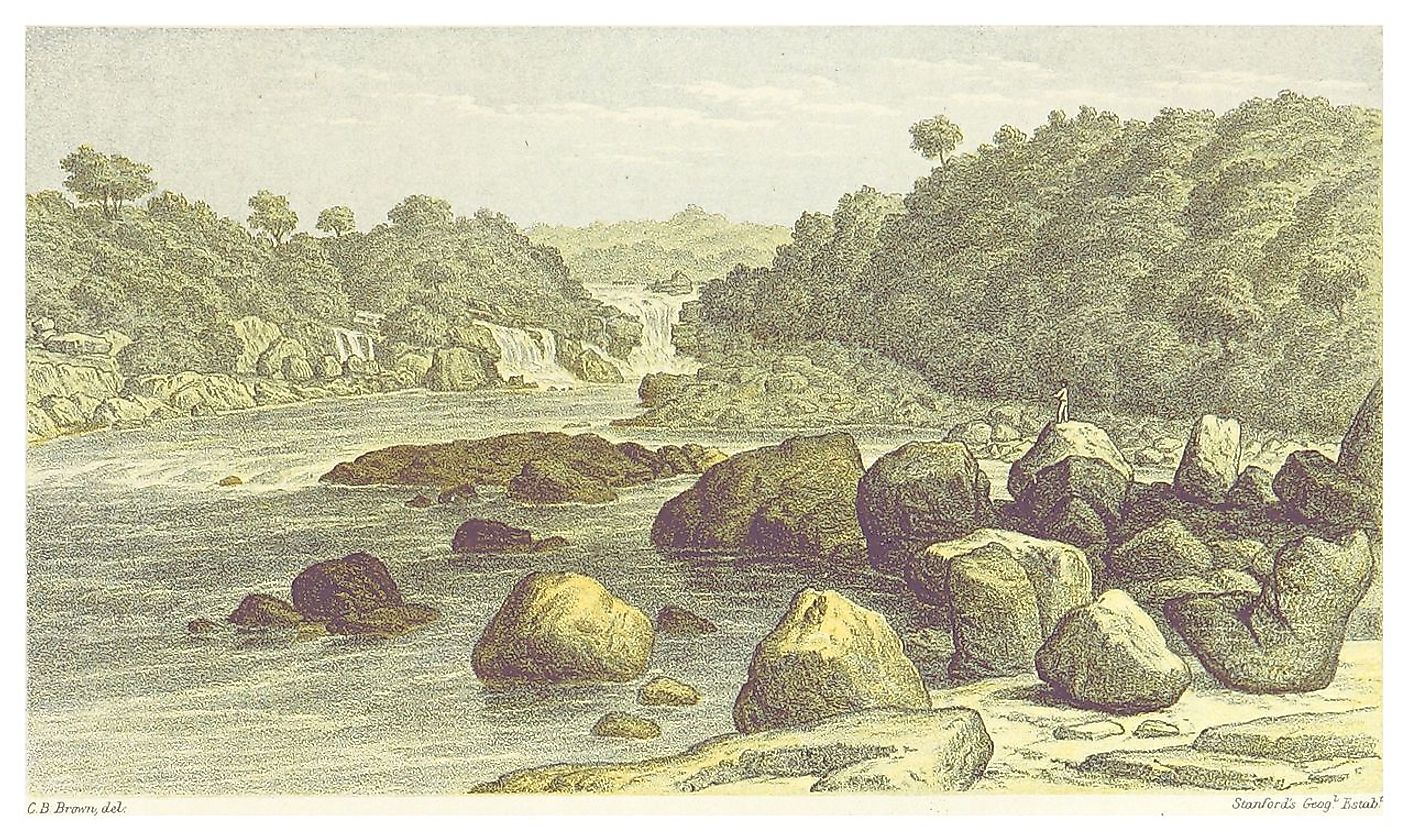
The Coeroeni River is in South America, specifically around Southwest Suriname. Considered a large river, the Coeroeni River starts at the Tumuc-Humac Mountains, creating a drainage divide between Brazil, Suriname, and Pará, and continues flowing northward. The river is located downstream of the Kutari (or Koetari) River, a small tributary that sits in Southern Suriname. The area surrounding the Coeroeni River, alongside the Upper Corentyne and Kutari Rivers, makes up the Tigri Area, an area of political dispute between Suriname and Guyana. Its waters are sourced from Suriname's Kutari, Aramatau, and Sipaliwini Rivers.
Geography Of The Coeroeni River

The Coeroeni River is one of the many tributaries to the Corantijin River, a water body that drains the land surface of Suriname (along with six other river systems). The Coeroeni River, Lucie River, the headwaters of the Kabalebo River, and the Upper Corantijin River make up the Coeroeni-Lucie area in Southwest Suriname. This area is a lowland with elevations between 100 to 250 meters and a handful of isolated hills. The environment surrounding the Coeroeni River can be described as having a tropical rainforest climate. Its rainforest environment and climate are likely to support a wide range of species that scientific researchers have studied in the past, especially insects and amphibians.
Coeroeni River Wildlife
Throughout the years, there has been scientific research to study the wildlife in the Coeroeni River and the surrounding areas. For example, in the late 1960s, researchers collected freshwater fish species in the Coeroeni River and other neighboring rivers. Expeditions have also been carried out to study amphibians, reptiles, fishes, and other species that live in (and around) the river. Species like spiders, grasshoppers, katydids, piranhas, scorpions, snakes, various insect species, and lizards have been found in the environment.
A genus of frogs known as Eleutherodactylus has also been studied and found around the Coeroeni River, particularly a species known as the Eleutherodactylus chiastonotus (or Prismantis chiastonotus). These frogs are also known as "rain frogs" for their high-pitch, insect-like voices. Besides Suriname, these frogs can also be found in the Southern United States, parts of Hawaii, Central America, Mexico, and the Caribbean. In addition, a few species of dendrobatids (commonly known as poison dart frogs) have also been reportedly found and identified around the south bank of the Coeroeni River. Typically, these amphibians are small, diurnal species known for their vibrant, colorful, and poisonous skin!
The Geology Of The Coeroeni River
The Coeroeni-Lucie area (which encompasses the Coeroeni River) is part of the Precambrian Guiana Shield, a geological formation in South America approximately 1.7 billion years old! The Guiana Shield is about 270 million hectares and includes other parts of Colombia, French Guiana, Guyana, Venezuela, and Suriname. This geological formation is significant, containing 18% and 20% of the world's tropical forests and freshwater.
Moreover, researchers studied the rocks in and around the Coeroeni River throughout the decades. Collectively with the area in and around the Corantijin and Lucie Rivers, these rocks are called the Coeroeni Group. It has been observed that this group is typically composed of high-grade metamorphic rocks, including a metamorphic rock variety known as gneiss.
Significance Of The Coeroeni River

The Coeroeni River, together with the Upper Corentyne River and the Kutari River, encompasses the area that comprises the Tigri Area, a "triangular" area of an ongoing dispute concerning territory boundaries between Guyana and Suriname. Also known as The New River Triangle, this conflict has separated both sister countries, putting them at odds.
The conflict has been around since the Dutch and English colonization and remains ongoing even after Guyana and Suriname claimed independence. To date, countries have not agreed upon the rights and appropriate to the area around The New River Triangle. Though Suriname regards it as a part of the Coeroeni Resort in the Sipaliwini District, Guyana considers it part of an area in the East Berbice-Corentyne region. Though the conflict peaked in 1968 and 1969, both governments agreed to continue discussing the border dispute.
The Coeroeni River is connected to several water bodies around Suriname and the surrounding area. Decades of research into the area's rocks and wildlife have also reported interesting findings about its geological composition and species diversity. Moreover, the Coeroeni River is also significant due to its involvement with ongoing boundary disputes between Guyana and Suriname.


