This North Carolina Scenic Byway Is The Road Trip Of A Lifetime
Few drives in America ask you to slow down the way the Blue Ridge Parkway does. The speed limit tops out at 45 miles per hour, there are no billboards and no trucks, and the whole point is to let the mountains scroll past at a pace you can actually take in. The full route runs 469 miles between Shenandoah National Park in Virginia and the Great Smoky Mountains in North Carolina, and roughly 250 of those miles belong to North Carolina alone. Over three unhurried days you can trace the state's share of it, past waterfalls, a mountain village modeled on the Swiss Alps, rhododendron thickets, and craft traditions handed down through generations. One caveat before you go: Hurricane Helene closed part of the North Carolina stretch, so check the National Park Service road map for current closures and winter ice before you lock in the drive.
Day 1: Cumberland Knob to Blowing Rock

North Carolina's stretch of the Parkway begins at Cumberland Knob, milepost 217.5, right where the National Park Service painted a line across the pavement to mark the Virginia line. This is hallowed ground for the road itself, since construction of the entire Parkway broke here in 1935. A short paved loop stretches your legs after the drive up, and a couple of miles south, the Fox Hunters Paradise overlook earns its odd name from the hunters who once stood here to listen for their hounds baying in the valley below. Little Glade Mill Pond, a former grist mill site, makes a quiet spot to stop a little farther on.
The road then winds past Stone Mountain and Mahogany Rock before reaching Doughton Park, whose 7,000 acres fill with color through the year. Flame azaleas and orange-tinged rhododendrons peak in late spring, and by high summer the meadows turn purple with dense blazing star. Come in fall and the overlooks near Bluff Mountain and Basin Cove run gold. About 40 minutes past Cumberland Knob you reach the Laurel Springs access point, a good place to pull over for photos before you continue on to milepost 250.

Roughly 15 minutes farther, the Northwest Trading Post in Glendale Springs is worth a stop for regional crafts, jams, and a restroom break, and it makes a handy spot to grab something for the road. Past the overlooks at Jumpinoff Rock, The Lump, and Mount Jefferson, the Park Vista Diner serves a straightforward American lunch about 15 minutes on. From there it is another 35 to 40 minutes to Mystery Hill, a family-friendly roadside attraction with a river walk, gem mining, and axe throwing, easily an hour or two of detour. Blowing Rock, one of the Parkway's most beloved little towns, sits near milepost 292 and makes the night's stop. The Alpine Village Inn is a homey base, and the Town Tavern is a reliable pick for a burger and a beer.
Day 2: Blowing Rock to Little Switzerland

Start the morning in Blowing Rock with breakfast at the wonderfully named Hellbender Bed & Beverage, where orange umbrellas shade the patio in warm weather. A few steps away, the Blowing Rock Art & History Museum runs mixed-media exhibitions and hands-on workshops covering subjects as varied as poetry and ecology, a small window into the culture of the southern mountains. If you have time before leaving town, Moses H. Cone Memorial Park is worth the pause, with the grand Cone Manor and easy paths down to Bass Lake and Cone Lake.
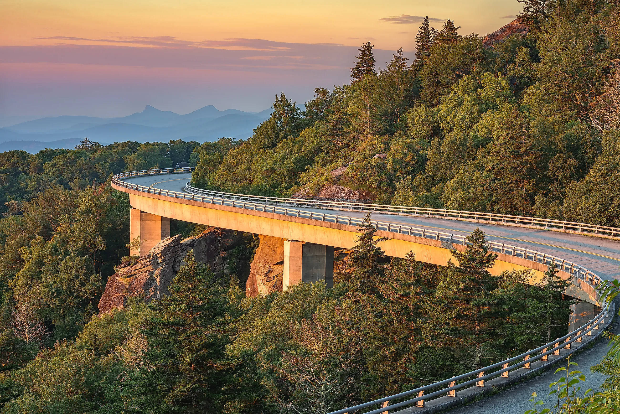
Back on the Parkway, the road runs past Price Lake and the edge of Grandfather Mountain to the Linn Cove Viaduct, about 25 minutes on. This quarter-mile ribbon of concrete curves along the mountainside in a long S, and it holds a special place in Parkway history: finished in 1983, it was the last piece of the whole 469-mile road to be built, closing the missing link that completed the route in 1987. The overlooks here run especially vivid in fall.

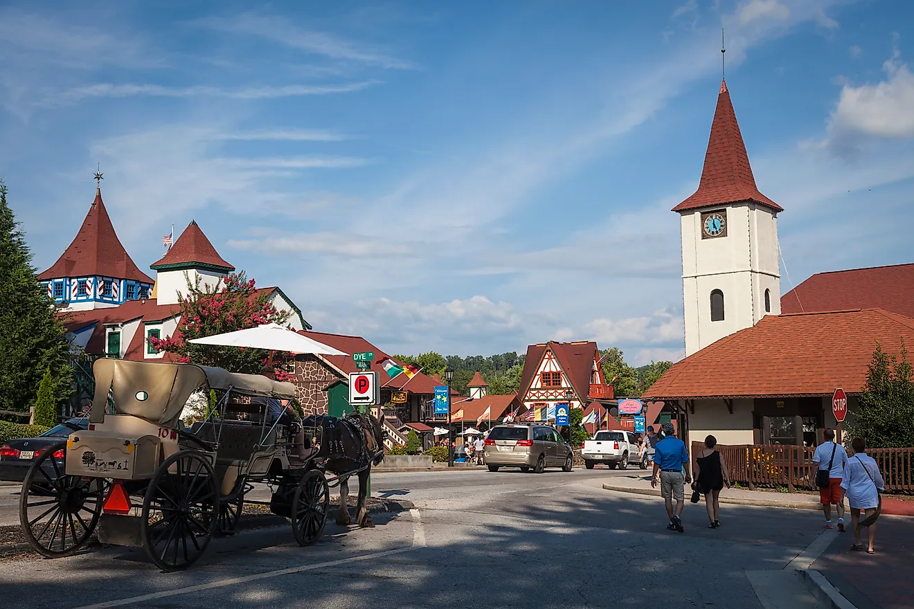
This is the stretch to check before you drive it. As of early 2026, roughly 35 miles between Linville Falls and Mount Mitchell, near milepost 317 through 355, were still closed to through traffic for Hurricane Helene repairs, with crews aiming to finish by late 2026. Where the road is closed, a detour on nearby state highways gets you around to Little Switzerland. Another 25 minutes past the viaduct brings you to milepost 317.5 and Linville Falls Winery, a relaxed afternoon stop. Under half an hour farther, the Orchard at Altapass lets you pick apples in harvest season and browse a general store stocked with local goods. The Museum of North Carolina Minerals, near milepost 331, lays out the region's mining and geologic story in under 10 minutes more. The night ends at the Switzerland Inn in Little Switzerland, an unincorporated village near milepost 334. Justice Heriot Clarkson founded the resort in 1910 after standing atop nearby Grassy Mountain and deciding the valleys and ridgelines looked like the Swiss Alps, and the chalet-style buildings have kept that theme ever since. The Switzerland Cafe rounds out the evening with dinner.
Day 3: Little Switzerland to Cherokee

Ease into the last day with coffee at the Switzerland Cafe, then pick up the Parkway toward milepost 344 and the Buck Creek overlook, where the air sharpens and the curves tighten. Craggy Gardens Visitor Center, near milepost 364, comes within 40 minutes or so, road conditions permitting, and its trails thread through gnarled beech and birch forest. Half an hour on, in Asheville, the Folk Art Center houses the Southern Highland Craft Guild, where you can watch Appalachian craft traditions handed down firsthand. The Blue Ridge National Heritage Area, five minutes away, gathers the region's music and art under one roof.

Leaving Asheville, the road crosses the French Broad River and reaches Graveyard Fields about an hour later, at milepost 418.8. A hike here may or may not lead you to a waterfall, depending on which fork you take, but the high, open meadow is a draw on its own. From there it is another hour southwest to the Waterrock Knob Visitor Center, near milepost 451, past some of the last great viewpoints on the route. This final leg borders the Qualla Boundary, homeland of the Eastern Band of Cherokee Indians. A little over half an hour more delivers you to the Oconaluftee Visitor Center at milepost 469, on the edge of the Great Smoky Mountains in Cherokee, where the Parkway comes to its end.
Where the Road Goes Next

You can turn around and drive the whole thing north again, watching the same country change in the opposite light. Or you can save the rest of North Carolina's scenic byways for another trip. The Cherohala Skyway climbs through Cherokee and Nantahala forest land, the Forest Heritage byway loops through Pisgah, and Newfound Gap Road runs deeper into the Great Smoky Mountains. For something completely different, the Outer Banks Scenic Byway runs along barrier islands and open Atlantic instead of ridgelines. Any one of them makes a fine next chapter, and the Parkway will still be here, waiting to be driven again.