9 Most Scenic Drives in Ohio
Ohio sits at the crossroads of America, balancing the bustle of cities like Cleveland, Columbus, and Cincinnati with landscapes that feel worlds apart from urban life. Known as the “Heart of it All,” the state stretches from the flat, glacial plains of the northwest to the rolling Appalachian foothills in the southeast. This geographic diversity makes Ohio one of the most rewarding states in the United States to explore by car.
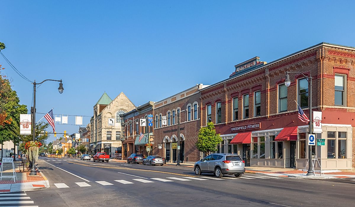
Its byways stitch together stories of industry, culture, and nature. In the east, the National Road cuts through Zanesville, once a central hub for pottery and river trade. In Holmes County, the Amish Country Byway slows travelers down with horse-drawn buggies, farm stands, and the quilt-like fields around Millersburg and Berlin. These scenic drives in Ohio are not about rushing to a destination, but about finding beauty in the in-between.
Hocking Hills Scenic Byway

The Hocking Hills Scenic Byway is one of Ohio's most popular short road trips, linking small towns, sandstone cliffs, and quiet valleys. Beginning in Logan at the Hocking Hills Regional Welcome Center, this loop to Laurelville can be comfortably done in under three hours. The first major stop is Cantwell Cliffs, just 17 minutes south of Logan. The short trails here are rugged but rewarding, with high overlooks and shaded gorges that make it less crowded than other Hocking Hills spots. Continuing down State Route 374, drivers reach Rock House, a natural corridor carved into Blackhand sandstone. This stop feels different from the waterfalls and caves that define most of the region and only takes 30-40 minutes to explore.
Not far ahead sits Conkle’s Hollow State Nature Preserve. The gorge trail is flat, accessible, and ideal for stretching your legs. On the opposite end of the preserve, a rim trail offers more expansive views of the forest canopy. For a break, travelers can stop at Grandma Faye’s Grocery, a corner store that doubles as a snack stop with sandwiches, coffee, and fuel.
The centerpiece of Hocking Hills, Old Man’s Cave, combines waterfalls, stone bridges, and cliff walls. Trails connect to Cedar Falls and Ash Cave, but even a short loop shows the region’s most iconic scenery. A few minutes south, Cedar Falls plunges into a shaded gorge. The half-mile trail is short but lovely, often framed by mossy boulders. The final natural stop is Ash Cave, the largest recessed cave in Ohio. The wide trail leads directly to a horseshoe-shaped sandstone amphitheater, with a thin waterfall spilling over the rim in wetter months. The byway ends in Laurelville. From here, many travelers loop back toward Logan or detour to local attractions, like the Hocking Hills Winery or Valley Zipline Tours.
Miami & Erie Canal Byway

The Miami & Erie Canal Byway traces a section of Ohio’s historic canal route, connecting small towns that once thrived on water transport. The trip begins in Delphos, where the Canal Museum gives context to the 19th-century engineering feat and the town’s role in its operation. The drive south to Piqua is about three hours from here with planned stops.
Heading southeast, the first stop is St. Marys, a canal town that preserves its roots. Visitors can stretch their legs on the Canal Towpath Trail, a short, flat section ideal for walking beside restored canal locks. The next key stop is New Bremen, home to the Bicycle Museum of America. The collection ranges from 19th-century wooden models to modern racing bicycles.
Further south, the route passes Lake Loramie State Park. This large lake and green space is a good stop for picnicking or renting a small boat. The park is less crowded than nearby Grand Lake St. Marys and offers shaded rest areas to pause before the final stretch. The drive concludes in Piqua at the Johnston Farm & Indian Agency, where preserved frontier buildings and a working canal boat (operational in summer) bring Ohio’s canal history to life.
National Forest Covered Bridge Scenic Byway (SR-26)

The National Forest Covered Bridge Scenic Byway follows State Route 26 through the Wayne National Forest. Starting in Marietta, one of Ohio’s oldest river towns, the route heads north into quiet valleys and dense woods before ending in Woodsfield, the Monroe County seat. The trip covers about 50 miles, and with stops for bridges, short hikes, and a meal, it can be completed in around three hours.
The first highlight is the Hune Covered Bridge, which is only a short drive outside Marietta. This 1879 construction spans the Little Muskingum River. A small parking area allows visitors to walk across the span and view the creek below. Further up the byway lies the Rinard Covered Bridge, restored after a flood in the 1990s. It is one of the most photographed structures on the route. The nearby picnic area makes it a quiet stop for a short break.
Midway through the drive, the Lamping Homestead Recreation Area offers a chance to step off the road. Trails loop through forested hills, and the small lake here is popular for birdwatching or a quick picnic. It’s a good midpoint before continuing north. Along the way, travelers will pass roadside Amish produce stands and seasonal farm markets. These are easy to miss but worth a stop for fresh pies or handmade goods. In Woodsfield, the Monroe County Courthouse dominates the town square.
Neil Armstrong Scenic Byway

The Neil Armstrong Scenic Byway highlights Ohio’s connection to space exploration while crossing small towns and lakeside landscapes.Beginning in Wapakoneta, the hometown of Neil Armstrong, and ending in St. Marys near Grand Lake St. Marys, the 60-mile drive takes about 2 hours with short stops. The drive starts at the Armstrong Air & Space Museum in Wapakoneta. The museum houses artifacts from Armstrong’s career, including a moon rock, the Gemini 8 spacecraft, and personal memorabilia. It provides a strong context for the road ahead. From here, the byway heads west along US-33.
A few miles out of town sits Heritage Park, a smaller but worthwhile stop with trails, a covered bridge, and picnic areas. Travelers often overlook it, making it a quiet place to pause. The byway leads to Fort Amanda Memorial Park, where earthworks from an 1812 fort remain. Interpretive signs and a short climb up the memorial tower give views of the Auglaize River.
Farther south, the route reaches New Knoxville, a small community with German heritage. The New Knoxville Historical Center preserves artifacts from early settlers, and the town’s bakeries and diners offer a practical food stop. The final stretch leads into St. Mary's, once a key canal town. The shoreline of Grand Lake St. Marys is the natural highlight here. The state park offers picnic shelters, walking paths, and views over Ohio’s largest inland lake. Guarnieri Pizzeria is near the water for a casual meal, so it is a convenient stop before the trip ends.
Triple Nickel (SR 555)

The Triple Nickel, or State Route 555, is one of Ohio’s most talked-about backroad drives. Known for its curves and hills, the route connects Zanesville, a historic town on the Muskingum River, to Little Hocking, a small community along the Ohio River. Zanesville is famous for the Y-Bridge, a rare three-way bridge worth a quick walk or photo. Before leaving town, the Alan Cottrill Sculpture Studio makes a unique stop, with hundreds of bronze works displayed in the artist’s gallery.
Heading south on SR 555, the road quickly narrows and winds through farmland and wooded hills. About 40 minutes in, a detour leads to Ringgold, a small crossroads community. Though quiet, it’s known for its historic church and scenic valley overlooks. This is also a good place to pause at a general store for drinks before continuing.
The route passes near Burr Oak State Park. A short side trip brings visitors to the lake, which has picnic spots and a lodge restaurant if they want a meal break. The forested hills here contrast with the open farmland earlier in the drive. Closer to the end, the road dips through small hamlets like Chesterhill, where Chesterhill Produce Auction displays local produce and baked goods. Finally, in Little Hocking, the Ohio River delivers expansive views at a slower pace.
Scenic Scioto Heritage Trail

The Scenic Scioto Heritage Trail follows the Scioto River and backroads of southern Ohio, connecting prehistoric sites, historic bridges, and small towns. The 90-mile stretch starts from Portsmouth, a river town at the Ohio River’s edge, and ends in West Union, the seat of Adams County. The first stop is in Portsmouth at the Floodwall Murals. This mile-long outdoor gallery tells 2,000 years of regional history, from ancient cultures to the steamboat era. Heading north, the byway passes through quiet farmland before reaching the Historic Otway Covered Bridge. Built in 1874, it was restored in the early 2000s and serves as a photo spot and a picnic stop today.
Continuing west, the road winds through small communities like Cherry Fork and Youngsville. Both are classic rural Ohio towns with churches, open fields, and small corner stores that make for good rest breaks. From here, the trail dips toward Decatur, a settlement with roots in the early 19th century and a few roadside markets selling local produce. The next town is Bentonville, home to the unique Bentonville Anti-Horse Thief Society monument commemorates a 19th-century vigilante group formed to protect farmers’ livestock. It’s a quirky and often-missed roadside landmark worth a quick pause. After reaching West Union, you can eat heartily at Frisch’s Big Boy.
Ohio River Scenic Byway

Ripley makes a strong starting point for a drive along the Ohio River. This town was central to the Underground Railroad, and the John Rankin House overlooks the water with views that set the tone for the trip. From here, the road follows U.S. Route 52. Your first stop is Aberdeen, just across from Maysville, Kentucky. It is home to the Simon Kenton Memorial, honoring the frontiersman who helped open Ohio to settlement. Heading east, the drive passes farmland and quiet communities until reaching Manchester, one of the state’s oldest towns, settled in 1791. Here you’ll find Massie’s Station Blockhouse, a replica of Ohio’s first permanent settlement, and small eateries where travelers can grab lunch.
Continuing along the byway, Cheshire offers a quieter stop. The village has scenic overlooks of the river and small shops often skipped by travelers. A short detour inland leads to Bob Evans Farm in Rio Grande, where the restaurant chain began. The journey comes to its last destination in Gallipolis, a river town with strong French heritage. City Park faces the river and is surrounded by historic buildings. Local galleries and the Ariel Theatre add culture to the riverfront finish, making this one of Ohio’s most rewarding day drives.
Appalachian Byway (State Scenic Byway)

This stretch of State Route 78 is a ridge-top ribbon through southeastern Ohio’s Appalachian foothills. The 105-mile Appalachian Byway connects with the Ohio River Scenic Byway at Clarington and can also be approached from Caldwell via I-77 exit 25. For a manageable, beautiful half-day drive, the section between Caldwell and Clarington offers the right mix of history, rolling hills, and wooded views in about 3½ hours.
Just east of Caldwell is the Thorla-McKee Well Wayside, the site of North America’s first oil-producing well. Visit the preserved hollow sycamore casing and read the marker about how early settlers extracted salt and accidentally tapped oil. Further down the route, Piatt Park in Monroe County has short hikes, waterfalls, and picnic spaces. Next, the county seat, Woodsfield, invites a stop at the Hollister-Parry House Museum or the restored historic Monroe Theatre. Though undergoing renovations, it still adds a touch of theater charm to the drive.
On SR 78, the road winds along Sunfish Creek Valley, where several pull-offs give expansive views over forested hills and narrow ridges. As the road drops into the river valley, it comes to a halt in Clarington. From here, a quick side trip south on SR 7 brings you to the Hannibal Locks & Dam, where you can watch barges navigate the Ohio River.
Amish Country Byway (National Scenic Byway)

The Amish Country Byway weaves through Holmes County, home to the largest Amish community in the world. In Millersburg, travelers can explore the Victorian courthouse square and stop by the Holmes County Historical Society’s Victorian House Museum before moving east. A short drive takes you to Berlin, a hub for Amish crafts and food. Berlin Village Antique Mall and Boyd & Wurthmann Restaurant are popular stops. You can also pause at the Berlin Creek & Blue River Gallery to see contemporary art in the middle of Amish country.
Continuing along SR-39, Charm is a quieter village often overlooked by visitors. Keim, a large family-owned store here, showcases handcrafted Amish wood furniture. From Charm, the road dips into rolling farmland dotted with horse-drawn buggies and whitewashed barns. Look for pull-offs near the Holmes County Trail, a multi-use path that shadows the route, before reaching Sugarcreek, detour slightly south to Walnut Creek. The Carlisle Inn provides a good rest stop, and the Walnut Creek Cheese Market sells baked goods and Amish staples. Finally, the drive ends in Sugarcreek, taking pride in its Swiss heritage. The World’s Largest Cuckoo Clock marks the town square, while the Alpine Hills Museum explains the area’s cultural mix.
What makes these journeys so rewarding is their ability to connect natural beauty with living history, whether passing through Millersburg’s quiet farmlands or tracing the bends of the Appalachian Byway through Gallipolis. Unlike the hurried pace of interstates, the scenic drives in Ohio encourage slowing down and noticing the details: a covered bridge tucked into a back road near Cherry Fork and the vibrant colors of fall along the Hocking Hills. Together, these drives form a patchwork of experiences celebrating Ohio’s balance of past and present, rural and urban, land and water.