9 Most Scenic Drives in Georgia
A single tank of gas can carry you across four of Georgia's geographic regions in a weekend. The Cohutta-Chattahoochee climbs through Appalachian foothills to overlooks that stretch for miles. Down south the Altamaha runs just 17 miles through tidal marsh past a 1721 colonial fort. Between them sit routes tracing Roosevelt's favorite country roads and Sherman's march to the sea. Every drive here rewards the detour more than the destination. These nine byways make the argument for slowing down.
Cohutta-Chattahoochee Scenic Byway

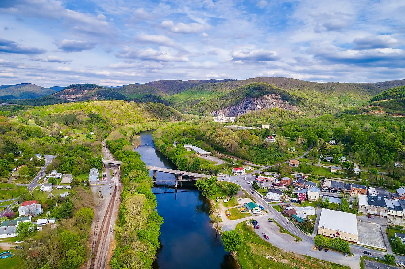
Traversing northwest Georgia's Appalachian foothills, the Cohutta-Chattahoochee Scenic Byway is a 54-mile route that winds through the Cohutta Mountains and into the Chattahoochee National Forest. The roughly three-hour drive runs from Historic Prater's Mill toward the higher slopes of Fort Mountain and Cohutta Overlook. It is accessible year-round, and each season brings its own display. Spring fills the fields with wildflowers, while fall turns the ridges into a wash of color.
Starting at Historic Prater's Mill in Whitfield County, a water-powered grist mill built in 1855, the Cohutta-Chattahoochee Scenic Byway begins eastward through rural farmland along State Route 2. The route continues toward the US 411/SR 61 corridor and Chatsworth before climbing east on State Route 52 through Fort Mountain State Park. As you travel toward the mountain's higher slopes, glance to your right to take in the ranges and valleys in the distance. After crossing Fort Mountain, the route reaches Cohutta Overlook, where the Appalachians offer a broad final view.
The highways are paved and suitable for ordinary vehicles, but SR 52 includes sustained grades and sharp curves. Fog, ice, or heavy fall foliage traffic can make the mountain crossing slower than expected.
Ridge and Valley Scenic Byway

Offering a different perspective of northwest Georgia's varied landscape, the Ridge and Valley Scenic Byway spans 51 miles via US 27, State Highway 156, State Route 136, and several rural county roads. Making a loop from the Villanow General Store, this route draws nature enthusiasts and aspiring historians alike with mountain overlooks, open farmland, and Civil War-era historical sites.
From your starting point in historic Villanow, a key supply route during the Civil War, head east on State Route 136 until you reach Pocket Road. While on Pocket Road, take in the ridgeline views expanding in the distance as you slowly wind through the Chattahoochee National Forest.
For an optional overlook detour, turn right onto Forest Service Road 208 toward Johns Mountain Overlook. After the roughly 2-mile drive, you can take a short walk to an incredible scene of the Chattahoochee National Forest and valleys below. The gravel access road can be rough after heavy rain and may not suit low-clearance vehicles. Return to Pocket Road and continue south toward US 27. Follow US 27 to Gore-Subligna Road until it turns to State Route 136, taking you back to Villanow.
Russell-Brasstown Scenic Byway

Deep in the Chattahoochee National Forest in northeast Georgia, the Russell-Brasstown Scenic Byway is a 40-mile loop featuring wide-ranging views of the state's mountainous region, including Brasstown Bald, Georgia's tallest peak. While scenic splendor can be found throughout the year, autumn attracts the most travelers with foliage unmatched anywhere in the state. Make sure to allow three hours of travel time, with room to spare for stops along this gorgeous mountain drive.
Beginning north of Robertstown at the intersection of GA 17/75 and GA 75 Alternate, follow GA 17/75 north before turning west onto GA 180. Continue west to GA 348, the Richard B. Russell Scenic Highway, which curves southeast through the mountains. GA 75 Alternate completes the loop by carrying drivers northeast toward the starting junction. Forestry signage for the byway can be found along the drive, so you need not fear a wrong turn.
Hugging the headwaters of the Chattahoochee River and crossing the Appalachian Trail, this route showcases 118,000 acres of designated wilderness with several scenic overlooks along the way. Though drivable with any vehicle, beware of steep inclines which can put a lot of strain on your brakes.
The most dramatic optional stop is Brasstown Bald, reached by following GA 180 Spur from the main byway to the visitor-area parking lot. You can stretch your legs on a steep, roughly 0.6-mile paved trail to the top or take the seasonal shuttle when it is operating. Once at the mountain's peak, you can expect to see spectacular views of Georgia, Tennessee, North Carolina, and South Carolina. Winter weather can close GA 180 Spur or interrupt visitor services, while drivers should use lower gears and careful braking on the steep descents.
Meriwether-Pike Scenic Byway

Celebrating former President Franklin Delano Roosevelt's relationship with the state, the Meriwether-Pike Scenic Byway connects the late president's favorite routes across west-central Georgia through Meriwether and Pike counties. The 55-mile loop uses State Routes 85, 18, and 190, along with Flat Shoals Road and other connecting local roads. It crosses Pine Mountain ridges and Flint River lowlands. Along the way it passes farms, old rail towns, and rural communities seemingly untouched by modernity. Typically, the drive takes two hours, but history buffs should expect to spend longer diving into the rich history of the region.
You can begin your journey anywhere along the route, though most start in Warm Springs on State Route 85, home to Roosevelt's historic Little White House. Leaving from the Warm Springs Welcome Center, a model of the train depot where Roosevelt came to town, head north on GA 85. If you are up for a slight detour, follow Covered Bridge Road to drive through Red Oak Covered Bridge, a 19th-century lattice bridge built by the formerly enslaved bridge builder and engineer Horace King.
Continue north on GA 85 through rolling farmland toward Gay, then east on Flat Shoals Road. You will cross the Flint River, part of the historic Muscogee trail network, before turning southwest on SR 18 toward Molena. South of Woodbury, return to SR 85 toward Manchester, a still-thriving 20th-century railroad town, then continue to SR 190, which will carry you back toward Warm Springs.
The roads are paved and suitable for ordinary vehicles, but the rural turns can be easy to miss. Drivers should download the official route map before leaving Warm Springs.
Enduring Farmlands Scenic Byway

For a closer look at the state's agricultural heritage, make your way to central Georgia's Enduring Farmlands Scenic Byway. The 65-mile loop follows portions of US 129/SR 11, SR 112, and US 280/SR 30 through Hawkinsville, Pineview, Rochelle, and Abbeville. The byway weaves through Pulaski and Wilcox counties, highlighting historic rural towns and colorful pastoral landscapes. Each season brings its own magic, though it is best to avoid this byway during summer if you are heat-averse, as southern humidity takes center stage. Allow about three hours of driving time, with extra time for brief heritage stops.
The route starts in Hawkinsville, with the 1907 Hawkinsville Opera House as a historic backdrop. Interior access will depend on the current event and tour schedule. Once you've left town, the route passes through Ocmulgee River lowlands before stretches of pine forest and farmland emerge along the road toward Pineview.
Continuing through Rochelle and Abbeville, brick storefronts and railroad-era town centers break up the agricultural scenery. Railway enthusiasts should take note of the Garden Club Caboose Park in Pineview, home to a historic red caboose commemorating the Hawkinsville and Florida Southern Railway. Seasonal produce stands may appear along the route, but services can be limited between towns, so drivers should fuel up before leaving Hawkinsville.
Historic Dixie Highway

Connecting Albany and Thomasville, the Historic Dixie Highway is a 62-mile route following the US 19/GA 3 corridor. It traces part of the Dixie Highway System established in 1915, a network of named auto routes that linked cities between Canada and Florida rather than one continuous road. Scenic views of quiet rivers and rural countryside account for most of the drive, with historic sites and quirky finds at either end. The route can easily be driven in a few hours, but most plan for a weekend to fully explore both towns.
Downtown Albany begins your journey near the Flint River. If you only have time for one stop before leaving, the Flint RiverQuarium offers an in-depth look at the history and ecology of the region's best-known waterway.
From Albany, follow US 19/GA 3 south through Baconton, Camilla, and Pelham. The road crosses flat agricultural country where pecan groves, cultivated fields, and small farming communities dominate the view. Farther south, the landscape gradually shifts toward longleaf pine and the rolling Red Hills surrounding Thomasville.
The route is paved and generally easy to drive, with broad, divided stretches carrying regular local and commercial traffic. Summer heat and thunderstorms can be intense, while spring and fall provide the most comfortable conditions. Downtown Thomasville makes a natural endpoint, with shops and restaurants close to the historic corridor.
Altamaha Historic Scenic Byway

A south Georgia treasure, the Altamaha Historic Scenic Byway is a 17-mile coastal-marsh and river corridor along State Route 99 and US Highway 17. It runs through McIntosh County, Glynn County, and the city of Darien, the state's second-oldest city. Do not let the byway's low mileage fool you; this route is dotted with historic sites, coastal attractions, and vast marsh scenery. You can complete the drive in under half an hour without stopping, though you will need longer to see everything the byway has to offer.
Your travels start at the Sapelo Island Visitors Center in Meridian, where you can check out exhibits on the island's ecosystem and cultural heritage. As the drive unfolds, the route will carry you south through tidal wetlands. Fort King George State Historic Site preserves the location of a 1721 British outpost, once the empire's southernmost fort in North America. Reconstructed barracks, a blockhouse, and other defenses show how the original installation would have appeared. Visitors can also explore nature trails or picnic beside the Altamaha River.
The journey ends near Needwood Baptist Church and School, a surviving 19th-century Black church and one-room school complex. If you're making the trip in summer, be aware of the oppressive humidity and potential for bugs.
Ocmulgee-Piedmont Scenic Byway

The Ocmulgee-Piedmont Scenic Byway is a 21-mile route in Jones County, an hour and a half south of Atlanta. Rich with historic sites documenting 17th- and 18th-century Muscogee history as well as Civil War-era sites, the byway highlights 200 years of the county's history. You can easily take this trek in one to two hours, making it the perfect quick getaway.
The route begins in downtown Gray on GA 11 and continues south for nine miles along the corridor used by General Sherman during his 1864 March to the Sea. Turn west onto Round Oak-Juliette Road and continue for 12 miles, ending near the Ocmulgee River in Juliette.
The byway itself serves as the main attraction, specifically the Round Oak-Juliette Road portion that once followed a Muscogee trail and now passes through the Piedmont National Wildlife Refuge. The rolling Piedmont terrain shifts between pine woods, open fields, and quiet rural junctions before reaching Juliette. As an endpoint detail, the town served as the primary setting for the 1991 film Fried Green Tomatoes.
Tybee Road Scenic Byway

Added to Georgia's Scenic Byways in 2024 and the shortest route on this list at 11 miles, the Tybee Road Scenic Byway provides a glimpse of the salt marshes and distinctive ecology of Georgia's coast. Significant historic landmarks highlight the drive, making it an ideal learning experience. This route is heavily traveled, particularly during the summer months, lending itself to a better fall or winter excursion.
The drive itself is fairly straightforward. Starting at Turner Creek, the byway follows US 80/GA 26 across Wilmington Island before narrowing toward the tidal marshes of McQueens Island. Long causeway stretches reveal creeks, salt grass, and open sky, while the road passes the entrance to Fort Pulaski National Monument on Cockspur Island before crossing Lazaretto Creek onto Tybee Island.
Originally begun after the War of 1812 to protect the port of Savannah, Fort Pulaski is especially important for the 1862 bombardment that demonstrated the power of rifled artillery against masonry defenses. The monument charges an entrance fee, and operating hours or ranger programs should be checked before departure.
US 80 is the only road onto Tybee Island, so beach-weekend traffic can become severe. A collision, evacuation, or busy holiday can cause long delays in either direction.
Georgia State of Mind
Georgia is one of the oldest and most ecologically varied states on the southeastern coast, and its byways reflect that range. Mountain loops climb through hardwood forests in the north. Central routes cross fields and railroad towns through the middle of the state. US 80 carries the drive east across miles of salt marsh to the Atlantic. Taken together, these nine drives cover terrain that few single states can match in a weekend of driving.