8 Cute Small Town Drives In Minnesota
Combine the coastlines of California, Florida, and Hawaii, and Minnesota's shoreline would still come out ahead. Much of that water sits within reach of small towns connected by two-lane roads. Short drives thread the state together across the river bluffs of the southeast, the shores of Lake Superior, the pine and lake country up north, and the open farmland along the Iowa line. The Great River Road runs about 50 miles from Hastings down to Wabasha, where the National Eagle Center houses rescued birds a block from the Mississippi. Highway 61 climbs the North Shore past Split Rock Lighthouse to the galleries and harbor at Grand Marais. Inland, the Paul Bunyan Scenic Byway loops through Pequot Lakes, where a giant fishing bobber sits on the water tower. These 8 cute small-town drives show how far Minnesota can shift from one stop to the next.
The Great River Road: Hastings To Wabasha

South of the Twin Cities, US Route 61 hugs the winding curves of the Mississippi River. Hastings is the most logical starting point, located 22 miles southeast of Saint Paul. From there, the highway stretches about 50 miles south to Wabasha, with Red Wing resting right around the halfway mark. The Red Wing Shoe Company operates a store and museum downtown, complete with a ginormous boot that's a magnet for photographers.
Continuing south, the road climbs past Frontenac State Park, where fall campsites disappear quickly as foliage-seekers flock to watch the bluffs over Lake Pepin erupt in fiery crimson. The journey concludes in Wabasha, an age-old community settled back in the early 19th century that boasts over 50 structures on the National Register of Historic Places. While movie buffs might recognize it as the backdrop for Grumpy Old Men, the town's primary attraction is the National Eagle Center, where visitors can view rescued bald eagles up close.
The North Shore Between Two Harbors And Grand Marais

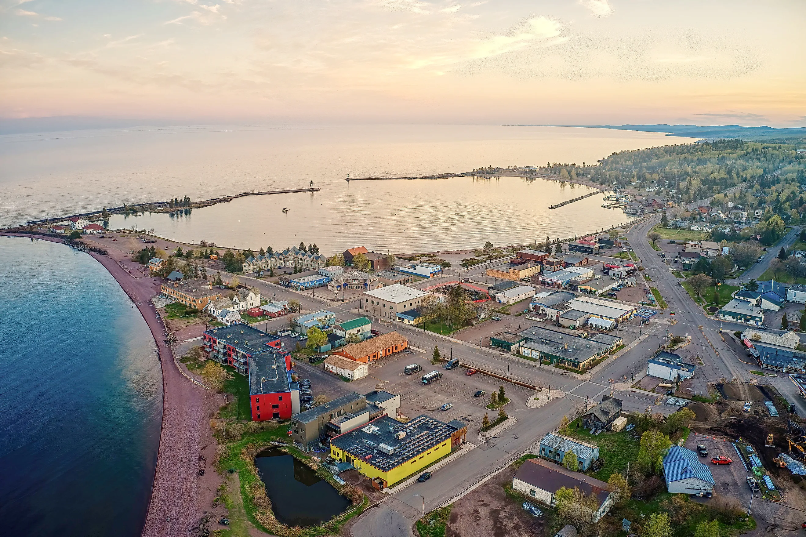
Lake Superior sets the pace on this 85-mile stretch of Highway 61, one of the most photographed drives in the Midwest. Kick off the journey with breakfast and coffee at Cedar Coffee Company in Two Harbors before the highway curves northeast toward Split Rock Lighthouse, perched atop a cliff just up the coast, which once guided heavy iron ore freighters safely to shore. The drive culminates in Grand Marais, with its harbor framed by art galleries and a walkable downtown you can explore in an afternoon. This is also the gateway to the Gunflint Trail, inviting travelers with extra time to venture inland before finishing their journey by the water. The smaller communities along the shoreline give the drive a steady rhythm of brief stops between stretches of open water and forest.
The St. Croix Scenic Byway From Stillwater To Taylors Falls

Stillwater looks like it was built for a postcard, and locals seem more than happy to embrace the description. Resting along the banks of the St. Croix River, this town's downtown overflows with independent bookstores, antique shops, and a vintage soda counter that has outlasted generations of chain competitors. Afton, a smaller detour off the main route, is worth the extra minutes for the gardens at Horta Culture and a lunch stop at the Lumberyard.
Continuing north from Stillwater, the scenic byway follows Highway 95 straight to Marine on St. Croix. Home to roughly 660 residents, this tiny community claims the site of Minnesota's very first commercial sawmill, established back in 1839. Further up the road between Marine on St. Croix and the quiet hamlet of Copas, William O'Brien State Park offers a swimming beach and river frontage worth a swim or a stroll before the drive ends approximately 30 miles later at Taylors Falls. Here, Interstate State Park frames the river with towering basalt cliffs and glacial potholes carved by ancient melting ice.
The Paul Bunyan Scenic Byway Near Brainerd

North of Brainerd, a 54-mile loop of county roads known as the Paul Bunyan Scenic Byway takes its legendary namesake to heart. The journey begins in Pequot Lakes, home to boutique shops, art galleries, and a landmark drawn from the legend that the lumberjack flung a 40-foot walleye so far his fishing bobber snagged on the Pequot Lakes Water Tower, where a painted replica still stands today. A few miles north, Pine River holds the visitor center and a massive pair of wooden baby boots, yet another Bunyan reference, that visitors can climb into for photographs.
Next on the loop is Crosslake and its Historic Log Village, which displays a replica of a 20th-century general store and a historically furnished logging camp. Along the drive, travelers cross paths with the Paul Bunyan State Trail, a 115-mile paved route running between Brainerd and Bemidji State Park, which hosts the Bean Hole Days during the summer months, drawing crowds for a communal feast of beans slow-cooked in underground pits.
Historic Bluff Country Through Lanesboro And Harmony

Highway 16 stretches for 88 miles across the southeastern corner of Minnesota, winding through the Driftless Area's trout streams and limestone bluffs. The federal government named the corridor a National Scenic Byway in 2002. Lanesboro anchors the route, its downtown district sitting on the National Register of Historic Places and largely unchanged for over a century, with the Root River State Bike Trail running right alongside it. The Commonweal Theatre brings professional productions to a small town.
Whalan is just a few miles east and holds its own historic district despite a population that barely reaches 70. Further along the byway sits Harmony, home to one of Minnesota's largest Old Order Amish communities. Horse-drawn buggies share the road here, and operators such as Bluffscape Amish Tours run guided visits into the surrounding farmlands. Preston, the Fillmore County seat, sits along the Harmony-Preston Valley State Trail and offers trout fishing access. Nearby, the gateway to bluff country, also known as Chatfield, closes out the route with the Chatfield Center for the Arts, a restored venue hosting live music and theater.
Edge Of The Wilderness From Grand Rapids To Effie

Stretching 47 miles north from Grand Rapids to Effie on Highway 38, the state's oldest scenic byway weaves past 36 pristine lakes and leads deep into the Chippewa National Forest, a protected woodland supporting the largest population of bald eagles in the entirety of the continental United States. Grand Rapids serves as a natural launching point, known as the childhood home of Judy Garland, whose museum anchors the main district.
Roughly 30 miles farther north, the quiet community of Marcell hosts the Edge of the Wilderness Discovery Center, which operates out of a former ranger station and offers free naturalist programs, public fishing piers, and other recreational activities throughout the summer. The journey continues to Bigfork, a town whose heritage is rooted in the region's logging history.
The Minnesota River Valley Near Le Sueur And St. Peter

Spanning nearly 300 miles in its entirety, this byway narrows to a corridor between Belle Plaine and New Ulm that captures the region's finest highlights in a single afternoon. The route can begin in Henderson, a river community with several preserved structures tied to early Dakota heritage. Le Sueur comes next, and claims the shared birthplace of two very different enterprises: the iconic Green Giant Food Company and the renowned Mayo Family. Visitors can explore the restored family home of Doctor William W. Mayo, founder of the Mayo Clinic, and, a short detour farther south in Blue Earth, reach the famous, massive Jolly Green Giant Statue and its museum.
Further along the path lies St. Peter, home to more than a dozen buildings listed on the National Register of Historic Places, along with a walkable downtown built for a lunch break or some boutique shopping. The excursion culminates in New Ulm, which leans heavily into its German ancestry and architectural traditions. Here, the towering Glockenspiel, an oversized mechanical clock, chimes for pedestrians at set hours.
Albert Lea And Lake Crystal Through Southern Farmland

Southern Minnesota trades rugged cliffs and dense pine forests for open farmland, and the short journey between Mankato and Albert Lea runs straight through the understated middle of it. Lake Crystal, a tight-knit community on the body of water it shares its name with, lies about 15 minutes south of Mankato and offers a quiet town center without the price tags of Minnesota's more commercialized tourist spots. From there, county roads guide motorists southeast toward Albert Lea, a hub of approximately 18,200 residents set between Fountain Lake and Lake Albert Lea, where a 7-mile pathway encircles Fountain Lake. The route keeps the scenery simple, with farm fields, lakes, and small communities replacing the more dramatic landscapes found elsewhere in the state.
Town Hopping In Minnesota
None of these routes demands a full week or an overly rigid itinerary. A single afternoon traversing any of them might reveal how much a state can truly vary, even within its own borders. Limestone cliff sides give way to open water, farmland slowly blends into vast pine forests, and each town along the way carries the marks of whatever industry, landscape, or heritage built it. Minnesota's smaller communities rarely compete with what larger cities can offer, and that absence of competition is largely their appeal. A slower drive tends to leave more room for the kind of detail that gets missed at highway speed, whether that is a storefront that's remained the exact same for decades or a stretch of river that looks extensively different depending on the season. When drives through a state are as compelling as this, all that is left to do is pick a route, check the forecast, and let each mile do the rest.