7 Great Road Trips to Take in Connecticut
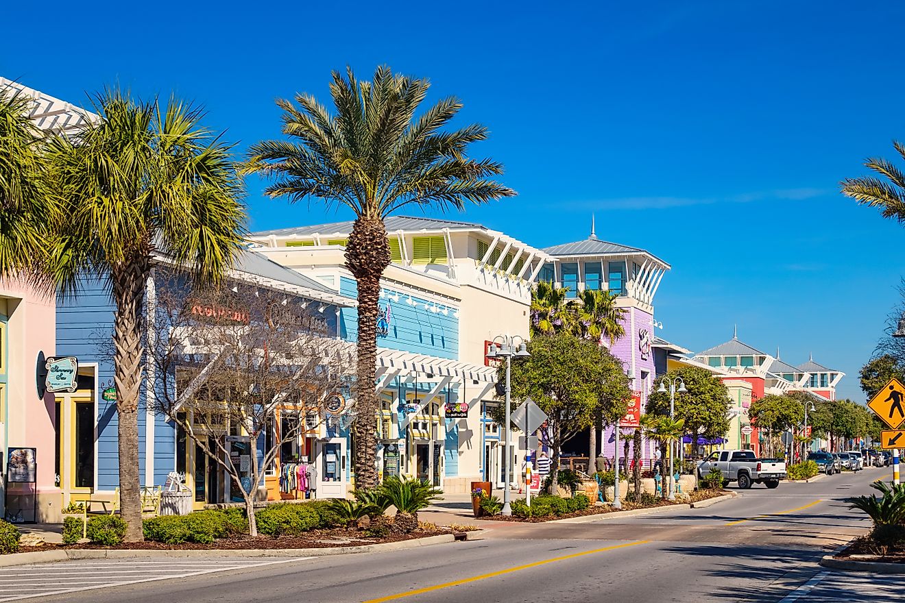
For a state that takes under two hours to cross end to end, Connecticut packs a remarkable variety of road trip terrain into its 5,500 square miles. The shoreline runs east-west along Long Island Sound, the Connecticut River cuts the state north-south through tidal lowlands and wooded valleys, the Litchfield Hills rise to over 1,700 feet in the northwest corner, and the Quiet Corner in the northeast preserves some of New England's last working colonial-era farmland. Two of Connecticut's secondary roads carry federal National Scenic Byway status, several follow major rivers through forested terrain, and a few hug the coast through colonial port towns. The seven point-to-point drives below cover the best of them. Each one runs from a clearly defined starting town to a clearly defined ending town, with notable stops in between, and each one has a distinct character that holds together across the full length of the route.
Connecticut River Valley Drive (CT-9): Old Saybrook To Hartford

CT-9 runs roughly 40 miles north from the mouth of the Connecticut River to its terminus at I-91 in Cromwell, with continued access to Hartford just up the road. The corridor follows the river through a mix of wooded hills, historic towns, and tidal lowlands. The road carries fewer commercial exits than the parallel coastal corridor and stays closer to the river landscape for most of the route.
The drive begins in Old Saybrook, where the Connecticut River empties into Long Island Sound and marinas line both sides of the channel. Heading north on CT-9, Essex appears first; the town center sits just above the waterfront and connects to docks and small tidal inlets. The Essex Steam Train departs from the station here and runs north along the river.
East Haddam is the most visually significant stop on the route, where a short detour off CT-9 leads to Gillette Castle State Park. The 24-room stone castle was built between 1914 and 1919 by William Hooker Gillette, the actor and playwright famous for his stage portrayal of Sherlock Holmes (he played the role more than 1,300 times), and sits 200 feet above the river on the southernmost hill of a chain known as the Seven Sisters. The 14,000-square-foot building, constructed of local fieldstone over a steel framework, contains 47 hand-carved doors with custom wooden latches, secret passages, and a system of mirrors that allowed Gillette to spy on guests. The grounds cover 184 acres with several miles of walking trails along the bed of Gillette's three-mile narrow-gauge railroad. The East Haddam Swing Bridge, a notable swing-span structure carrying Route 82 across the Connecticut River, crosses just south of the castle.
North of East Haddam, the wooded hills press closer to the road as the route continues toward Cromwell, where the river widens and the surroundings shift toward a more urban edge. The river remains a constant reference point while elevation and road curvature change gradually over the full length of the route.
Litchfield Hills Drive (US-7 And CT-4): New Milford To Canaan

US-7 runs roughly 80 miles through Connecticut, following the Housatonic River through the northwestern corner of the state and crossing some of its most rural and forested terrain. The road rises and falls through forested terrain with long shaded sections and limited commercial development for most of the drive.
The route begins in New Milford, where the Housatonic widens at the town center before the road begins climbing north. Passing through Housatonic State Forest, the road tightens alongside the river with several pull-offs allowing direct water access. Kent Falls State Park appears just off the roadside, where a short walking path connects a series of waterfalls dropping a total of about 250 feet over cascading ledges, making it one of the most accessible waterfall stops in the state.
The covered Bull's Bridge in Kent, one of only two covered bridges in Connecticut still open to motor vehicles, crosses the Housatonic just south of the village and offers a direct view of the river from the roadbed. Continuing north through Cornwall Bridge and West Cornwall, the road passes through the Housatonic Meadows State Park campground area before reaching Falls Village, where the Housatonic drops sharply through a series of rapids historically used to power an ironworks.
The drive ends in Canaan, where US-7 meets US-44 and the Housatonic turns east toward Massachusetts. This route works because the river stays within sight or earshot for most of the northern half of the drive, and the road itself rarely widens beyond two lanes.
Quiet Corner Byway (CT-169): Lisbon To Woodstock

CT-169 is one of Connecticut's two federally designated National Scenic Byways, running approximately 32 miles through the northeastern corner of the state with almost no commercial interruption. The road stays narrow and consistent throughout, passing through a sequence of small towns where historic buildings sit close to the pavement.
The drive begins in Lisbon near the Rhode Island border, where the road enters a landscape of open fields and second-growth forest. Moving north through Canterbury, the route passes the Prudence Crandall Museum, which preserves the site of New England's first academy for African American women, opened in 1833 and forced to close after fierce local opposition the following year.
Continuing into Pomfret, the road opens onto one of the longest stretches of uninterrupted farmland visible from any Connecticut highway, with stone walls running along both sides. Mashamoquet Brook State Park in Pomfret provides a trail network and river access just off the road. The final stretch reaches Woodstock, where Roseland Cottage sits directly on CT-169, a Gothic Revival house built in 1846 by abolitionist Henry Bowen and surrounded by a formal boxwood parterre garden. The cottage hosted four sitting US presidents (Grant, Hayes, Harrison, McKinley) for July 4th celebrations during the late 19th century. The character of this drive stays consistent from start to finish, and the towns appear at regular intervals without breaking the rural rhythm between them.
Shoreline Drive (US-1): New Haven To Stonington

US-1 runs approximately 65 miles east along the Connecticut shoreline, staying closer to Long Island Sound for most of the route and passing through a sequence of distinct coastal towns.
The drive begins in New Haven, where a short detour south on Townsend Avenue leads to Lighthouse Point Park on New Haven Harbor. The park features a 1916 carousel with 72 hand-carved horses still in operation and open views across Long Island Sound. Back on US-1 heading east, the road passes through Branford, where CT-146 leads south toward the Thimble Islands.
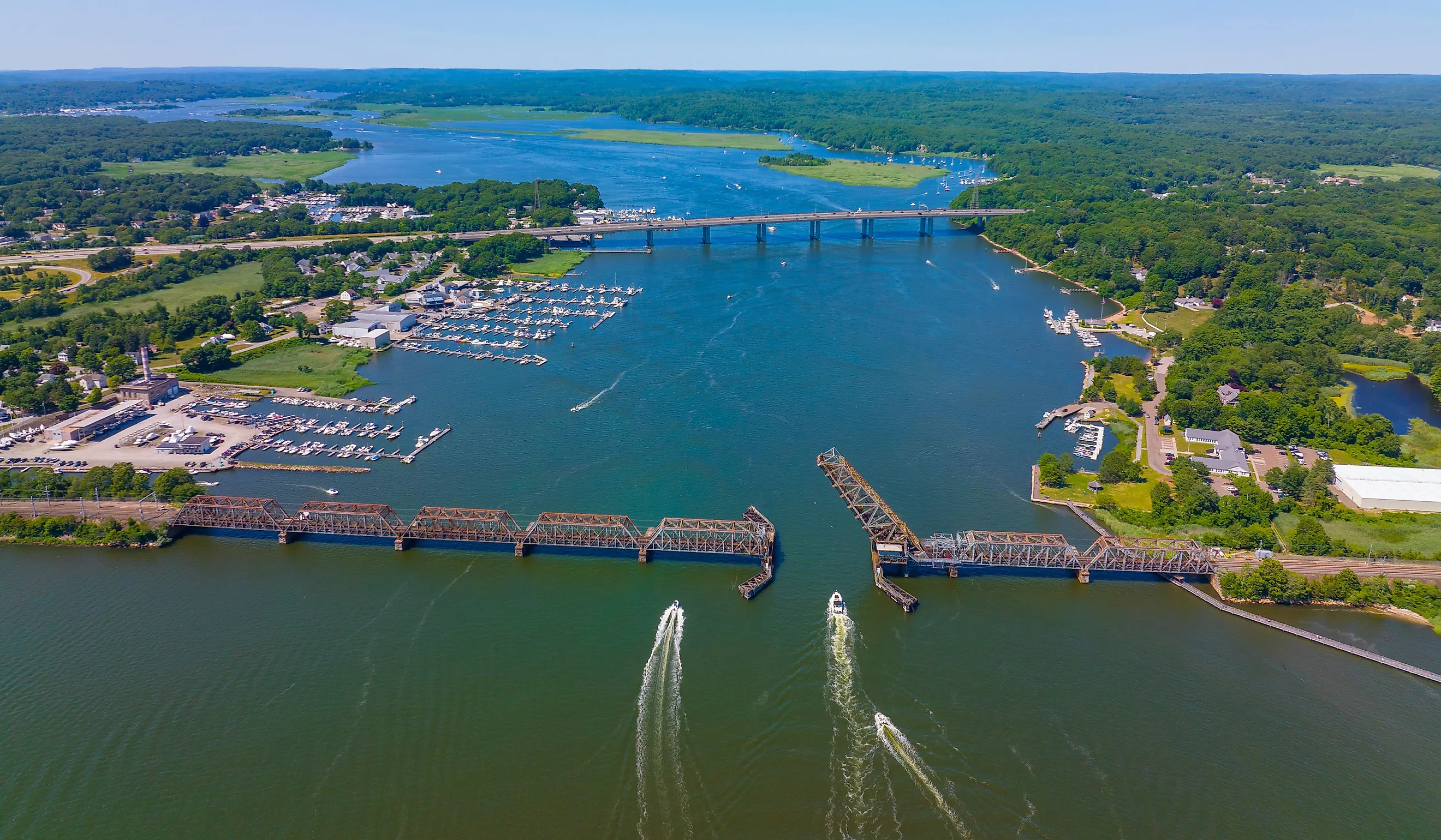
Continuing east, the route reaches Guilford, where the town green anchors one of the most intact colonial-era centers on the shoreline, and Hammonasset Beach State Park in Madison provides two miles of open beach directly off the highway. Further east, the road enters Old Lyme, historically significant as the early-20th-century home base of the Lyme Art Colony and a center of American Impressionism, before reaching Mystic, where the river cuts through the town center and the Mystic Seaport Museum occupies 19 acres of waterfront with a working shipyard and dozens of preserved 19th-century vessels, including the last surviving wooden whaleship in the world, the Charles W. Morgan (built 1841).
The drive ends in Stonington Borough, where narrow streets on a small peninsula lead directly to the water on three sides. On this route, the road repeatedly reconnects to the shoreline even when it briefly moves inland through commercial stretches.
Merritt Parkway (CT-15): Greenwich To Stratford

The Merritt Parkway runs 37.5 miles northeast from Greenwich through Fairfield County and is designated as a National Scenic Byway. Built between 1934 and 1940 to ease traffic on the Boston Post Road (US-1), it was Connecticut's first divided-lane, limited-access highway and was hailed as the "Road of the Future" at the 1939 World's Fair. The parkway carries no commercial vehicles (an 8-foot height limit excludes trucks and most trailers) and maintains a consistent two-lane design in each direction with no large signage or commercial exits along the corridor.
The defining feature of the route is its 69 bridges, all designed by a single architect, George Dunkelberger, in a range of styles including Art Deco, Art Moderne, French Renaissance, Gothic, Rustic, and Neoclassical. No two bridges share the same ornamentation. The Merwin's Lane Bridge in Fairfield carries metal panels depicting cobwebs with spiders, with butterflies on the borders. The Lake Avenue Bridge in Greenwich features cast-iron grapevines wrapping the arches, a nod to the state seal. The James Farm Road overpass carries Art Deco "Nike Wings" sculpted by Edward Ferrari in 1940. The metalwork on the bridges was produced by Kenneth Lynch, the same craftsman who created the gargoyles for the Chrysler Building in Manhattan.
The road passes through Fairfield County without entering any town center directly, keeping the driving experience separate from the development running parallel to the south. The parkway ends in Stratford at the Sikorsky Memorial Bridge over the Housatonic River, where it continues as the Wilbur Cross Parkway. On this drive the road itself is the primary feature, with the bridge sequence providing consistent visual variety across the full length.
Highland Plateau Drive (US-44): Avon To Salisbury

US-44 runs across Connecticut from the New York state line through the Farmington Valley and Litchfield Hills to the Rhode Island border, covering roughly 105 miles within the state. It climbs steadily into the Litchfield Hills before reaching the highest towns in the state.
The drive begins in Avon, where US-44 crosses the Farmington River and begins ascending Talcott Mountain. A pull-off near the summit connects to Talcott Mountain State Park, where a 1.5-mile trail leads to the Heublein Tower, a 165-foot structure built in 1914 as a summer residence for Hartford liquor distributor Gilbert Heublein, with views extending into four states on clear days. Continuing west, the road passes through Canton and into Collinsville, where the Collins Company Axe Factory historic district sits along the Farmington River, a preserved 19th-century industrial complex (the company manufactured edged tools from 1826 to 1966) now used as shops and studios.
The terrain rises more steeply past Winsted, where the road runs along the Mad River through the town center before climbing into Norfolk, the highest-elevation incorporated town in Connecticut at about 1,200 feet above sea level, with surrounding high points exceeding 1,700 feet. Norfolk's town green and surrounding Victorian architecture reflect its history as a summer retreat for Hartford and New York families. The drive ends in Salisbury near the Massachusetts border, where Twin Lakes provides boat access and fishing on two connected glacial lakes.
The elevation gain is gradual and continuous, and the road character shifts noticeably from the Farmington Valley floor to the plateau towns of the northwest corner.
Naugatuck Valley Drive (CT-8): Shelton To Winsted

CT-8 runs approximately 50 miles north through the Naugatuck River valley, moving from dense post-industrial development in the lower valley to increasingly forested terrain in the upper reaches near the Litchfield Hills.
The drive begins in Shelton, where CT-8 crosses the Housatonic River and enters the Naugatuck Valley proper. The lower section of the route passes through Derby and Ansonia, where 19th-century mill buildings still line the riverbanks on both sides of the road. The surroundings remain built-up through Waterbury, the largest city on the route, where the road runs between steep valley walls before emerging onto a broader floodplain north of the city.
Past Waterbury, traffic decreases noticeably, and the valley narrows again with the Naugatuck State Forest pressing closer to the road through Thomaston and Torrington. The Thomaston Dam and reservoir appear just off the road near Thomaston, where a pull-off provides a direct view of the flood-control structure and the valley it manages. The dam, completed in 1960 by the US Army Corps of Engineers after the catastrophic 1955 flood that killed 87 people across Connecticut, holds back up to 42,000 acre-feet of water during high-flow events.
The drive ends in Winsted, where the upper reaches of the Naugatuck River begin nearby and the Mad River runs through the town center before joining the Naugatuck just to the south. The valley walls define this road corridor, compressing and expanding across the full length of the route in a way that makes the terrain actively present throughout the drive.
Compact And Connected In Connecticut
From the tidal lowlands at the mouth of the Connecticut River to the plateau towns of the northwest corner, Connecticut packs a notable range of terrain into a state that takes under two hours to cross. The Merritt Parkway and CT-169 carry national scenic byway designations for good reason, but the river drives on CT-9, US-7, and CT-8 offer equally distinct experiences.
Seasonal considerations matter here. The Quiet Corner and Litchfield Hills routes are best driven in spring, when water levels are highest at the falls, and in autumn, when foliage fills the shaded corridors. The shoreline drive on US-1 runs most reliably in summer, when ferry access to the Thimble Islands and beach access at Hammonasset are both active. For a state this compact, the variety holds up across all seven routes.