The Best National Parks In The American Southwest
Six arid parks hold the National Park System's most extreme geology. The Grand Canyon is 6,093 feet deep and two billion years old at the bottom. Zion's sandstone walls stand over 2,000 feet high. White Sands is the largest gypsum dune field on Earth. Petrified Forest is a scatter of 225-million-year-old trees turned to solid quartz. Across these parks, elevation swings of over 6,000 feet put desert scrub within a day's hike of snow-dusted pine. Expect flash floods, hard sun, and geological time visible layer by layer.
Grand Canyon National Park, Arizona

The Colorado River has carved a 277-mile-long chasm through the Colorado Plateau, exposing nearly two billion years of Earth's geological history in the vertical walls of Grand Canyon National Park.
The canyon reaches a maximum depth of 6,093 feet, revealing rock layers that range from the 1.8-billion-year-old Vishnu Schist at the bottom to the 270-million-year-old Kaibab Limestone at the rim. This vertical relief creates distinct life zones. The rim sits at 7,000 to 8,000 feet in elevation, supporting ponderosa pine and aspen forests that experience heavy snowfall in winter, while the inner canyon floor mimics a Sonoran Desert climate with summer temperatures often exceeding 100 degrees Fahrenheit.
The South Rim remains open year-round and receives the majority of the park's visitors, offering trails like the 13-mile Rim Trail and access to the Bright Angel Trail, which descends 4,380 feet to the river. The North Rim, sitting 1,000 feet higher than the South, is closed between December and May due to snow, limiting access to a shorter seasonal window. The National Park Service strongly discourages hiking down to the river and back in a single day, given the extreme elevation change and heat, and rescue operations are frequently required for unprepared visitors.
Zion National Park, Utah

Zion National Park protects the deep, narrow gorges of the Virgin River, where towering Navajo Sandstone cliffs rise over 2,000 feet above the canyon floor. The park's defining feature is the Virgin River Narrows, a slot canyon where the river itself is the trail, requiring hikers to wade or swim through water that can range from ankle-deep to waist-deep depending on the season and flow rate.
Access to the main canyon is restricted during peak seasons, requiring visitors to use the park's mandatory shuttle system to reach trailheads. The Temple of Sinawava serves as the entry point for the Narrows via the Riverside Walk, while The Grotto provides access to the steep ascent of Angels Landing. The Angels Landing chain section is a narrow sandstone spine with 1,000-foot drop-offs on either side. It now requires a permit obtained via lottery, a measure implemented to reduce congestion and improve safety.
The park's elevation ranges from 3,666 feet at the southern entrance to 8,726 feet at Horse Ranch Mountain, creating a habitat diversity that supports over 78 species of mammals, including desert bighorn sheep and mountain lions. Flash floods are a constant hazard in the slot canyons, capable of raising water levels by several feet in minutes and requiring strict monitoring of weather forecasts upstream.
Arches National Park, Utah

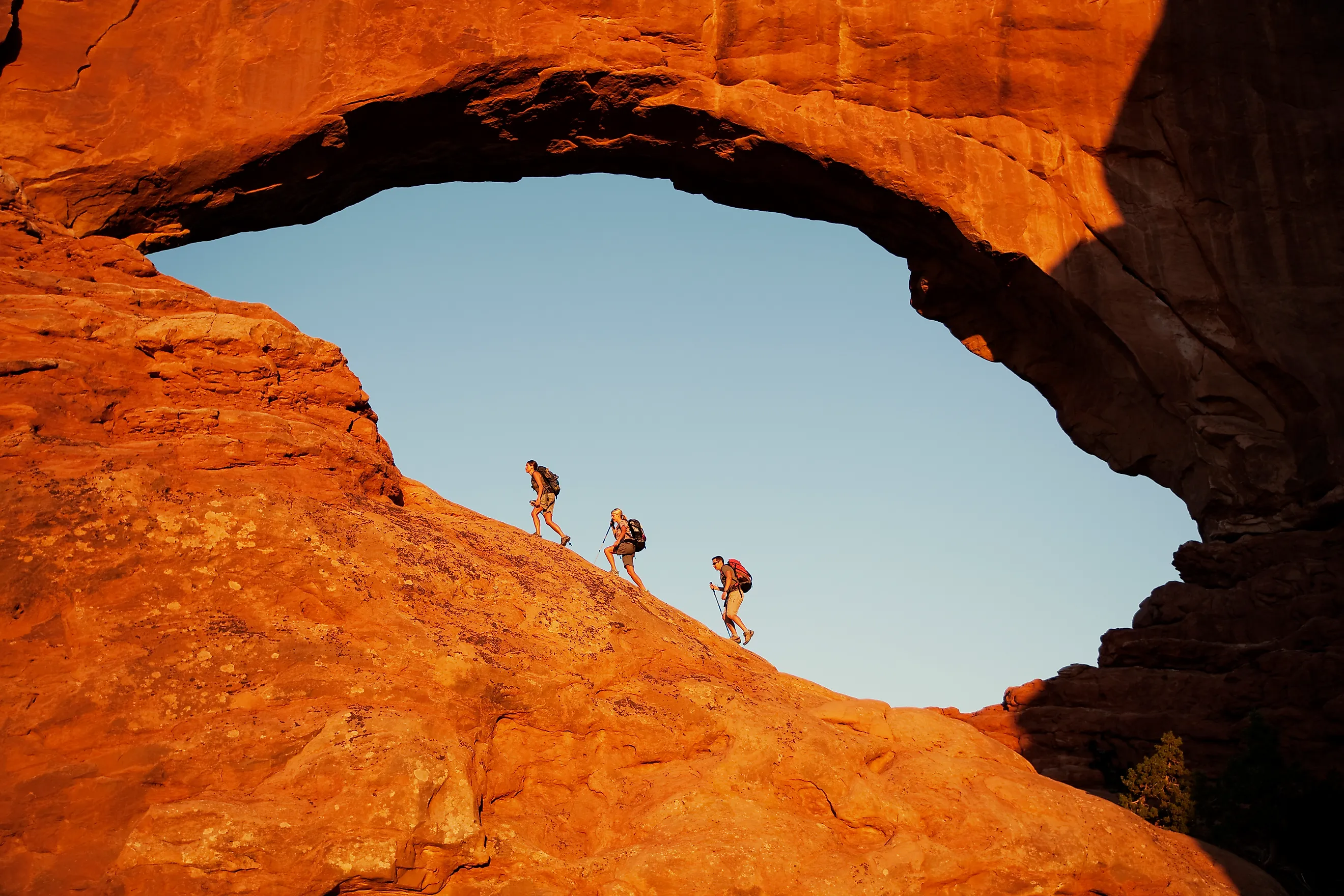
Arches National Park preserves the highest density of natural sandstone arches in the world, with over 2,000 documented formations scattered across a high-desert landscape. The park sits atop a massive salt bed deposited 300 million years ago. As overlying sediment layers shifted and eroded, the salt rose into fins that eventually weathered into the arches seen today, including Delicate Arch, which frames the La Sal Mountains in the distance.
The geology is fragile. The sandstone is prone to exfoliation, and several famous arches, including Wall Arch in 2008, have collapsed due to gravity and erosion. Elevations range from 4,085 feet at the visitor center to 5,653 feet at Elephant Butte, creating a harsh environment where annual rainfall averages less than 10 inches.
The park implemented a timed entry reservation system in 2025 for visits between April and October to manage overcrowding on the narrow scenic drive and popular trails like the three-mile round-trip hike to Delicate Arch. Night skies here are exceptionally dark, and the park is designated an International Dark Sky Park, offering unobstructed views of the Milky Way above the silhouetted red rock formations.
Petrified Forest National Park, Arizona

Petrified Forest National Park preserves one of the largest concentrations of petrified wood in the world, scattered across a 221,390-acre expanse of painted desert badlands. The wood here dates to the Late Triassic period, approximately 225 million years ago, when ancient conifers fell into river floodplains and were buried by sediment rich in volcanic ash. Groundwater carrying dissolved silica replaced the organic material cell by cell, turning the logs into solid quartz that retains the original tree ring structures and bark textures.
The landscape is defined by the Chinle Formation, a layer of sedimentary rock that erodes into vibrant hues of red, purple, and blue due to the oxidation of iron and manganese. Unlike many southwestern parks with high peaks, Petrified Forest is relatively flat. Its elevations run between 5,300 and 6,200 feet, making it accessible year-round without the seasonal road closures common in higher terrain.
The park also protects over 800 known archaeological and historical sites, including petroglyphs at Newspaper Rock and the remains of Ancestral Puebloan structures like Agate House, a pueblo built entirely from petrified logs.
Saguaro National Park, Arizona

Saguaro National Park protects the densest forests of the giant saguaro cactus, a species endemic to the Sonoran Desert and capable of living for over 150 years. The park is split into two districts: the Tucson Mountain District (West) and the Rincon Mountain District (East), separated by the city of Tucson. The eastern district contains higher elevations, rising from 2,180 feet on the desert floor to 8,666 feet at the summit of Mica Mountain, and encompasses six distinct ecological life zones between desert scrub and pine-oak forest.
The western district is drier and features a higher density of mature saguaros, some reaching heights of 40 to 60 feet and weighing up to 4,800 pounds when fully hydrated. These cacti bloom in late spring, producing the white flowers that are the state flower of Arizona, followed by red fruit that is harvested by local Tohono O'odham communities.
The two districts differ sharply in their geology. The western Tucson Mountains preserve the eroded remains of a volcanic caldera that erupted roughly 70 million years ago, along with ancient lava flows, while the eastern Rincon Mountains are a metamorphic core complex of gneiss and schist. The Rincons rise as a sky island that isolates high-elevation species like the coati and the jaguar, which occasionally roams north from Mexico into the region.
White Sands National Park, New Mexico

White Sands National Park protects a major portion of the world's largest gypsum dune field, a 275-square-mile expanse spread across the Tularosa Basin. Unlike silica-based sand, which is hard and permanent, gypsum is soft, water-soluble, and rare as dunes because it typically dissolves in water. Here, the arid climate and enclosed basin allow the mineral to accumulate and form dunes that can reach heights of 60 feet.
The dunes are active, migrating up to 30 feet per year toward the northeast, driven by prevailing southwest winds that constantly reshape the landscape and bury vegetation unable to adapt quickly enough.
The park's surface reflects 80% of the sun's radiation, keeping the sand cool to the touch even on hot days, while the white color creates a stark, high-contrast environment that supports specialized wildlife like the bleached earless lizard and the white sands pocket mouse, both of which have evolved lighter coloration to blend in. Nighttime visits are popular thanks to the park's dark sky designation, which offers clear views of the Milky Way unobstructed by light pollution.
Reading Deep Time in the Southwest's National Parks
These six national parks illustrate the geological and ecological range of the American Southwest, spanning the river-cut gorges of Zion, the gypsum dunes of White Sands, and the sandstone arches of Arches.
Each park operates under its own environmental constraints, with seasonal closures, flash flood risks, and extreme temperature fluctuations dictating visitor access. Ultimately, these parks preserve sites where geological time is visible in every layer, offering a window into the Earth's power to shape, erase, and renew the desert landscape over millions of years.