Mason County, WV, USA
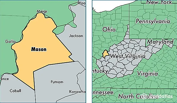
Mason County is a county equivalent area found in West Virginia, USA. The county government of Mason is found in the county seat of Point Pleasant.
With a total 1,151.81 sq. km of land and water area, Mason County, West Virginia is the 2363rd largest county equivalent area in the United States. Home to 27,016 people, Mason County has a total 12874 households earning 38411 on average per year.
Mason County, West Virginia - Quick Facts
| FIPS Code | 54053 |
| Area Codes | 304 |
| Time Zone | EST |
| Major Cities | Point Pleasant (population: 9,028), Leon (population: 3,529), Gallipolis Ferry (population: 2,322), Letart (population: 2,040), Mason (population: 1,568), Glenwood (population: 1,560), New Haven (population: 1,555), West Columbia (population: 1,265), Apple Grove (population: 1,028), Ashton (population: 725) |
| Land Area | 10,431 sq miles |
| Water Area | 431 sq miles |
| Household Income | $38,411 |
| Housing Units | 12,874 |
| Median Home Value | $83,900 |
| High School Grads | 82% of population |
| Holders of Bachelors Degrees | 10% of population |
| Retail Spending | $5,320 per capita |
| Food & Accomodation Sales | $12,058 per capita |