Where is Marshall County, West Virginia?
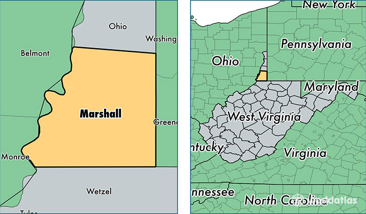
Marshall County is a county equivalent area found in West Virginia, USA. The county government of Marshall is found in the county seat of Moundsville.
With a total 808.48 sq. km of land and water area, Marshall County, West Virginia is the 2821st largest county equivalent area in the United States. Home to 32,416 people, Marshall County has a total 15786 households earning 40681 on average per year.
Marshall County, West Virginia - Quick Facts
| FIPS Code | 54051 |
| Area Codes | 304 |
| Time Zone | EST |
| Major Cities | Moundsville (population: 15,971), Cameron (population: 3,004), Glen Dale (population: 2,817), McMechen (population: 2,075), Proctor (population: 1,734), Benwood (population: 1,732), Glen Easton (population: 1,047), Dallas (population: 419) |
| Land Area | 12,516 sq miles |
| Water Area | 305 sq miles |
| Household Income | $40,681 |
| Housing Units | 15,786 |
| Median Home Value | $86,000 |
| High School Grads | 88% of population |
| Holders of Bachelors Degrees | 14% of population |
| Retail Spending | $8,199 per capita |
| Food & Accomodation Sales | $26,294 per capita |
This page was last updated on June 30, 2016.