Where is Ohio County, West Virginia?
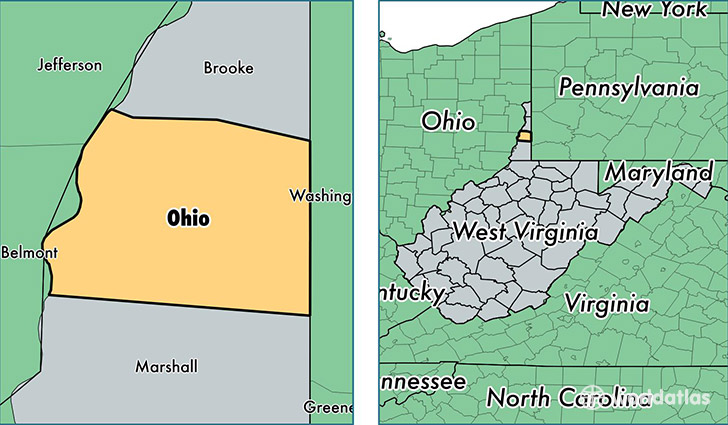
Ohio County is a county equivalent area found in West Virginia, USA. The county government of Ohio is found in the county seat of Wheeling.
With a total 282.37 sq. km of land and water area, Ohio County, West Virginia is the 3093rd largest county equivalent area in the United States. Home to 43,328 people, Ohio County has a total 21018 households earning 41025 on average per year.
Ohio County, West Virginia - Quick Facts
| FIPS Code | 54069 |
| Area Codes | 304 |
| Time Zone | EST |
| Major Cities | Wheeling (population: 42,624), Triadelphia (population: 3,056), Valley Grove (population: 1,865), West Liberty (population: 1,174) |
| Land Area | 16,729 sq miles |
| Water Area | 106 sq miles |
| Household Income | $41,025 |
| Housing Units | 21,018 |
| Median Home Value | $98,700 |
| High School Grads | 91% of population |
| Holders of Bachelors Degrees | 29% of population |
| Retail Spending | $14,665 per capita |
| Food & Accomodation Sales | $98,255 per capita |
| Universities and Colleges | West Liberty State College |
This page was last updated on June 30, 2016.