Where is Monroe County, Ohio?
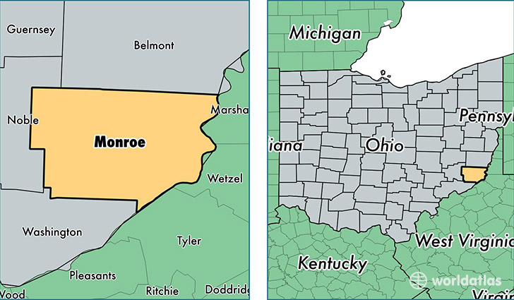
Monroe County is a county equivalent area found in Ohio, USA. The county government of Monroe is found in the county seat of Woodsfield.
With a total 1,184.81 sq. km of land and water area, Monroe County, Ohio is the 2319th largest county equivalent area in the United States. Home to 14,465 people, Monroe County has a total 7464 households earning 40573 on average per year.
Monroe County, Ohio - Quick Facts
| FIPS Code | 39111 |
| Area Codes | 740 |
| Time Zone | EST |
| Major Cities | Woodsfield (population: 5,077), New Matamoras (population: 2,785), Sardis (population: 2,100), Beallsville (population: 1,958), Lewisville (population: 1,532), Clarington (population: 1,485), Jerusalem (population: 1,074), Graysville (population: 545), Hannibal (population: 270), Cameron (population: 93) |
| Land Area | 5,585 sq miles |
| Water Area | 456 sq miles |
| Household Income | $40,573 |
| Housing Units | 7,464 |
| Median Home Value | $89,100 |
| High School Grads | 86% of population |
| Holders of Bachelors Degrees | 10% of population |
| Retail Spending | $4,401 per capita |
| Food & Accomodation Sales | $4,292 per capita |
This page was last updated on June 30, 2016.