Where is Wetzel County, West Virginia?
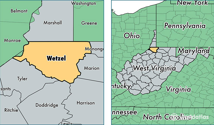
Wetzel County is a county equivalent area found in West Virginia, USA. The county government of Wetzel is found in the county seat of New Martinsville.
With a total 935.84 sq. km of land and water area, Wetzel County, West Virginia is the 2709th largest county equivalent area in the United States. Home to 15,988 people, Wetzel County has a total 8110 households earning 37969 on average per year.
Wetzel County, West Virginia - Quick Facts
| FIPS Code | 54103 |
| Area Codes | 304 |
| Time Zone | EST |
| Major Cities | New Martinsville (population: 8,734), Paden City (population: 2,710), Pine Grove (population: 1,120), Littleton (population: 1,093), Reader (population: 856), Hundred (population: 818), Burton (population: 640), Smithfield (population: 638), Folsom (population: 194), Porters Falls (population: 104) |
| Land Area | 6,173 sq miles |
| Water Area | 358 sq miles |
| Household Income | $37,969 |
| Housing Units | 8,110 |
| Median Home Value | $79,000 |
| High School Grads | 82% of population |
| Holders of Bachelors Degrees | 10% of population |
| Retail Spending | $12,539 per capita |
| Food & Accomodation Sales | $21,022 per capita |
This page was last updated on June 30, 2016.