Where is Monroe County, West Virginia?
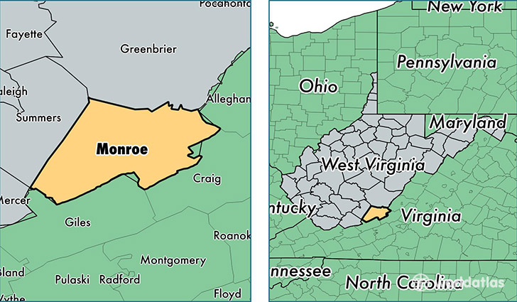
Monroe County is a county equivalent area found in West Virginia, USA. The county government of Monroe is found in the county seat of Union.
With a total 1,226.72 sq. km of land and water area, Monroe County, West Virginia is the 2265th largest county equivalent area in the United States. Home to 13,582 people, Monroe County has a total 7526 households earning 41234 on average per year.
Monroe County, West Virginia - Quick Facts
| FIPS Code | 54063 |
| Area Codes | 304 |
| Time Zone | EST |
| Major Cities | Peterstown (population: 4,081), Union (population: 2,435), Ballard (population: 1,670), Lindside (population: 1,484), Gap Mills (population: 1,055), Sinks Grove (population: 1,002), Greenville (population: 391), Wayside (population: 360), Secondcreek (population: 298), Waiteville (population: 184) |
| Land Area | 5,244 sq miles |
| Water Area | 473 sq miles |
| Household Income | $41,234 |
| Housing Units | 7,526 |
| Median Home Value | $102,200 |
| High School Grads | 80% of population |
| Holders of Bachelors Degrees | 14% of population |
| Retail Spending | $2,327 per capita |
| Food & Accomodation Sales | $2,844 per capita |
This page was last updated on June 30, 2016.