Where is King and Queen County, Virginia?
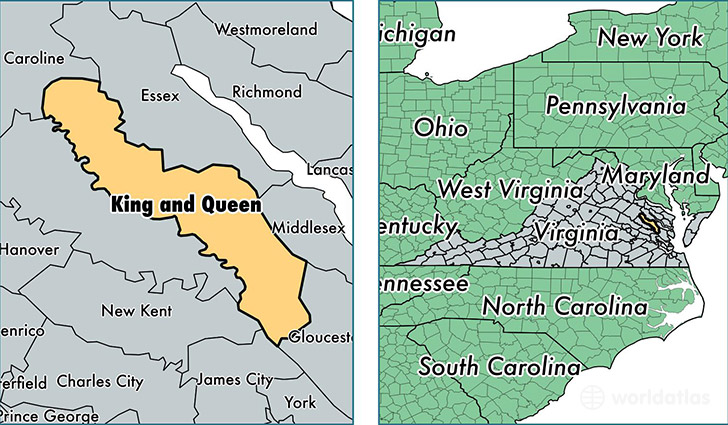
King and Queen County is a county equivalent area found in Virginia, USA. The county government of King and Queen is found in the county seat of King and Queen Court House.
With a total 845.16 sq. km of land and water area, King and Queen County, Virginia is the 2795th largest county equivalent area in the United States. Home to 7,175 people, King and Queen County has a total 3425 households earning 48372 on average per year.
King and Queen County, Virginia - Quick Facts
| FIPS Code | 51097 |
| Area Codes | 804 |
| Time Zone | EST |
| Major Cities | Saint Stephens Church (population: 1,851), Shacklefords (population: 1,577), Mattaponi (population: 805), Walkerton (population: 623), Newtown (population: 541), King and Queen Court House (population: 369), Bruington (population: 327), Little Plymouth (population: 313), Stevensville (population: 175), Mascot (population: 163) |
| Land Area | 2,770 sq miles |
| Water Area | 315 sq miles |
| Household Income | $48,372 |
| Housing Units | 3,425 |
| Median Home Value | $154,200 |
| High School Grads | 82% of population |
| Holders of Bachelors Degrees | 14% of population |
| Retail Spending | $2,357 per capita |
This page was last updated on June 30, 2016.