Where is Washington County, Oregon?
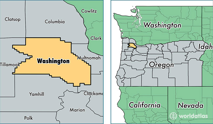
Washington County is a county equivalent area found in Oregon, USA. The county government of Washington is found in the county seat of Hillsboro.
With a total 1,881.42 sq. km of land and water area, Washington County, Oregon is the 1332nd largest county equivalent area in the United States. Home to 562,998 people, Washington County has a total 215773 households earning 64180 on average per year.
Washington County, Oregon offers the following attraction to visitors: Washington County Museum
Washington County, Oregon - Quick Facts
| FIPS Code | 41067 |
| Area Codes | 503 |
| Time Zone | PST |
| Major Cities | Beaverton (population: 190,098), Portland (population: 165,635), Hillsboro (population: 96,017), Tualatin (population: 28,314), Forest Grove (population: 24,921), Sherwood (population: 24,243), Cornelius (population: 14,634), Banks (population: 4,704), Gaston (population: 4,548), North Plains (population: 4,135) |
| Land Area | 217,375 sq miles |
| Water Area | 724 sq miles |
| Household Income | $64,180 |
| Housing Units | 215,773 |
| Median Home Value | $282,400 |
| High School Grads | 91% of population |
| Holders of Bachelors Degrees | 39% of population |
| Retail Spending | $16,886 per capita |
| Food & Accomodation Sales | $849,401 per capita |
| Universities and Colleges | Oregon College of Art and Craft, Phagans Tigard Beauty School, University of Phoenix-Oregon Campus, DeVry University-Oregon |
This page was last updated on June 30, 2016.