Where is Clatsop County, Oregon?
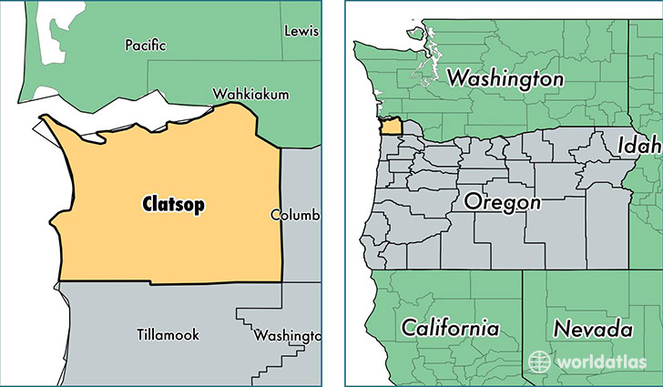
Clatsop County is a county equivalent area found in Oregon, USA. The county government of Clatsop is found in the county seat of Astoria.
With a total 2,808.54 sq. km of land and water area, Clatsop County, Oregon is the 676th largest county equivalent area in the United States. Home to 37,474 people, Clatsop County has a total 21669 households earning 44683 on average per year.
Clatsop County, Oregon offers the following attraction to visitors: Lewis and Clark National and State Historical Parks
Clatsop County, Oregon - Quick Facts
| FIPS Code | 41007 |
| Area Codes | 503 |
| Time Zone | PST |
| Major Cities | Astoria (population: 16,978), Seaside (population: 10,091), Warrenton (population: 5,946), Hammond (population: 1,392), Cannon Beach (population: 1,293), Tolovana Park (population: 444), Arch Cape (population: 206) |
| Land Area | 14,469 sq miles |
| Water Area | 829 sq miles |
| Household Income | $44,683 |
| Housing Units | 21,669 |
| Median Home Value | $256,500 |
| High School Grads | 92% of population |
| Holders of Bachelors Degrees | 23% of population |
| Retail Spending | $16,299 per capita |
| Food & Accomodation Sales | $160,570 per capita |
This page was last updated on June 30, 2016.