Where is Marion County, Oregon?
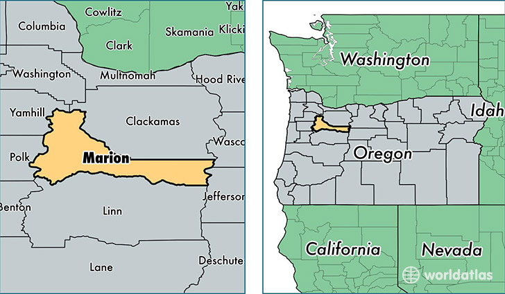
Marion County is a county equivalent area found in Oregon, USA. The county government of Marion is found in the county seat of Salem.
With a total 3,085.41 sq. km of land and water area, Marion County, Oregon is the 589th largest county equivalent area in the United States. Home to 326,110 people, Marion County has a total 121628 households earning 46885 on average per year.
Marion County, Oregon offers the following attraction to visitors: Hallie Ford Museum of Art
Marion County, Oregon - Quick Facts
| FIPS Code | 41047 |
| Area Codes | 503,541 |
| Time Zone | PST |
| Major Cities | Salem (population: 224,463), Woodburn (population: 29,234), Silverton (population: 14,927), Stayton (population: 9,728), Aumsville (population: 6,711), Aurora (population: 5,714), Jefferson (population: 5,686), Turner (population: 5,267), Hubbard (population: 5,120), Mount Angel (population: 4,402) |
| Land Area | 125,912 sq miles |
| Water Area | 1,181 sq miles |
| Household Income | $46,885 |
| Housing Units | 121,628 |
| Median Home Value | $192,200 |
| High School Grads | 83% of population |
| Holders of Bachelors Degrees | 21% of population |
| Retail Spending | $12,950 per capita |
| Universities and Colleges | Mount Angel Seminary, Willamette University |
This page was last updated on June 30, 2016.