Where is Jefferson County, Oregon?
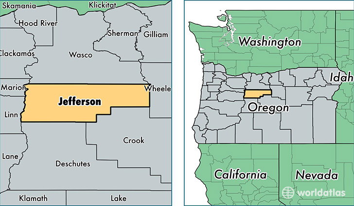
Jefferson County is a county equivalent area found in Oregon, USA. The county government of Jefferson is found in the county seat of Madras.
With a total 4,639.29 sq. km of land and water area, Jefferson County, Oregon is the 371st largest county equivalent area in the United States. Home to 22,192 people, Jefferson County has a total 9712 households earning 43373 on average per year.
Jefferson County, Oregon - Quick Facts
| FIPS Code | 41031 |
| Area Codes | 541 |
| Time Zone | PST |
| Major Cities | Madras (population: 11,927), Terrebonne (population: 6,849), Warm Springs (population: 4,000), Culver (population: 2,789), Camp Sherman (population: 252), Ashwood (population: 61) |
| Land Area | 8,568 sq miles |
| Water Area | 1,781 sq miles |
| Household Income | $43,373 |
| Housing Units | 9,712 |
| Median Home Value | $165,900 |
| High School Grads | 85% of population |
| Holders of Bachelors Degrees | 17% of population |
| Retail Spending | $8,056 per capita |
| Food & Accomodation Sales | $45,756 per capita |
This page was last updated on June 30, 2016.