Where is Wayne County, Ohio?
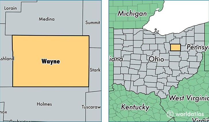
Wayne County is a county equivalent area found in Ohio, USA. The county government of Wayne is found in the county seat of Wooster.
With a total 1,442.14 sq. km of land and water area, Wayne County, Ohio is the 1981st largest county equivalent area in the United States. Home to 115,537 people, Wayne County has a total 45725 households earning 49135 on average per year.
Wayne County, Ohio - Quick Facts
| FIPS Code | 39169 |
| Area Codes | 330,419 |
| Time Zone | EST |
| Major Cities | Wooster (population: 43,878), Orrville (population: 13,519), Rittman (population: 8,918), Doylestown (population: 8,276), Apple Creek (population: 7,841), West Salem (population: 7,566), Fredericksburg (population: 6,902), Dalton (population: 6,875), Shreve (population: 4,905), Creston (population: 4,155) |
| Land Area | 44,609 sq miles |
| Water Area | 555 sq miles |
| Household Income | $49,135 |
| Housing Units | 45,725 |
| Median Home Value | $135,300 |
| High School Grads | 86% of population |
| Holders of Bachelors Degrees | 20% of population |
| Retail Spending | $9,760 per capita |
| Food & Accomodation Sales | $111,046 per capita |
This page was last updated on June 30, 2016.