Where is Ashtabula County, Ohio?
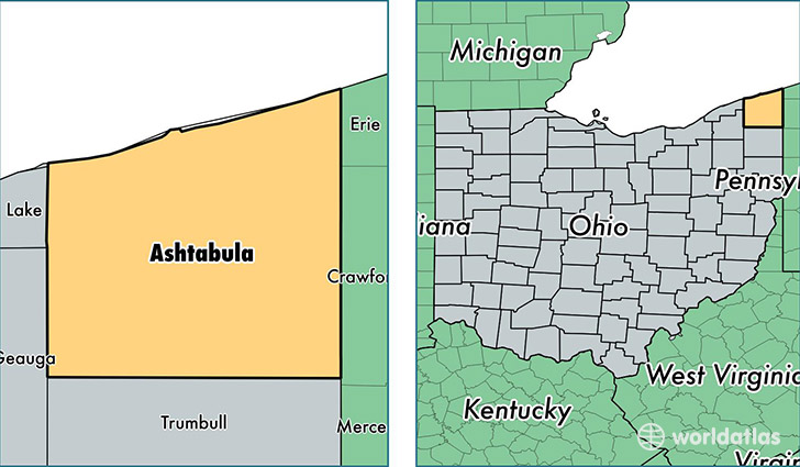
Ashtabula County is a county equivalent area found in Ohio, USA. The county government of Ashtabula is found in the county seat of Jefferson.
With a total 3,542.83 sq. km of land and water area, Ashtabula County, Ohio is the 495th largest county equivalent area in the United States. Home to 99,175 people, Ashtabula County has a total 45737 households earning 40516 on average per year.
Ashtabula County, Ohio - Quick Facts
| FIPS Code | 39007 |
| Area Codes | 440 |
| Time Zone | EST |
| Major Cities | Ashtabula (population: 33,056), Conneaut (population: 16,470), Geneva (population: 14,816), Jefferson (population: 9,112), Orwell (population: 5,082), Andover (population: 4,624), Rock Creek (population: 3,571), Rome (population: 3,241), Kingsville (population: 2,536), Windsor (population: 2,294) |
| Land Area | 38,292 sq miles |
| Water Area | 702 sq miles |
| Household Income | $40,516 |
| Housing Units | 45,737 |
| Median Home Value | $110,800 |
| High School Grads | 85% of population |
| Holders of Bachelors Degrees | 13% of population |
| Retail Spending | $10,627 per capita |
| Food & Accomodation Sales | $110,649 per capita |
This page was last updated on June 30, 2016.