Where is Fulton County, Ohio?
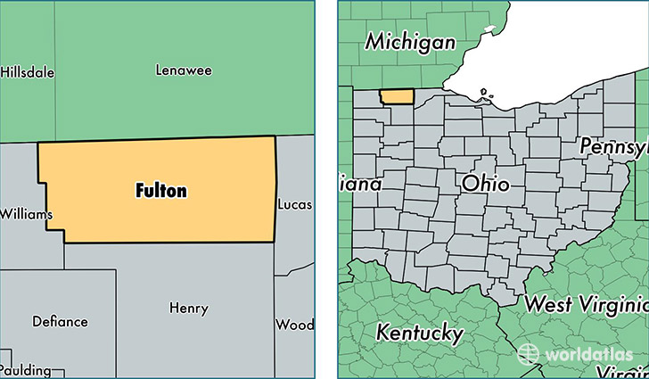
Fulton County is a county equivalent area found in Ohio, USA. The county government of Fulton is found in the county seat of Wauseon.
With a total 1,054.71 sq. km of land and water area, Fulton County, Ohio is the 2562nd largest county equivalent area in the United States. Home to 42,580 people, Fulton County has a total 17299 households earning 52856 on average per year.
Fulton County, Ohio - Quick Facts
| FIPS Code | 39051 |
| Area Codes | 419 |
| Time Zone | EST |
| Major Cities | Swanton (population: 13,499), Wauseon (population: 13,225), Delta (population: 7,944), Archbold (population: 6,901), Fayette (population: 2,798), Lyons (population: 1,546), Metamora (population: 1,494), Pettisville (population: 250) |
| Land Area | 16,440 sq miles |
| Water Area | 405 sq miles |
| Household Income | $52,856 |
| Housing Units | 17,299 |
| Median Home Value | $128,900 |
| High School Grads | 89% of population |
| Holders of Bachelors Degrees | 16% of population |
| Retail Spending | $9,561 per capita |
| Food & Accomodation Sales | $34,650 per capita |
This page was last updated on June 30, 2016.