Where is Missoula County, Montana?
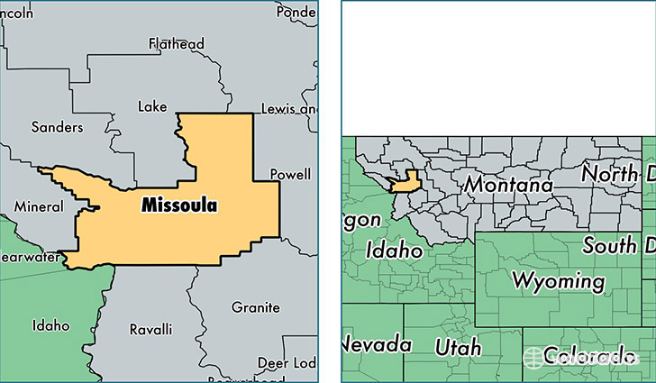
Missoula County is a county equivalent area found in Montana, USA. The county government of Missoula is found in the county seat of Missoula.
With a total 6,781.41 sq. km of land and water area, Missoula County, Montana is the 218th largest county equivalent area in the United States. Home to 112,684 people, Missoula County has a total 50759 households earning 46117 on average per year.
Missoula County, Montana - Quick Facts
| FIPS Code | 30063 |
| Area Codes | 406 |
| Time Zone | MST |
| Major Cities | Missoula (population: 92,381), Lolo (population: 5,744), Clinton (population: 2,447), Frenchtown (population: 2,274), Seeley Lake (population: 2,085), Huson (population: 1,641), Bonner (population: 1,584), Alberton (population: 1,361), Condon (population: 528), Milltown (population: 175) |
| Land Area | 43,508 sq miles |
| Water Area | 2,593 sq miles |
| Household Income | $46,117 |
| Housing Units | 50,759 |
| Median Home Value | $237,500 |
| High School Grads | 95% of population |
| Holders of Bachelors Degrees | 39% of population |
| Retail Spending | $20,589 per capita |
| Food & Accomodation Sales | $269,078 per capita |
| Universities and Colleges | The University of Montana, Modern Beauty School Inc |
This page was last updated on June 30, 2016.