Where is Flathead County, Montana?
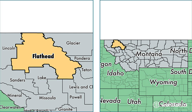
Flathead County is a county equivalent area found in Montana, USA. The county government of Flathead is found in the county seat of Kalispell.
With a total 13,614.1 sq. km of land and water area, Flathead County, Montana is the 76th largest county equivalent area in the United States. Home to 94,924 people, Flathead County has a total 47035 households earning 46581 on average per year.
Flathead County, Montana offers the following attraction to visitors: Glacier NP
Flathead County, Montana - Quick Facts
| FIPS Code | 30029 |
| Area Codes | 406 |
| Time Zone | MST |
| Major Cities | Kalispell (population: 50,078), Columbia Falls (population: 13,603), Whitefish (population: 12,685), Bigfork (population: 7,739), Lakeside (population: 2,426), Kila (population: 1,693), Somers (population: 1,660), Marion (population: 1,446), Hungry Horse (population: 845), Coram (population: 680) |
| Land Area | 36,650 sq miles |
| Water Area | 5,088 sq miles |
| Household Income | $46,581 |
| Housing Units | 47,035 |
| Median Home Value | $228,100 |
| High School Grads | 94% of population |
| Holders of Bachelors Degrees | 28% of population |
| Retail Spending | $18,135 per capita |
| Food & Accomodation Sales | $232,886 per capita |
| Universities and Colleges | Flathead Valley Community College |
This page was last updated on June 30, 2016.