Where is Sanders County, Montana?
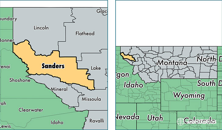
Sanders County is a county equivalent area found in Montana, USA. The county government of Sanders is found in the county seat of Thompson Falls.
With a total 7,226.14 sq. km of land and water area, Sanders County, Montana is the 202nd largest county equivalent area in the United States. Home to 11,364 people, Sanders County has a total 6640 households earning 32881 on average per year.
Sanders County, Montana - Quick Facts
| FIPS Code | 30089 |
| Area Codes | 406 |
| Time Zone | MST |
| Major Cities | Plains (population: 3,268), Thompson Falls (population: 3,083), Trout Creek (population: 1,567), Hot Springs (population: 1,186), Heron (population: 735), Noxon (population: 698), Dixon (population: 453), Paradise (population: 346), Lonepine (population: 105) |
| Land Area | 4,388 sq miles |
| Water Area | 2,761 sq miles |
| Household Income | $32,881 |
| Housing Units | 6,640 |
| Median Home Value | $166,500 |
| High School Grads | 87% of population |
| Holders of Bachelors Degrees | 17% of population |
| Retail Spending | $7,460 per capita |
| Food & Accomodation Sales | $12,192 per capita |
This page was last updated on June 30, 2016.