Where is Norfolk County, Massachusetts?
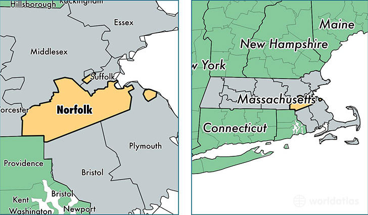
Norfolk County is a county equivalent area found in Massachusetts, USA. The county government of Norfolk is found in the county seat of Dedham.
With a total 1,150.85 sq. km of land and water area, Norfolk County, Massachusetts is the 2366th largest county equivalent area in the United States. Home to 692,254 people, Norfolk County has a total 271904 households earning 84916 on average per year.
Norfolk County, Massachusetts offers the following attractions to visitors: USS Salem (CA-139), Quincy (John Adams [Father and Son]), John Kennedy Home, Adams NHP, Frederick Law Olmsted NHS, John Fitzgerald Kennedy NHS
Norfolk is the home to this professional sports team: Patriots (NFL)
Norfolk County, Massachusetts - Quick Facts
| FIPS Code | 25021 |
| Area Codes | 508,781,617 |
| Time Zone | EST |
| Major Cities | Quincy (population: 93,782), Brookline (population: 50,808), Braintree (population: 36,329), Randolph (population: 32,685), Franklin (population: 32,153), Norwood (population: 29,070), Milton (population: 27,445), Stoughton (population: 27,441), Dedham (population: 25,116), Canton (population: 21,914) |
| Land Area | 267,281 sq miles |
| Water Area | 396 sq miles |
| Household Income | $84,916 |
| Housing Units | 271,904 |
| Median Home Value | $391,100 |
| High School Grads | 94% of population |
| Holders of Bachelors Degrees | 49% of population |
| Retail Spending | $17,133 per capita |
| Food & Accomodation Sales | $1,294,000 per capita |
| Universities and Colleges | Babson College, Boston Graduate School of Psychoanalysis Inc, Dean College, Mansfield Beauty Schools, Massachusetts School of Barbering and Men's Hairstyling, Franklin W. Olin College of Engineering |