Where is Ohio County, Kentucky?
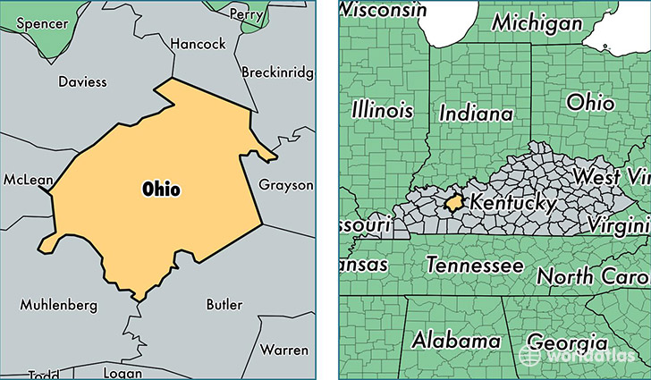
Ohio County is a county equivalent area found in Kentucky, USA. The county government of Ohio is found in the county seat of Hartford.
With a total 1,544.22 sq. km of land and water area, Ohio County, Kentucky is the 1755th largest county equivalent area in the United States. Home to 23,977 people, Ohio County has a total 10152 households earning 40830 on average per year.
Ohio County, Kentucky - Quick Facts
| FIPS Code | 21183 |
| Area Codes | 270 |
| Time Zone | CST |
| Major Cities | Beaver Dam (population: 8,285), Hartford (population: 6,212), Fordsville (population: 1,800), Horse Branch (population: 1,517), Centertown (population: 1,402), Cromwell (population: 1,122), Olaton (population: 496), Rockport (population: 334), McHenry (population: 254), Dundee (population: 88) |
| Land Area | 9,258 sq miles |
| Water Area | 587 sq miles |
| Household Income | $40,830 |
| Housing Units | 10,152 |
| Median Home Value | $78,800 |
| High School Grads | 77% of population |
| Holders of Bachelors Degrees | 8% of population |
| Retail Spending | $6,066 per capita |
| Food & Accomodation Sales | $15,269 per capita |
This page was last updated on June 30, 2016.