Where is Hardin County, Kentucky?
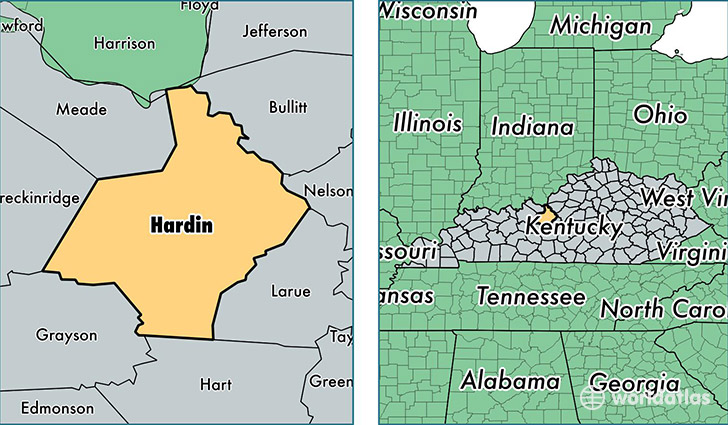
Hardin County is a county equivalent area found in Kentucky, USA. The county government of Hardin is found in the county seat of Elizabethtown.
With a total 1,632.04 sq. km of land and water area, Hardin County, Kentucky is the 1642nd largest county equivalent area in the United States. Home to 108,266 people, Hardin County has a total 45259 households earning 48687 on average per year.
Hardin County, Kentucky - Quick Facts
| FIPS Code | 21093 |
| Area Codes | 502,270 |
| Time Zone | EST |
| Major Cities | Elizabethtown (population: 48,870), Radcliff (population: 23,905), Vine Grove (population: 13,296), Fort Knox (population: 10,288), Rineyville (population: 6,141), Cecilia (population: 4,780), Sonora (population: 2,761), Upton (population: 2,704), Eastview (population: 2,149), Glendale (population: 2,000) |
| Land Area | 41,802 sq miles |
| Water Area | 623 sq miles |
| Household Income | $48,687 |
| Housing Units | 45,259 |
| Median Home Value | $140,600 |
| High School Grads | 88% of population |
| Holders of Bachelors Degrees | 21% of population |
| Retail Spending | $14,781 per capita |
| Food & Accomodation Sales | $168,623 per capita |
| Universities and Colleges | The Hair Design School-Elizabethtown, Trend Setters Academy of Beauty Culture-Elizabethtown |
This page was last updated on June 30, 2016.