Where is Hall County, Georgia?
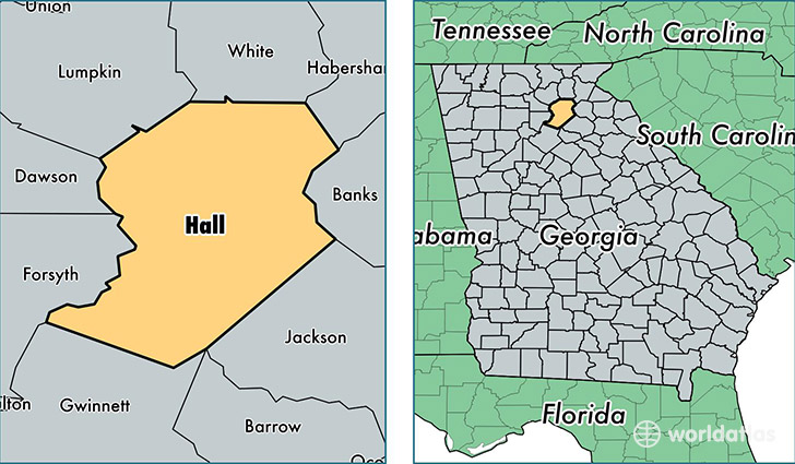
Hall County is a county equivalent area found in Georgia, USA. The county government of Hall is found in the county seat of Gainesville.
With a total 1,111.87 sq. km of land and water area, Hall County, Georgia is the 2451st largest county equivalent area in the United States. Home to 190,761 people, Hall County has a total 68781 households earning 50853 on average per year.
Hall County, Georgia - Quick Facts
| FIPS Code | 13139 |
| Area Codes | 770 |
| Time Zone | EST |
| Major Cities | Gainesville (population: 124,844), Flowery Branch (population: 32,965), Lula (population: 8,715), Oakwood (population: 8,158), Gillsville (population: 4,588), Clermont (population: 4,171) |
| Land Area | 73,653 sq miles |
| Water Area | 393 sq miles |
| Household Income | $50,853 |
| Housing Units | 68,781 |
| Median Home Value | $165,300 |
| High School Grads | 79% of population |
| Holders of Bachelors Degrees | 23% of population |
| Retail Spending | $12,417 per capita |
| Food & Accomodation Sales | $224,064 per capita |
This page was last updated on June 30, 2016.