This Cascade Volcano All-American Road Is the Ultimate US Road Trip
A recent study by the University of Oregon's Department of Earth Sciences determined that the American portion of the Cascade Range includes 2,835 volcanoes, about ten of which can be seen along the 500-mile Volcanic Legacy Scenic Byway. The All-American Road essentially traces the spine of this volcanic region in Northern California and Southern Oregon and is divided into 11 regions, with access points along the way for a customizable journey if you're limited on time or prefer to break it into smaller sections. Higher-elevation segments within Crater Lake and Lassen National Parks sometimes close due to heavy snow, while southern entrances and access to low segments typically remain open, offering seasonal beauty year-round. You can usually expect the full route to be open from June to October.
The main route for this scenic byway explores volcanic landscapes between Crater Lake National Park in Oregon and Lassen Volcanic National Park in California, which equates to about 16 hours of travel end-to-end. Driving "volcano-to-volcano," you will face the ancient beauty of its massive and unique geological features, including geothermal areas and lava flows. Be sure to allow stops to take photos at overlooks, enjoy picnics with a view, stretch your legs on short hikes, and spend a night or two in some of the charming towns along the way.
Volcanic Legacy Scenic Byway Overview

The Volcanic Legacy Scenic Byway runs directly through and alongside the Cascade Range, just east of and parallel to I-5, the major north-south freeway in Oregon and California. While many prefer to start south at Lassen Volcanic National Park and work their way north, a route that provides a classic progression and connects major volcanoes like Mount Shasta and Crater Lake, traveling southbound is a wonderful way to observe wildlife, chase the fall colors, and escape the cold.
The Oregon portion follows lakes, diverse wetlands, agricultural landscapes, and dense forests, passing the brilliant Mount McLoughlin en route, a dormant, steep-sided stratovolcano. Within Crater Lake National Park, Crater Lake is the deepest lake in the US and one of the deepest in the world. Filled almost entirely by snowfall, the cold lake is also one of the world's clearest, offering iconic views and access to overlooks along the Rim Drive. The national park also encompasses dramatic cliffs, ranging in elevation across diverse habitats, an array of wildlife, and heavy winter snows.
As for California, the Golden State has plenty in store, from Mount Shasta and an abundance of waterfalls to recreation by Medicine Lake, hot springs, caves, and stunning views of Lassen Peak. The otherworldly Lava Beds National Monument also offers extensive exploration over 46,000 acres along the byway. Travelers can explore more than 800 lava tube caves, which, like many features of this rugged volcanic landscape, reveal the region’s fiery past through one of the largest concentrations in North America.
Crater Lake & Crater Lake National Park, OR

The 183,224-acre Crater Lake National Park in Southern Oregon features mountain peaks, evergreen forests, and the 1,943-foot-deep lake, created from a massive eruption of the 12,000-foot Mount Mazama 7,700 years ago, forming a volcanic basin. The majestic caldera walls offer viewing points along the rim and access to Crater Lake itself for warm-weather swimming and boat tours in the deep blue water. In addition to the lake's natural rock pillar, named Phantom Ship for its likeness in foggy and low-light conditions, and Wizard Island, formed from a cinder cone, there's trout and salmon fishing, the Rim Drive, and trails through evergreen forests.
Though currently closed for major rehabilitation, the popular Cleetwood Cove Trail starts on the East Rim Drive, about 4.6 miles from the North Junction. As the only way to reach the lake's shore, it is an essential hike via a strenuous trail down to the water and a steep uphill return. Meanwhile, Vidae Falls is the most viewed waterfall at Crater Lake National Park, accessible year-round to observe its seasonal splendor. The 100-foot chute is just above the East Rim Drive, 3 miles east of the park's headquarters, and you can drive right up to it in the summer.
Chiloquin and Klamath Falls, OR

After leaving Crater Lake National Park, you can stop in the town of Chiloquin before tracing Upper Klamath Lake, where over 1 million birds migrate during peak season in the fall. Klamath Basin is the largest freshwater ecosystem west of the Great Lakes, where President Roosevelt greatly enjoyed fishing in the wetlands across six different national wildlife refuges.
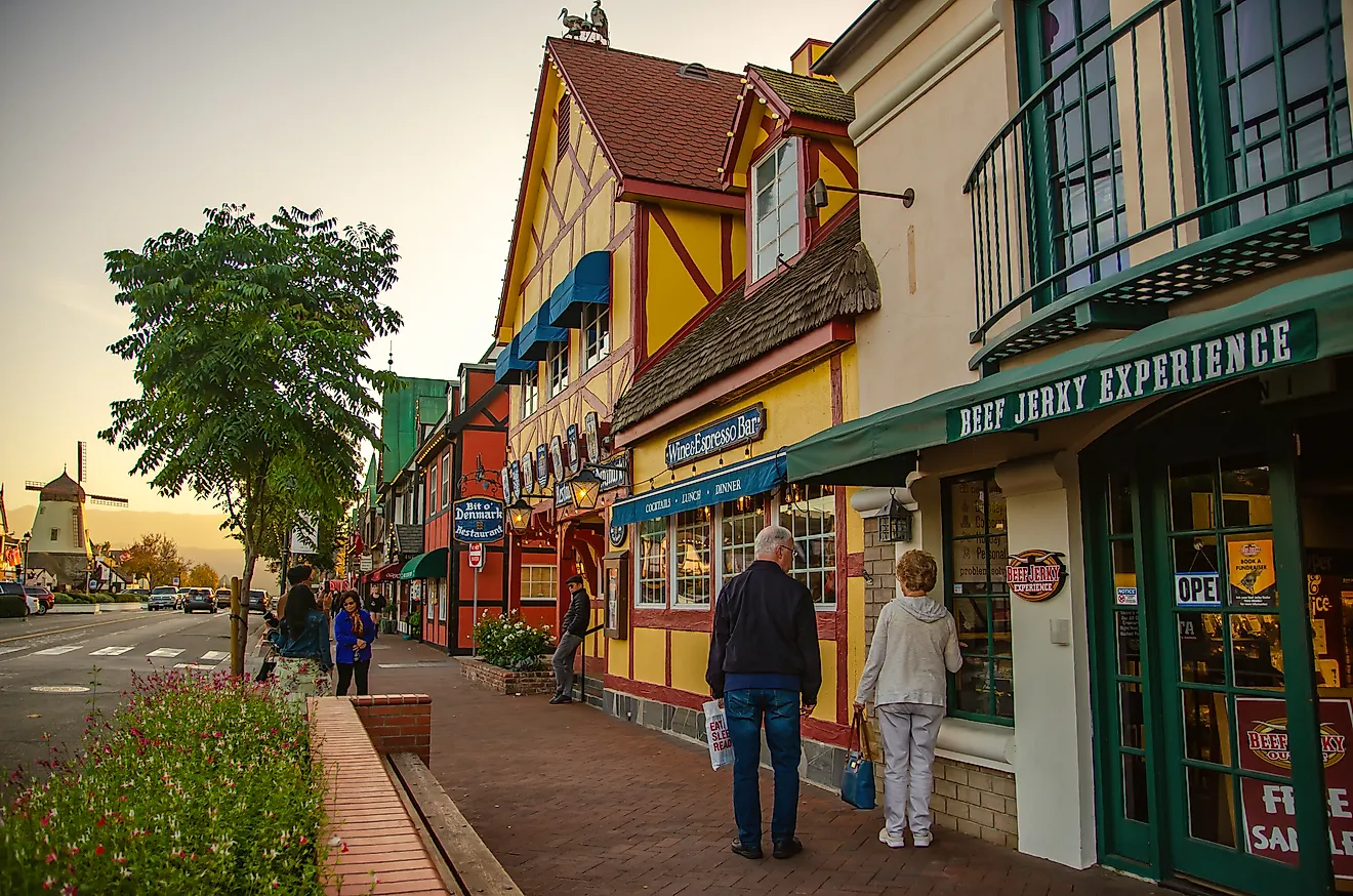
Klamath Falls sits at the lake's southern tip, with great dining options and all-budget lodgings, like the Cimarron Inn, perfect if you left late in the day or spent the bulk of your time exploring Crater Lake. Enjoy scenic views at Moore Park, featuring sports and picnic areas, marinas, fishing, and trails. About 20 miles from the stateline, some of the region's most striking volcanic features still lie ahead.
Lava Beds National Monument, CA

The Medicine Lake Volcano created this high desert wilderness over thousands of years, with each eruption shaping lava tubes, cinder cones, spatter cones, and collapsed craters. In addition to the lava beds themselves, the striking landscape features over 800 caves, Native American rock art, and Modoc War sites, plus amenities and trails like Schonchin Butte Lookout. The area is known for its underground adventures, from easy walk-through caverns to complex tunnels and challenging systems.
The Indian Well Campground is a convenient spot to set up for the night, amidst trails and many more caves. Dotted with sagebrush, juniper, and volcanic rock, the alien beauty of the lava fields stands stark against alpine lakes, wildlife refuges, and towering volcanic formations. The rugged wilderness park is characterized by otherworldly terrain, offering a diverse insight into high desert wildlife and rich cultural history, all a legacy of its dramatic past and a vital part of the Volcanic Legacy Scenic Byway.
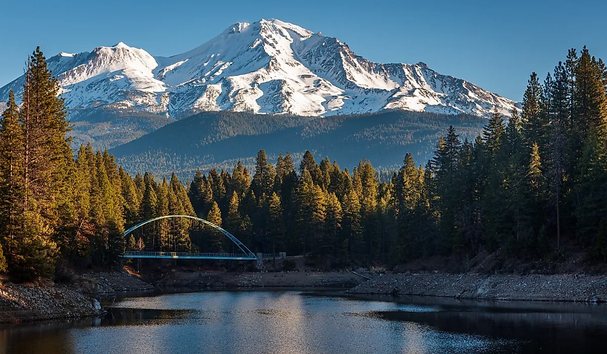
Mount Shasta, CA

As you follow the byway south-southwest, Mount Shasta becomes the rightful focus. A mighty, sacred, and potentially active stratovolcano, it is a hub for outdoor recreation while remaining monitored for volcanic activity. Known for its stunning beauty and spiritual significance, the 14,179-foot peak dominates Northern California, and small towns like Mt. Shasta offer uninterrupted views of the volcano, perennially crowned with snow and ice.
From climbing to hiking, skiing, and biking, there's no off-season to soak in Mount Shasta’s mystical beauty and the surrounding national forest. In winter, Mount Shasta Ski Park features over 600 skiable acres and 38 trails, offering unique and uncrowded skiing and riding through a winter wonderland of lava buttes and bowls, plus the new Gray Butte quad lift carrying skiers up to 7,500 feet.
Summer travelers enjoy lighter hikes and the delicate high-alpine wildflowers in Panther Meadows, and a trail from the Panther Meadows campground leads to the summit of Gray Butte for a full-frontal view of Shasta. Meanwhile, the pine-rimmed Lake Siskiyou offers warm water for swimming and water sports, with rentable kayaks, stand-up paddleboards, and patio boats at Lake Siskiyou Camp Resort Marina.
McCloud Falls, CA

Just past Mount Shasta, discover the majestic beauty of McCloud Falls, a series of three distinct waterfalls within walking distance of each other. The Volcanic Legacy Scenic Byway offers turnoffs for each of the three tiers leading to parking areas and short walks, including paved paths and stairs to viewing areas.
The quiet river gathers its energy into a massive rock chute at the Upper Falls, charging the waterfall down into a pool far below. Middle Falls spills in a delicate sheet over a lava cliff into a large pool, while Lower Falls is a small chute with a pool below. Travelers in the summer enjoy dipping their feet or even submerging in the chilly water, or simply picnicking by the river's edge.
McArthur-Burney Falls, CA

Back at the steering wheel for another 35 miles, the namesake chute within McArthur-Burney Falls Memorial State Park is directly off the scenic byway, specifically the portion that runs along California Highway 89. You can hear the falls from the parking lot, and there are accessible paths and lookouts for initial views. A short, paved trail with some switchbacks will take you down to the base of the 129-foot-tall, extensive, fern-draped cascade, starkly lit against the porous, black basalt.
Surrounded by an overlook and greenery, NorCal's Burney Falls dispels over layers of volcanic rock, most intense during the spring peak snowmelt. Early April through October is the perfect time to visit, and the weather is ideal for exploring the additional five miles of hiking trails through the park. Moreover, the nearby campground offers rest with more than 100 sites and 24 cabins for those traversing the Pacific Crest Trail, or if you crave a rustic overnight experience to break up the drive.
Lassen Volcanic National Park, CA

Just under an hour south, your final destination of the road trip is directly across from Manzanita Lake. Established in 1916 after Mount Lassen's last eruption, Lassen Volcanic National Park protects the southernmost active volcano in the Cascade Range. The centerpiece, Lassen Peak, is a landmark 10,460-foot active volcano with a popular hike and climb to the mountain summit.
Covering over 100,000 acres, travelers have access to 150 miles of trails, camping amenities, a snow park, a lava tube, and more. Jagged peaks tower over wildflower meadows, clear mountain lakes, and steaming fumaroles from the Earth's crust. These "ground vents" are found near volcanoes, releasing steam and volcanic gases typically from groundwater heated by magma below.

Bumpass Hell is a popular hike, open in the late summer and fall, to the park's largest hydrothermal area. For those not keen to hike, Sulphur Works is right along Lassen Peak Highway for an up-close geothermal experience, particularly the boiling mud, trance colors of the volcanic salts, and steam rising against the bright blue summer sky.
In addition to Manzanita Lake Campground, Mill Creek Resort is minutes from Lassen National Park's southwest entrance, while St. Bernard Lodge, about half an hour south, is a perfect base to end your road trip, offering comfortable rooms and hearty meals in rustic lodgings.
The Volcanic Legacy Scenic Byway is a journey filled with destinations. From cobalt-blue calderas to steaming fumaroles and fern-lined waterfalls, the Volcanic Legacy Scenic Byway delivers a front-row seat to the forces that shaped the Cascades. Whether you tackle the full route or savor it in sections, this volcano-to-volcano journey blends deep geologic history with small-town charm and outdoor adventure, making for an unforgettable drive through one of the most dramatic landscapes in the American West.