Maps of Malawi

Malawi, located in southeastern Africa, is one of the smaller nations in the continent and covers an area of 118,484 sq. km. Completely landlocked, Malawi's main body of water is the enormous lake from which the nation gets its name. For access to the ocean, it relies on rail lines that run into port cities of Mozambique. Despite being surrounded by neighboring countries, it only shares 3 borders—a very small one with Tanzania and two others with Mozambique and Zambia.
The country can be divided into four physiographic regions. These are the Great Rift Valley, the central plateau, highland region, and isolated mountains.
The Great Rift Valley traverses Malawi from north to south. As marked on the physical map of Malawi, this deep hosts Lake Malawi, the third-largest lake in Africa and one of the nation's most famous landmarks. The Shire River flows from the south end of that lake and joins the Zambezi River 249 mi (400 km) farther south in Mozambique. In the extreme south, the elevation is just slightly above sea level. It is there that Malawi's lowest point sits at the junction of the Shire River and the border of Mozambique at 37 m.
Plateaus can be found in the west and east of the Shire River. Generally between 900 and 1,200 m)above sea level, the two largest plateaus are the Nyika Plateau and the Shire Highlands. In the north, the Nyika Uplands rise as high as 2,600 m.
The highland region, located in the south of the country is home to many hills and valleys. As the Shire River continues south, the land rises to an elevation of 1,600 m, and eventually to the country's highest point, Sapitwa Peak at 3,003 m near the Mozambique border. It has been marked on the map with a yellow upright triangle.
Isolated mountains dot the western half of the nation. Located not far from the capital city of Lilongwe, Ntchisi Mountain, and Chipata Mountain dominated the landscape. This region is the most heavily populated and contains the largest cluster of cities and towns.
Regions and districts of Malawi Map

Malawi is divided into three regions with 28 districts. The regions are Northern, Central, and Southern. In alphabetical order, the districts are as follows: Balaka, Blantyre, Chikwawa, Chiradzulu, Chitipa, Dedza, Dowa, Karonga, Kasungu, Likoma, Lilongwe, Machinga, Mangochi, Mchinji, Mulanje, Mwanza, Mzimba, Neno, Ntcheu, Nkhata Bay, Nkhotakota, Nsanje, Ntchisi, Phalombe, Rumphi, Salima, Thyolo, and Zomba.
Mzimba in the Northern region is the largest district by area (10,619 sq. km). Lilongwe in the Central District that houses the national capital of Lilongwe is the most populous one.
Where is Malawi?

Malawi is a landlocked nation in southeastern Africa in the Southern and Eastern Hemisphere regions of the Earth. It is bordered by three countries. Mozambique bounds it on the east, south, and southwest. Tanzania borders it to the north and northeast while Zambia is located to the west.
Malawi Bordering Countries: Mozambique, Zambia, Tanzania.
Regional Maps: Map of Africa
Outline Map of Malawi


Key Facts
| Legal Name | Republic of Malawi |
|---|---|
| Flag |
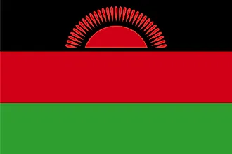
|
| Capital City | Lilongwe |
| 13 58 S, 33 47 E | |
| Total Area | 118,484.00 km2 |
| Land Area | 94,080.00 km2 |
| Water Area | 24,404.00 km2 |
| Population | 18,628,747 |
| Major Cities |
|
| Currency | Malawian kwachas (MWK) |
| GDP | $7.67 Billion |
| GDP Per Capita | $411.55 |
This page was last updated on December 7, 2023