Largest Islands Of Europe By Area
Europe’s geography features many islands of varying sizes. The continent has some of the world’s biggest islands like Great Britain and Iceland that rank as the 9th and 18th largest islands in the world respectively. Some of Europe's islands like Iceland and Cyprus are sovereign nations. The largest European islands by area are as follows:
- Great Britain
- Iceland
- Ireland
- Severny Island
- Spitsbergen
- Yuzhny Island
- Sicily
- Sardinia
- Nordaustlandet
- Cyprus
1. Great Britain - 229,848 Km2

The island of Great Britain is situated in the Atlantic Ocean to the northwest of mainland Europe. The island has an area of 229,848 km2 and a population of about 61 million people. The island is the world’s ninth-largest island by area and the third-largest by population. The island of Great Britain is part of the British Isles, an archipelago that also includes the island of Ireland and other surrounding islands. The island experiences a maritime climate with little variations in temperature all year round. Politically, the island is part of the United Kingdom and contains most of England, Scotland, and Wales.
2. Iceland - 101,826 Km2

Europe’s second-biggest island is Iceland, located in the North Atlantic Ocean. Iceland’s population of 332,529 people live in an area of 101,826 km2. The geography of Iceland is highly varied and features mountains, glaciers, waterfalls, lava fields, and more. The island is both geologically and volcanically active. Tundra climate prevails over the country.
3. Ireland - 84,421 Km2

Ireland, Europe’s third-biggest island, is located in the North Atlantic Ocean. Politically, the island is divided into the sovereign nation of Ireland and Northern Ireland, a part of the UK. The total area covered by the island of Ireland is 84,421 km2. The human population of the island is 6,572,728. The island has a central plain surrounded by low-lying mountains. Several navigable rivers run through the island. The mild oceanic climate here supports lush vegetation.
4. Severny Island - 47,079 Km2

A remote island located in the northern part of the Novaya Zemlya, an archipelago in the Arctic Ocean, Severny Island is Europe’s fourth-largest island by area. The island is part of the protected area of the Russian Arctic National Park. The Severny Island encompasses an area of 47,079 km2. The Severny Island Ice Cap covers nearly 40% of the total area of the island. Several other glaciers and ice caps are present on the Severny. The island served as a base for nuclear weapons testing between 1958 and 1961. Currently, a Russian army base is located here. The island also has a meteorological station and a harbor.
5. Spitsbergen - 37,673 Km2

The island of Spitsbergen is the fifth largest European island by area. It is also the only permanently inhabited island of the Norwegian archipelago of Svalbard. The island has coastlines along the Greenland Sea, the Norwegian Sea, and the Arctic Ocean. The total area of the island is 37,673 km2. Longyearbyen is the largest settlement and administrative center of Spitsbergen. Ice covers most of the island and an Arctic climate prevails in the region. Some research and mining posts are located here and are temporarily inhabited by researchers and miners, respectively. Polar bears, reindeer, seabirds, and marine mammals live in the region. These species are protected within the limits of six national parks that encompass a large area of Spitsbergen.
6. Yuzhny Island - 33,246 Km2

Europe’s sixth-largest island by area, Yuzhny Island is part of the archipelago of Novaya Zemlya in the Arctic Ocean. It is the archipelago’s southern island and covers an area of 33,246 km2. Yuzhny Island is separated from the larger Severny Island by the Matochkin Strait. The Barents Sea and the Kara Sea lie on either side of the island. Although the island served as the home of the Nenets people for centuries, the indigenous population of the island was cleared in the 1950s to make the island a base of nuclear testing and research. Yuzhny Island is an important nesting habitat for seabirds.
7. Sicily - 25,662 Km2

An autonomous region of Italy, Sicily is located in the Mediterranean Sea and is separated from mainland Italy by the Strait of Messina. The island is volcanically active with Mount Etna, Europe’s tallest active volcano being its most notable geographical feature. Sicily covers an area of 25,662 km2 and has a population of 5,048,553 people.
8. Sardinia - 23,949 Km2

An autonomous region of Italy, the island of Sardinia is Europe’s eighth largest island and the Mediterranean’s second-largest island. The island is located south of the Corsica island in the western part of the Mediterranean Sea. The Tyrrhenian Sea and the Sea of Sardinia, both part of the Mediterranean Sea, lie to the east and west of Sardinia, respectively. Cagliari is the capital city of Sardinia. The island has a total area of 23,949 km2 and a population of 1,656,003 people. The coastline of Sardinia is 1,849 km long.
9. Nordaustlandet - 14,443 Km2

With an area of 14,443 km2, Nordaustlandet is the second biggest island in Norway’s Svalbard archipelago. Vestfonna and Austfonna are two massive ice caps that cover most of the island. The remaining part of the island is covered by tundra. No permanent human settlements exist in Nordaustlandet. Reindeer and walruses are, however, found in large numbers. The entire island is part of the Nordaust-Svalbard Nature Reserve which is Norway’s largest preserve area.
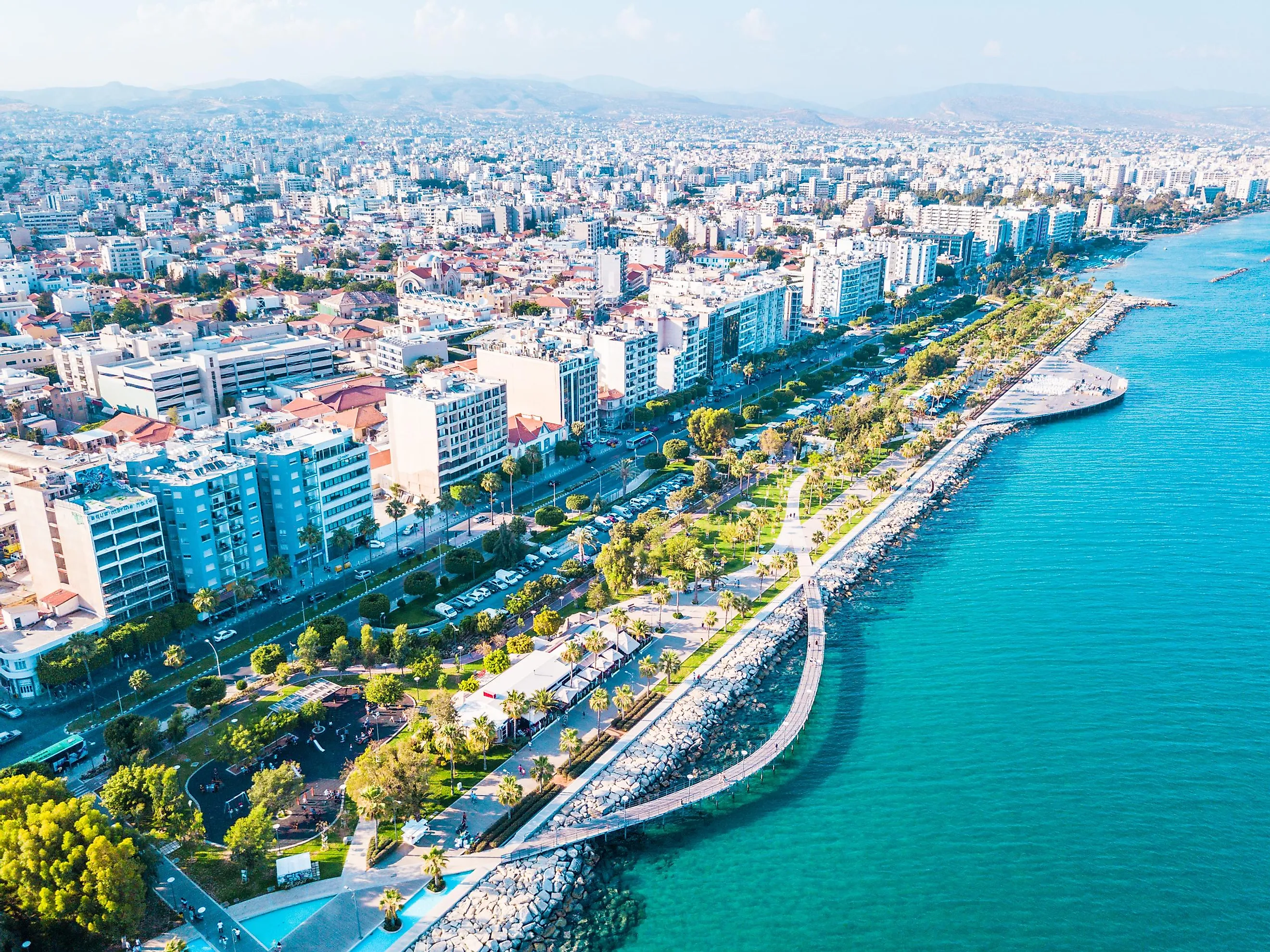
10. Cyprus - 9,251 Km2

With an area of 9,251 km2, Cyprus is Europe’s tenth biggest island in size. It is located in the eastern part of the Mediterranean Sea and is the Mediterranean’s third most populous island. The population of Cyprus, as estimated in 2016, was 1,170,125 people. The most notable features of the landscape of Cyprus are two mountain ranges, the Kyrenia Range and the Troodos Mountains. A central plain, the Mesaoria, lies between these two ranges. The 6,404 ft tall Mount Olympus is the highest mountain in this range.
Islands Of Europe With An Area Over 1,000 Km2
| Rank | Island | Area (km2) | Area (mi2) | Countries/Regions |
|---|---|---|---|---|
| 1 | Great Britain | 229,848 | 88,745 | United Kingdom ( England, Scotland, Wales) |
| 2 | Iceland | 101,826 | 39,315 | Iceland |
| 3 | Ireland | 84,421 | 32,595 | Ireland, United Kingdom (Northern Ireland) |
| 4 | Severny Island | 47,079 | 18,177 | Russia |
| 5 | Spitsbergen | 37,673 | 14,546 | Norway (Svalbard) |
| 6 | Yuzhny Island | 33,246 | 12,836 | Russia |
| 7 | Sicily | 25,662 | 9,908 | Italy |
| 8 | Sardinia | 23,949 | 9,247 | Italy |
| 9 | Nordaustlandet | 14,443 | 5,576 | Norway (Svalbard) |
| 10 | Cyprus | 9,251 | 3,572 | Cyprus Northern Cyprus United Kingdom (Akrotiri and Dhekelia) |
| 11 | Corsica | 8,741 | 3,351 | France |
| 12 | Crete | 8,312 | 3,209 | Greece |
| 13 | Zealand | 7,180 | 2,715 | Denmark |
| 14 | Edgeøya | 5,074 | 1,959 | Norway (Svalbard) |
| 15 | Vendsyssel-Thy | 4,685 | 1,809 | Denmark |
| 16 | Euboea | 3,655 | 1,411 | Greece |
| 17 | Mallorca | 3,640 | 1,406 | Spain |
| 18 | Kolguyev | 3,497 | 1,350 | Russia |
| 19 | Vaygach Island | 3,329 | 1,306 | Russia |
| 20 | Gotland | 2,994 | 1,156 | Sweden |
| 21 | Fyn | 2,984 | 1,152 | Denmark |
| 22 | Zemlya Georga | 2,821 | 1,089 | Russia |
| 23 | Saaremaa | 2,672 | 1,032 | Estonia |
| 24 | Wilczek Land | 2,203 | 851 | Russia |
| 25 | Hinnøya | 2,198 | 849 | Norway |
| 26 | Lewis and Harris | 2,179 | 841 | United Kingdom (Scotland) |
| 27 | Skye | 1,656 | 639 | United Kingdom (Scotland) |
| 28 | Soisalo | 1,638 | 631 | Finland |
| 29 | Lesbos | 1,630 | 629 | Greece |
| 30 | Senja | 1,586 | 612 | Norway |
| 31 | Graham Bell Island | 1,557 | 601 | Russia |
| 32 | Rhodes | 1,398 | 540 | Greece |
| 33 | Öland | 1,347 | 520 | Sweden |
| 34 | Barents Island | 1,288 | 497 | Norway (Svalbard) |
| 35 | Lolland | 1,243 | 480 | Denmark |
| 36 | Södertörn | 1,207 | 466 | Sweden |
| 37 | Zemlya Aleksandry | 1,095 | 423 | Russia |
| 38 | Gallya | 1,049 | 405 | Russia |


