The US Counties That Spans Two Time Zones
The US runs on nine standard time zones, and the lines between them usually track a state border closely enough that nobody notices. Then there are the nine counties where a single line splits the county itself, so a person can drive to the next town over and arrive an hour behind where they started. The U.S. Department of Transportation draws those lines, weighing where people shop, work, go to school, and tune their radios before it decides which hour a place will keep. What follows is a tour of all nine, and a pattern worth watching for along the way: again and again, the clock the government assigns and the clock people actually live by turn out to be two different clocks.
Gulf County, Florida

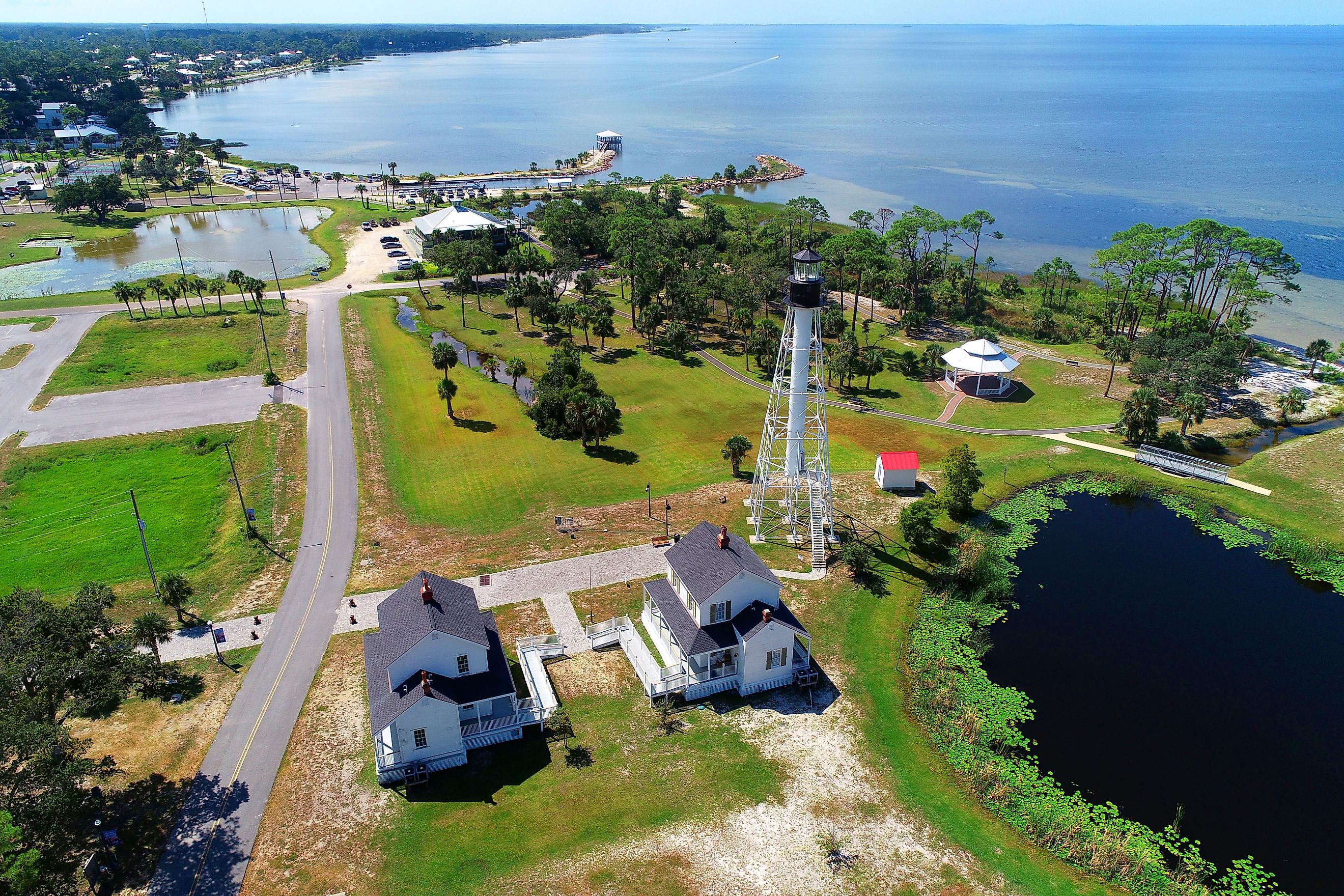
Almost all of Florida runs on Eastern Time, from Miami up through Jacksonville and across to Tallahassee, with only the western Panhandle an hour behind on Central. Gulf County is where those two halves meet, and it is the only county in the state cut by the seam. Port St. Joe and the beach communities along the southern coast run on Eastern Time. Wewahitchka and the piney country to the north run on Central. The dividing line is anything but tidy. Federal regulations run it up the Apalachicola River, then along the Jackson River and a stretch of the Intracoastal Waterway before it reaches the county boundary.
There is a reason the line bends coastward instead of holding a clean course inland. When the zones were first drawn along the Apalachicola, shipping and railroad interests pushed to keep the ports and the coast on the same clock as the East Coast markets they served, so the boundary jogs to fold Port St. Joe into Eastern Time. Locals have made their peace with the oddity and even had some fun with it. The welcome center in Port St. Joe keeps a row of clocks on the wall, one for Eastern, one for Central, and a couple more for the hours that only a vacation runs on.
Elko County, Nevada

Nearly all of Nevada sits on Pacific Time, and so does Elko County except for one stubborn corner. West Wendover, a casino town pressed right against the Utah line, runs on Mountain Time instead. Step across the state border and you are in Wendover, Utah, close enough that the two towns share stoplights and customers and function as a single community with a survey line drawn through the middle. The casinos draw most of their traffic from Salt Lake City, roughly 120 miles east and already on Mountain Time, while Reno and Las Vegas sit more than 400 miles the other way. Matching the clock to the customers made obvious sense, so town officials petitioned Washington to move it.
The Department of Transportation granted the request in 1999 and lifted West Wendover into the Mountain Time Zone, creating a small legal island inside an otherwise Pacific county. Residents of other northeastern Nevada towns do the same thing for the same reasons. Jackpot, up near the Idaho line, quietly runs on Mountain Time to stay in step with its neighbors across the border, though no rule requires it. West Wendover is the piece that did it by the book, and its landmark suits the story: a 63-foot neon cowboy named Wendover Will stands at the edge of town, and the caption lit up beneath him for westbound drivers reads, "Where the West begins."
Idaho County, Idaho

Idaho County is enormous, a rugged sprawl of canyons and backcountry across north-central Idaho, and the state's Pacific-Mountain divide cuts straight through it along the Salmon River. The clearest place to watch it happen is the bridge on U.S. 95 just north of Riggins. Cross the Salmon there and your phone jumps an hour: the town of Riggins is the northwesternmost outpost of Mountain Time, and Pacific Time takes over on the far bank. Drivers have known this spot for generations. The tied-arch span is marked on maps as the Goff Bridge, but almost everyone calls it the Time Zone Bridge, and rafters running the rapids upstream like to say they start a wave in one zone and finish it in another.
The divide tracks the way Idaho links up with its neighbors. The northern Panhandle has long done its business with Spokane and eastern Washington, both on Pacific Time, while the southern and eastern reaches of the state look toward Boise, Salt Lake City, and the Mountain Time interior. Idaho County sits on that hinge. Grangeville, the county seat, is on Mountain Time along with most of the county's land, and only the sliver north of the Salmon falls on the Pacific side.
Malheur County, Oregon

Oregon is a Pacific Time state with a single exception, and Malheur County is it. Most of this wide, high-desert county in the southeastern corner runs on Mountain Time, including Ontario, its largest city, and Vale, the county seat. Both sit close to the Idaho line, and Ontario in particular is wrapped into the orbit of Boise, half an hour up the Snake River and firmly on Mountain Time. Keeping the same clock as the metro area next door makes the ordinary business of commuting, shopping, and school pickups far simpler than living an hour out of sync with the place most people drive to.
Only a thinly populated southern slice of the county stays on Pacific Time, which means the official boundary runs across Malheur rather than around its edge. That arrangement makes it the only Oregon county divided between the two zones, and a clean example of federal timekeeping following the pull of a nearby city instead of the neat logic of a state line.
Cherry County, Nebraska

Cherry County is big enough to hold two time zones without much strain. It covers roughly 6,000 square miles of the Nebraska Sandhills, larger than the whole state of Connecticut, a grassy expanse of stabilized dunes and cattle range where, as locals like to note, the cows outnumber the people by a wide margin. Valentine, the county seat up near the South Dakota line, is on Central Time. The western two-thirds of the county, out toward Merriman, is on Mountain Time instead. The boundary between them does not follow a highway or a river. Federal regulations trace it along township and section lines, the surveyor's grid, as it crosses the dunes.
Cherry County sits on the broad seam between Central Time in eastern Nebraska and Mountain Time out west. Because so much of the land is ranch country and lightly settled Sandhills, the line runs through long stretches where the nearest neighbor is miles off, and the practical friction is small. Where it does matter, the effect is part of the everyday rhythm: when a rancher on the western end drives into Valentine for supplies or a livestock sale, the courthouse clock reads an hour later than the one back home.
Dunn County, North Dakota

Most of North Dakota is on Central Time, with the state's larger cities all in step, and only the southwestern counties slipping over to Mountain. Dunn County sits right on that transition. Its western and southern reaches run on Mountain Time while the rest is on Central, and the federal boundary that separates them is a patchwork rather than a single stroke, stitched together from county borders, township lines, roads, and the shape of the land itself. Dunn is one of several places where that ragged route passes directly through a county rather than skirting it.
This is ranch and oil country, part of the Bakken energy region, with communities scattered far apart across open range. The practical effect of the divide is quiet but real. A one-hour gap can sit between two ends of the same county, nudging work shifts, appointments, school events, and the timing of a long drive to a bigger town elsewhere in the state.
McKenzie County, North Dakota

McKenzie County is the largest in North Dakota by land area, a broad sweep of the state's western edge that takes in Watford City, a big share of the Little Missouri National Grassland, and the North Unit of Theodore Roosevelt National Park. The time-zone boundary crosses it too, leaving the northern part on Central Time and the southern part on Mountain. As in Dunn County next door, the line follows geographic features and survey markers instead of running the length of the county border.
Rivers shape both the scenery and pieces of the boundary here. The Yellowstone River joins the Missouri near the county's northwestern corner, and the Little Missouri carves the badlands to the south, the same broken country that drew a young Theodore Roosevelt to ranch here in the 1880s. The county is vast enough that a traveler can log serious miles without ever leaving it, and depending on the route, that drive can also mean crossing the legal seam between Central and Mountain Time.
Sioux County, North Dakota

Sioux County spreads along North Dakota's southern border, bounded by the Missouri River and the South Dakota line, and it is largely a Mountain Time county with a Central Time wedge on its eastern side. Fort Yates, the county seat and the headquarters of the Standing Rock Sioux Tribe, sits on the Central side. The boundary enters from the north and then follows State Highway 31 down toward the South Dakota line, carving out a relatively narrow Central band against the wider Mountain expanse to the west.
The current setup is younger than most. In 2003, at the county commissioners' request, the Department of Transportation moved the land east of Highway 31 out of Mountain Time and into Central. The reasoning behind it reveals how these lines really work: much of northern Sioux County had already been running on Central Time unofficially, out of step with the law but in step with daily life, and the 2003 order brought the legal boundary into line with what residents were doing anyway. Sioux County is proof that these boundaries are not carved in stone, and that they tend to move in the direction people have already gone.
Stanley County, South Dakota

Stanley County lies along the Missouri River in central South Dakota, directly across the water from Pierre, the state capital, and the Central-Mountain boundary runs through it. That produces the county's central oddity, which is easiest to see in Fort Pierre, the county seat on the western bank. By the letter of the law, Fort Pierre is in the Mountain Time Zone. In practice, almost everyone there runs on Central Time to stay aligned with Pierre, a bridge away, where they go for jobs, shopping, school events, and government business. The legal clock and the lived clock are simply two different things here.
That gap turns into local sport after dark. Bars in Pierre close at 2 a.m. Central, which is only 1 a.m. by Fort Pierre's Mountain designation, so a certain crowd crosses the river to squeeze in an extra hour, and a public transit service ferries a hundred or more people back and forth on a typical weekend. Fort Pierre's motto is "Where the West Begins," and on the question of what time it is, its residents have quietly decided the West can wait an hour. The federal line still runs through Stanley County on paper, which is what earns it a place among the nine.
The Line on Paper and the Time on the Wall

Run through the nine and the same lesson keeps surfacing: a time zone is a decision about people, not a fact about geography, and the official map is forever trailing the way communities actually keep time. West Wendover's officials asked to match Utah and got their wish. Fort Yates was already on Central before the law made it so. In Fort Pierre, residents set their own hour aside every single day. That tension is exactly why a tenth county gets mentioned so often and yet does not belong on the list. Culberson County, Texas, contains Guadalupe Mountains National Park, where staff and visitors run on Mountain Time because the park lies a short drive from the New Mexico line and the rest of the region does the same. Ask a ranger at the visitor center what time it is and Mountain is the answer, but it is an unofficial answer. The Department of Transportation places all of Culberson County in Central Time, so the park's hour is one the law never granted. That is the whole story of these boundaries in miniature, and the reason nine counties, not ten, are truly split in two.