6 Breathtaking Towns to Visit in The Pacific Northwest
Some of the most dramatic landscapes in the Pacific Northwest come with a town attached. These six towns are spread across Oregon, Washington, and Idaho, each wrapped around a setting of its own. Most face the Pacific. The rest reach inland, into the North Cascades and onto a glacier-carved lake so deep the Navy tests submarines in it. The coastal beaches stretch for miles under sea stacks and black basalt headlands. The payoff might be a wide beach at low tide or snow still on the peaks.
Yachats, Oregon

Overlooking the coast in Yachats, Oregon.
The rainforest meets the Pacific over a wall of black basalt at Yachats (say it YAH-hots), a small village on the central Oregon coast. Thor's Well is the centerpiece, a saltwater sinkhole in the rock shelf that looks like it is draining the whole ocean before spitting it all back out with the next wave. It is at its best in the hour or so around high tide, when the spray comes up hard enough to soak the front row. The same shoreline hides Spouting Horn and Cook's Chasm, sea caves that fire seawater straight up like geysers.
Just south of town, the Cape Perpetua Scenic Area packs old-growth forest and lava-rock coast into a few miles. A winding drive up the headland reaches the Cape Perpetua Overlook, the highest point reachable by car on the Oregon coast at about 800 feet, where a stone shelter from the 1930s frames a clear-day view stretching 70 miles down the shoreline. Inland, the Giant Spruce Trail leads to a 500-year-old Sitka spruce nearly 185 feet tall. Gray whales pass close offshore during the spring and winter migrations, and the tide pools open at low water.
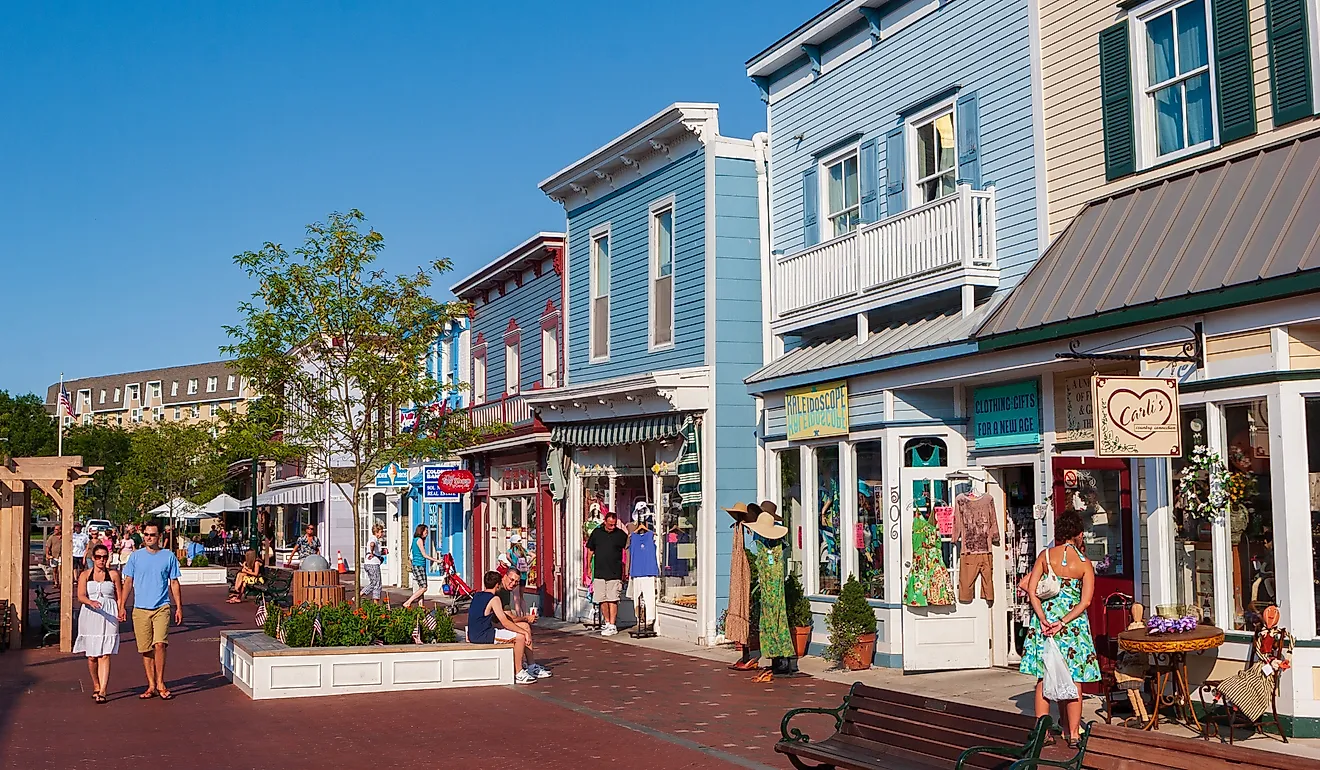
Manzanita, Oregon

Pinned between three big landmarks, the small oceanside village of Manzanita is one of the quietest on the north Oregon coast. The open Pacific is out front, the green headland of Neahkahnie Mountain climbs about 1,600 feet behind it, and the sheltered Nehalem Bay curls in to the south. The beach stretches about seven miles of firm sand down toward the bay, and even in summer it rarely feels crowded. Walkable Laneda Avenue is the spine of town, lined with nautically named side streets that dead-end at beach paths, plus seafood spots, shops, and a seasonal farmers market.
Just north, Oswald West State Park spreads across nearly 2,500 acres of coastal forest, with trails up Neahkahnie Mountain and Cape Falcon and a path down to the surf at Short Sand Beach. Neahkahnie was sacred to the Tillamook people, and a centuries-old legend says Spanish sailors buried treasure on its slopes that nobody has ever found. Down on Nehalem Bay, the catch is Chinook salmon, sturgeon, and steelhead, with clams to dig and crab pots to drop at low tide. The neighboring towns of Nehalem and Wheeler make an easy afternoon.
Cannon Beach, Oregon

Haystack Rock is the first thing in view from the sand, one of the most recognizable rocks in the country. It rises 235 feet right off Cannon Beach, close enough to walk out to at low tide. That is when the tide pools at its base fill with sea stars and anemones, and in spring and summer tufted puffins nest on the upper ledges. The rock and its tide pools fall inside a protected marine garden and wildlife refuge, so the rule is look but do not climb.
Local rules keep chain stores and chain restaurants out, so downtown is all family kitchens, independent shops, and makers selling their own pottery and prints. The beach itself stretches nearly four miles, with Tillamook Head closing off the south end, so even a packed summer Saturday leaves room to walk until the crowd thins. Bring layers. This is the Oregon coast, and the fog has opinions.
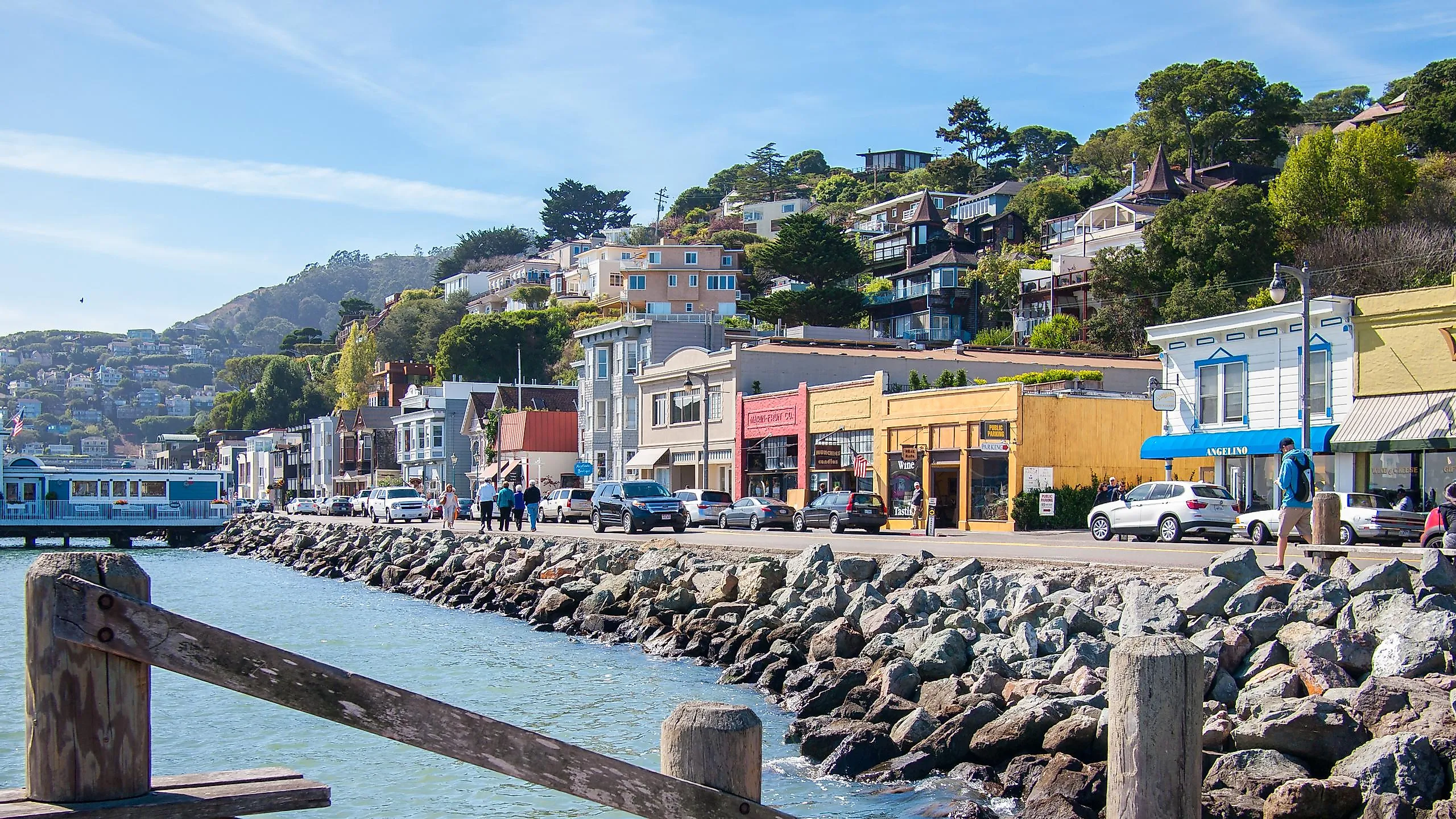
La Conner, Washington

A fishing town that turned into an art town without losing the fishing, La Conner lines the Swinomish Channel in the Skagit Valley. Fewer than 1,000 people live here, and the orange Rainbow Bridge over the channel is the shot everybody takes first. A few walkable blocks downtown pack in boutiques, art galleries, and three small museums, with waterfront restaurants looking out on the boats. On a clear day, Mount Baker, a Cascade Range volcano, rises across the water behind the whole scene.
The Skagit Valley Tulip Festival blankets the surrounding farmland through April, pulling hundreds of thousands of people out to fields that bloom in waves at gardens like RoozenGaarde and Tulip Town. Its quieter little sister, the La Conner Daffodil Festival, started in 2015 and turns March yellow a full month before the tulips open, against that same Mount Baker backdrop. March brings the daffodils and quiet back roads, April brings the tulips and the traffic.
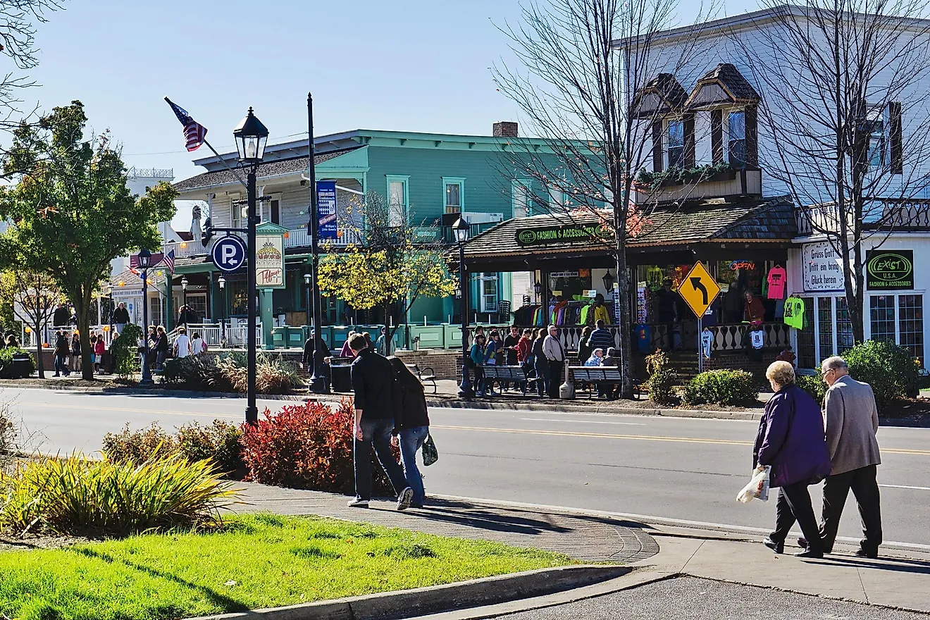
Winthrop, Washington

Street view of downtown Winthrop, Washington.
The Methow Valley is a sixty-mile glacial trench down the dry eastern side of the North Cascades, and Winthrop holds its upper end. The town went all in on a frontier look in the early 1970s, so downtown today is wooden boardwalks and false-front storefronts, home to about 500 people. Confluence Park, a block off the boardwalk, overlooks the spot where the Chewuch River meets the Methow. The peaks close in on every side, sage and brown down low, snow up top well into summer.
The North Cascades Highway climbs west out of town toward Washington Pass, where the granite spires of the Liberty Bell group stand over the road near 5,400 feet. The whole route closes over the passes each winter. North Cascades National Park is half an hour the same direction. In winter the valley grooms more than 100 miles of cross-country trails, one of the largest networks in North America, and the same paths carry hikers and bikers once the snow goes. Pearrygin Lake, just outside town, has swimming and boats in summer.
Sandpoint, Idaho

Lake Pend Oreille is the biggest and deepest lake in Idaho, and Sandpoint wraps around its north end. The water drops past 1,100 feet, glacier-carved and so deep the US Navy still tests submarines out on it. The Selkirk and Cabinet mountains rise on every side. Downtown packs locally owned shops and the 1927 Panida Theater into a few blocks, plus the Cedar Street Bridge, a covered marketplace built right across Sand Creek. When the weather warms up, City Beach has real sand and swimming water a short walk from the main drag, and the two-mile Long Bridge crosses the water with the whole town and the mountains lined up behind it.
Schweitzer, the largest ski resort in Idaho, climbs the ridge about 20 minutes above town, and the view from the top reaches clear across the lake to the peaks beyond. Snow piles up there into spring, and in summer the chairlift still turns for hikers, mountain bikers, and huckleberry pickers. Back down at the water, sailboats and paddlers share the lake with bald eagles working the shoreline. Rand McNally and USA Today named Sandpoint the most beautiful small town in America back in 2011.
Salt Water, Lake Water, Mountain Air
Manzanita is a barefoot walk on the beach with Neahkahnie Mountain behind it. Sandpoint is the top of Schweitzer 20 minutes above town, the lake and the next range of peaks laid out below. La Conner is a Skagit Valley fishing town with tulip fields blooming to the foot of a Cascade volcano. These towns set salt water against lake water, basalt headlands against alpine snow.