2026's 12 Most Scenic The Great Lakes Towns
The best Great Lakes scenery is in the towns nobody puts on the poster. These are the working harbors and quiet waterfronts that the big travel roundups skip year after year. A few sit on the open lake. Others line a river or a sheltered bay or look out at an island chain offshore. All of them stay small, and all of them keep the shoreline within a short walk. They stretch across five lakes and two countries.
Leland, Michigan

Fishtown still looks like a place built around fishing rather than a waterfront designed to imitate it. Weathered wooden shanties line the Leland River, with commercial boats tied up beside smokehouses, fish markets, and small shops. The buildings sit close together, the docks are narrow, and the river reaches Lake Michigan only a short distance away.
Van's Beach opens onto a broad stretch of Lake Michigan where rock hunters sometimes look for pieces of "Leland Blue." The material is not a natural stone but glassy slag left from the area's 19th-century iron-smelting industry. Beyond town, the Leelanau Peninsula shifts into vineyards, orchards, and winding roads with frequent lake views. Early morning is the clearest time to catch Fishtown as a working harbor, with boats moving and dock activity underway before the lanes fill with summer visitors.
Manistique, Michigan

Manistique is one of those rare Great Lakes stops with strong scenery on both the shoreline and the inland side. Along Lake Michigan, the town's boardwalk follows the water toward the Manistique River and the red East Breakwater Lighthouse. The square steel tower has marked the harbor entrance for more than a century, and its color stands out sharply even on gray days. A short drive inland leads to Kitch-iti-kipi at Palms Book State Park. Michigan's largest natural freshwater spring measures roughly 200 feet across and reaches about 40 feet deep. Its water is clear enough to reveal trout, submerged tree trunks, and sand shifting where groundwater pushes upward from below. Visitors cross the spring on a self-operated observation raft with openings in the deck for looking straight down. The raft moves slowly across the water, quiet enough for watching fish pass beneath it.
Port Austin, Michigan

Turnip Rock is the image most people associate with Port Austin. Wave erosion has narrowed the base of the limestone formation while leaving a much broader cap above, complete with trees growing on top. It stands offshore in Lake Huron, and because the neighboring shoreline is privately owned, visitors generally reach it by kayak or boat.
The paddle from Port Austin passes other sculpted rock features and small sea caves, though the trip depends heavily on wind and wave conditions. Lake Huron can turn rough quickly, so local outfitters and marine forecasts matter more here than a fixed sightseeing schedule.
The village itself sits at the tip of Michigan's Thumb, with a marina facing a wide horizon. A seasonal farmers market fills out weekends, and the offshore Port Austin Reef Light remains visible beyond the harbor.
Bay City, Michigan

Bay City stands along the Saginaw River, a few miles upstream from where it opens into Saginaw Bay and Lake Huron. The east-side downtown was spared the urban-renewal demolitions of the mid-20th century, so block after block of Victorian and Italianate commercial buildings still lines the streets near the water. Several historic bridges cross the river between the two banks, and the RiverWalk follows the east shore past Wenonah Park.
The river is the center of the scenery. BaySail's Appledore tall ships work the water downtown and sail out toward Saginaw Bay, and the marinas fill with pleasure craft through the warm months. Just north of town, Bay City State Park runs along the bay with a sandy beach and the boardwalks and observation towers of the Tobico Marsh wetland. Morning is the time to catch the low light on the river, with the bridges and old storefronts reflected in the water before the downtown crowds arrive.
Pentwater, Michigan

Pentwater keeps its village center, harbor, dunes, and Lake Michigan beach within an easy walk of one another. Charles Mears State Park sits at the edge of town, where a broad sandy beach meets the channel connecting Pentwater Lake with Lake Michigan. The piers extend into open water, and boats pass through the channel between the protected harbor and the lake.
Old Baldy provides the higher view. The wooded dune rises inside the state park, with a trail leading to an overlook above the shoreline and village. Back at street level, Hancock Street stays small-scale, with local shops and places to eat clustered near the Village Green. On summer afternoons, sailboats and fishing boats move through the channel only a few blocks from downtown, while the pier and beach stay in view beyond the harbor mouth.
Kelleys Island, Ohio

Long before ferries began carrying visitors to Kelleys Island, glacial ice was carving its most unusual attraction. At Glacial Grooves Geological Preserve, deep parallel channels cut into exposed limestone mark where rock and debris dragged across the island beneath moving ice. Walkways run alongside the formation, so the grooves are easy to examine at close range without stepping onto the protected surface. Much of the island suits bicycles or golf carts, with old quarry landscapes and wooded roads between stretches of shoreline. Kelleys Island State Park has a sandy swimming beach and trails, and the small downtown has places to eat near the ferry docks. Historic homes survive across the island from the community that grew up around limestone quarrying. The grooves are the most striking evidence of an even older force, the scraped bedrock still exposed beside the road.
Sackets Harbor, New York

Sackets Harbor is one of the few small Great Lakes towns where the shoreline itself frames a major chapter of American military history. During the War of 1812, the harbor became an important naval base on Lake Ontario. The Sackets Harbor Battlefield State Historic Site now preserves the ground where American forces defended the settlement, with exhibits and historic structures overlooking Black River Bay.
The military story continues at Madison Barracks, whose surviving buildings add another layer of 19th-century architecture to the village. Between the historic sites, older homes and quiet streets make walking more rewarding than a quick drive-through.
The harbor is still active, but today sailboats and recreational craft occupy the water once used by warships. From the battlefield lawns, Black River Bay stretches directly below, and the town's old strategic position becomes immediately clear.
Grand Marais, Minnesota

Artist's Point is the most recognizable shoreline in Grand Marais, a rocky finger of land beside the harbor. Wind, spray, and sudden shifts in weather leave it looking different from one walk to the next, even within the same day. The harbor lighthouse stands just beyond it, and fishing boats and sailboats move through the sheltered water below. Grand Marais also carries a creative identity rooted in the place rather than added for visitors. North House Folk School teaches traditional northern crafts, and the Grand Marais Art Colony, founded in 1947, has long drawn painters working near the lake. Just inland, the Gunflint Trail climbs away from town toward forests, inland lakes, and Boundary Waters country. Within a few miles, storefronts and harbor views give way to spruce, rock, and long stretches of northern Minnesota wilderness.
Fish Creek, Wisconsin

Fish Creek is almost inseparable from Peninsula State Park, which begins beside the village and runs along the Green Bay shoreline. Eagle Tower rises above Eagle Bluff, with a view over wooded islands and a broad sweep of water. Visitors can reach its observation deck by stairs or along an accessible canopy walk that climbs gradually through the trees.
The park has a rougher side as well. Eagle Trail drops below the bluff through limestone outcrops, forest, and springs, while Nicolet Beach is a much gentler place for swimmers and paddlers to spend the afternoon.
Outside the park, the harbor sits within walking distance of restaurants, galleries, and small shops, so the village stays connected to the landscape around it. On clear days, the tower view reaches across Green Bay toward Michigan's Upper Peninsula, with the village below the wooded bluff.
Bayfield, Wisconsin

Bayfield sits on a steep little slope above Lake Superior, so the water keeps reappearing between buildings as you move through town. The harbor is also the main departure point for Apostle Islands National Lakeshore, where boats head toward sandstone cliffs, historic lighthouses, and the island chain scattered offshore. Kayakers often aim for the mainland sea caves when lake conditions are suitable, while the Madeline Island Ferry runs another easy route onto the water.
Small galleries and cafes occupy the compact center, and farms outside town sell berries, apples, and other seasonal produce. Boat traffic and harvest season arrive together in late summer, and the mix keeps the peninsula feeling local even at its busiest. From the upper streets, rooftops fall away toward the marina, with the Apostle Islands low on the horizon beyond the sailboats.
Kincardine, Ontario

Bagpipes are part of Kincardine's summer rhythm. From the 1881 lighthouse above the Penetangore River, a lone piper plays the Phantom Piper tradition at sunset on summer evenings, as the light lowers over Lake Huron. On Saturdays in July and August, the Kincardine Scottish Pipe Band marches through downtown in Highland dress.
Station Beach sits beside the harbor, close enough that swimming, walking, and lighthouse visits can all happen without moving the car. The lighthouse also holds a seasonal marine museum, and Queen Street keeps much of its older streetscape. Murals and independent businesses fill the blocks behind the water, with Lake Huron only a few minutes away on foot. The town faces west, so the lighthouse, beach, and harbor all sit directly in the path of the evening light.
Port Stanley, Ontario

In Port Stanley, the beach is the main event. Main Beach runs along Lake Erie with a broad sandy shoreline and has held Blue Flag recognition for years, a mark of standards for water quality, safety, and environmental management. Seasonal lifeguards supervise designated swimming areas through the main summer period, while Little Beach is a smaller alternative across the harbor.
Port Stanley Terminal Rail runs heritage excursions from the historic station into the Kettle Creek valley, trading lake views for wooded countryside for part of the ride. Around the harbor, fishing boats and pleasure craft sit close to cafes and patios. The railway station, waterfront, and Main Beach are all close enough to reach on foot, so the village stays lively without spreading thin along the lakeshore.
Wellington, Ontario
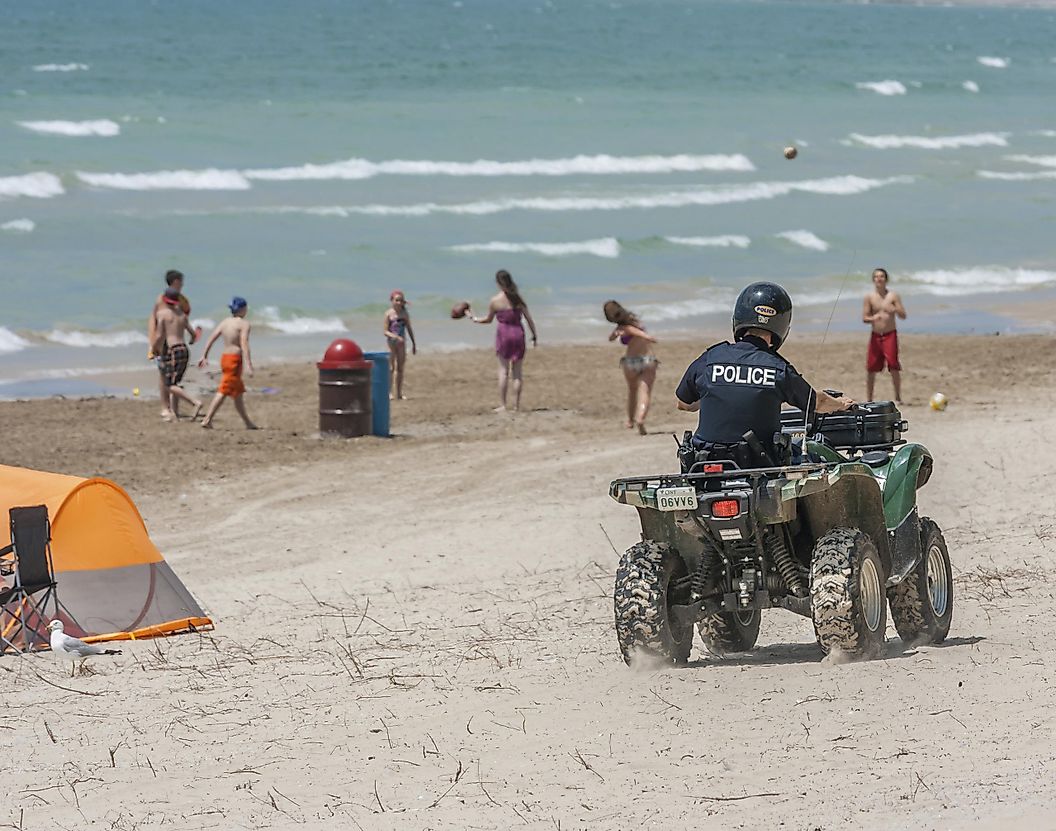
Wellington sits in the middle of Prince Edward County, with Lake Ontario right at the edge of the village. Wellington Rotary Beach and the waterfront are close to the center, and the Millennium Trail passes nearby on its route through farmland and wine country. Cyclists can leave the village for rural roads, galleries, and winery areas without committing to a long drive.
At Sandbanks Provincial Park, the landscape changes abruptly. Its baymouth dune system rises above long sandy beaches, one of the most distinctive natural settings on Lake Ontario. The Dunes Trail crosses sections of the fragile terrain on boardwalks and lookout points, a better sense of scale than the beach alone gives. Outlet Beach has a gentler entry into the water and is popular with families. From the dune overlooks, pale ridges roll toward wetlands on one side while Lake Ontario opens beyond the beaches on the other.
Planning A Great Lakes Route
These towns reward different kinds of trips. Bayfield, Fish Creek, and Pentwater put a walkable village center within reach of a harbor and a beach, which suits a slower family weekend. Port Austin, Kelleys Island, and Manistique lead with a single natural landmark, a sea stack, a glacial groove, a spring, each worth building a day around. Bay City, Sackets Harbor, and Kincardine add a layer of history and ritual to the shoreline, one with a nineteenth-century riverfront, one with a War of 1812 battlefield, one with a piper at sunset. The lineup covers both Great Lakes countries, so any one town can anchor a trip while the others fill out a longer route along the coast.