2025's 11 Most Scenic Montana Towns
Montana, the “Big Sky Country,” really lives up to its name with grand landscapes that are sure to captivate every traveler. From the peaks of the Rocky Mountains to significant waterways like the Missouri River, Montana is full of natural wonders. Within these landscapes are plenty of scenic towns to explore, each offering unique views of the Montana landscape and wilderness.
Livingston

Positioned along the Yellowstone River in south-central Montana is Livingston. With the Absaroka Mountain Range to the south of the town, and the Crazy Mountains to the north, this town is set in a valley surrounded by mountain views. Livingston Peak, sitting at 9,300 feet and south of the town, is visible from the main streets of Livingston.
Livingston is near Yellowstone National Park, just a 55-mile drive through the Paradise Valley. The proximity to the northern section of Yellowstone National Park means there are plenty of regional wildlife, including elk and various bird species, in the sprawling river valleys and foothills. Nearby National Forest Service land allows for a true escape from the crowds to soak up the scenic views of mountain peaks and lakes. Outdoor access is not lacking in the winter either, with Bridger Bowl Ski Resort within an hour's drive and cross-country skiing and snowshoeing trails located nearby.
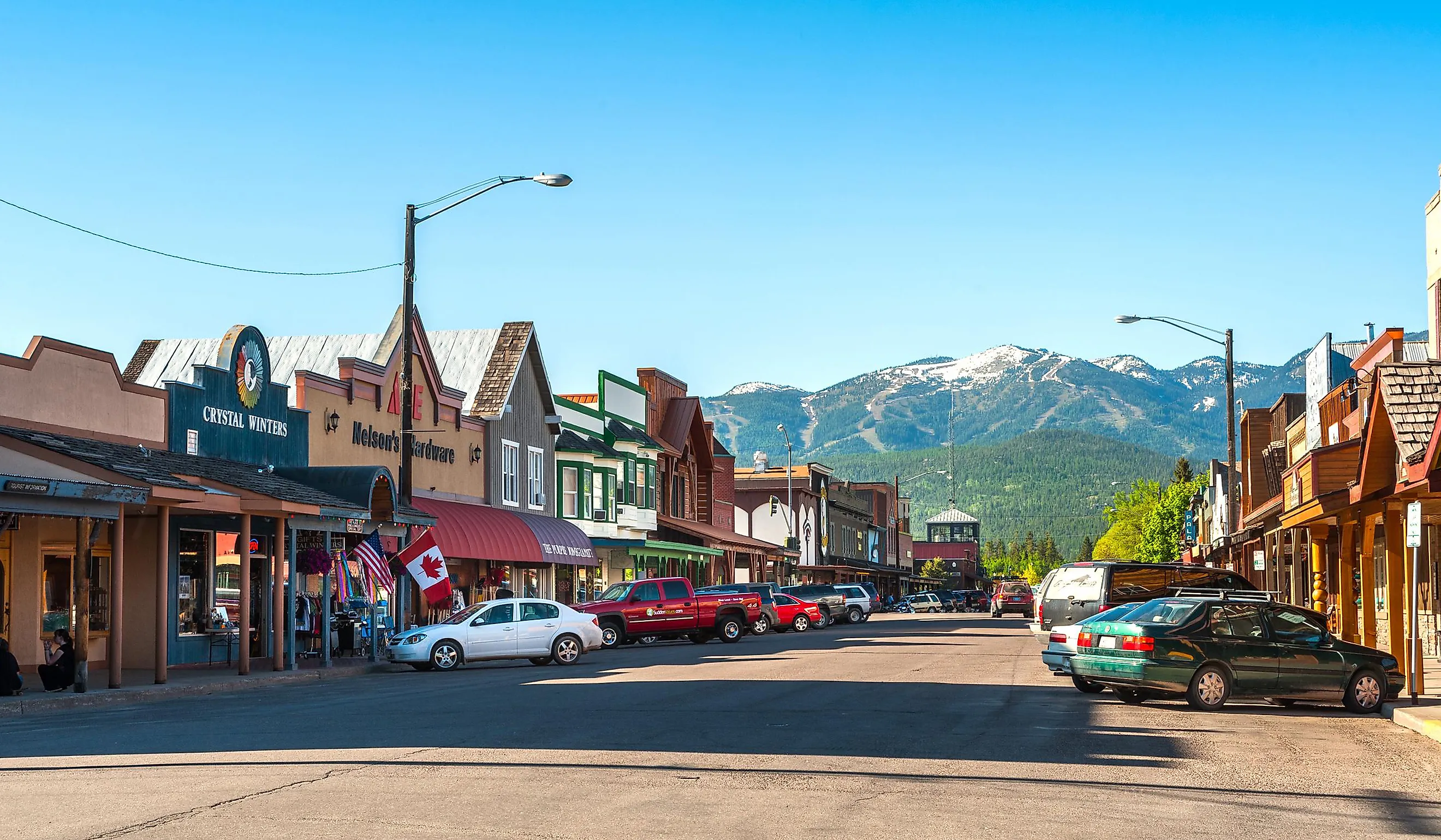
Whitefish

The town of Whitefish is located in NorthWestern Montana and sits at an elevation of 3,036 feet above sea level, giving it a dramatic mountain landscape. The town sits in the Flathead Valley and is surrounded by the Rocky Mountains. Whitefish Lake, a significant feature, lies adjacent to the town and spans approximately seven miles in length. The Whitefish River also flows through the area.
Just 20 miles from town is Glacier National Park’s west entrance. This national park has over 700 miles of hiking trails through forests, past waterfalls, and along the colorful rocky shores of Lake McDonald. The surrounding forests and mountain landscape are home to wildlife like elk and bears. Prominent geological formations within the park include numerous peaks and ridges, which are the result of extensive glacial erosion.
Whitefish Mountain Resort has skiing in the winter and over 20 miles of mountain biking trails in the summer. Both of these activities allow visitors to get up close and personal with the mountain terrain.
Big Sky

The town of Big Sky is within the Custer Gallatin National Forest and surrounded by several mountain ranges, including the Madison Range to the west and the Gallatin Range to the east. The Gallatin River flows through the canyon area of Big Sky.

The nearby Lone Peak has a summit of 11,166 feet, offering challenging hiking terrain with scenic views. For travelers looking to visit Montana in the winter, the Big Sky Resort has over 5,800 acres of skiable terrain as well as Nordic ski trails. Visitors can use the snowmobile, snowshoe, ice skate, and even dog sled here. In the summer, visitors can raft on whitewater on the Yellowstone, Gallatin, and Madison rivers. Yellowstone National Park is located approximately 45 miles south of the town. Offering yet another scenic escape for travelers to the area.
Helena

Helena, the state capital, has scenic views thanks to its location in a valley surrounded by the Rocky Mountains. With Mt. Helena and Mt. Ascension practically in its backyard, you can go from strolling downtown to mountain trails in minutes. For an exhilarating way to take in the scenery, visitors can utilize the 75 miles of dirt biking trails that wind through the area.

The Missouri River, a designated Blue Ribbon Trout Area, flows near Helena, offering fishing and other water sports like boating, kayaking, waterskiing, and wakeboarding. Hauser Lake provides accessible beaches close to town, while Holter Lake, a bit further out, is ideal for wildlife viewing. Don't miss the nearby Gates of the Mountains Wilderness, a unique geological formation of towering limestone cliffs carved by the Missouri River and one of the most recognized landmarks from the Lewis and Clark expedition.
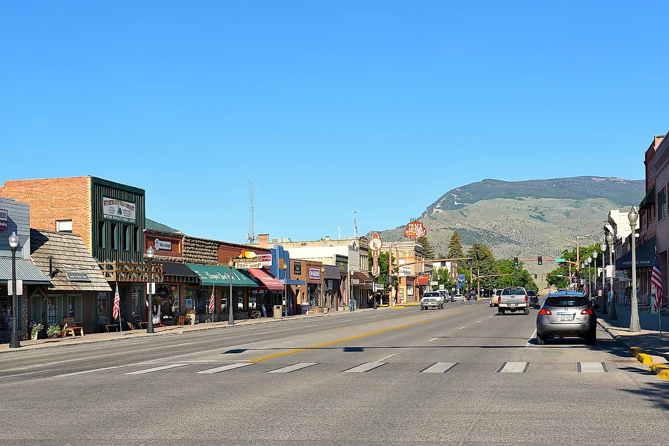
Red Lodge

At the base of the Beartooth Mountains, some of the highest peaks in Montana, lies the town of Red Lodge, a true gateway to outdoor adventure. This historic mountain town serves as the northern entrance to Yellowstone National Park via the legendary Beartooth Highway. Recognized as one of the most scenic drives in the United States, this 69-mile stretch of Highway 212 delivers breathtaking views of mountain terrain as it winds through high-elevation passes.
Surrounded by the vast Custer, Gallatin, and Shoshone National Forests, the area offers endless trails leading to pristine alpine lakes and sparkling mountain streams. As part of the Greater Yellowstone Ecosystem, keep an eye out for incredible wildlife like bighorn sheep and mountain goats.
Hamilton

Hamilton is located in the Bitterroot Valley and is surrounded by the Bitterroot Mountains and the Sapphire Mountains to the west and east, respectively. Because of its location, the town is surrounded by scenic mountain views. These mountains are part of the Rocky Mountain range.
This location has opportunities for hiking with trails that lead to creeks, lakes, waterfalls and even granite walls at the base of some canyons.

The Bitterroot Mountain Range includes Trapper Peak, a granite peak at 10,157 feet, the highest peak in the range. This mountain terrain includes canyons with creeks and lakes to view when hiking in the area. The hiking trails have a variety of options, including paths that lead to overlooks of these canyons, routes to lakes and waterfalls, and trails that follow creeks and pass fauna like huckleberries, ferns, and wildflowers.
Hamilton is also a place for cycling. For road biking, the valley's highways have views of the Rocky Mountains. For mountain biking, the two mountain ranges offer many trails, with some hiking trails also open to bikes.
Choteau

Choteau is unique because, unlike other valley-settled or high altitude towns, Choteau sits in a scenic area where the mountains first begin to rise from the plains.
The region offers a range of outdoor activities without the crowds found in larger national parks. For hiking, options include day hikes on Forest Service lands to places like Headquarters Creek Pass, Our Lake, and Reardon Gulch. This location is a habitat for animals such as grizzlies, moose, and elk. The Priest Butte Trail is a nearby walking path that leads to the top of Priest Butte. From the top, there are panoramic views of the Rocky Mountains to the west and the Priest Lake watershed to the east. This trail is open year-round to foot traffic. The region includes the Lewis and Clark National Forest and the Bob Marshall Wilderness Complex, which spans over 1.5 million acres and provides opportunities for hiking and camping.
Wildlife viewing is a major activity near Choteau. Freezout Lake is a destination for bird-watching, known for its population of geese, ducks, swans, and other birds. In winter, there is an opportunity for a variety of cold-weather sports. Teton Pass is available for alpine and backcountry skiing.
West Yellowstone

West Yellowstone is, as the name suggests, positioned at the western entrance to Yellowstone National Park. The town's elevation is 6,673 feet above sea level and the surrounding terrain consists of extensive national forest lands, including portions of the Gallatin National Forest and the Targhee National Forest. These forests border the park's geologically active areas, which feature a high concentration of geysers and hot springs. The Madison River flows near West Yellowstone.

The area supports populations of large native mammals, including bison and elk, which frequently inhabit the open valleys and thermal areas of Yellowstone National Park. The broader landscape features a combination of mountains, valleys, and canyons, shaped by volcanic and glacial processes. Observing the park's iconic wildlife and geological formations is a primary natural draw for this location.
Libby

The town of Libby is located in northwest Montana, south of the Kootenai National Forest. This forest, bordered by Canada to the north, has over 1,400 miles of trails for hiking and recreation. This area has two major rivers, the Kootenai and Clark Fork, and contains 141 lakes.
A primary feature is the Lake Koocanusa Scenic Byway. This 67-mile route follows the Kootenai River and Lake Koocanusa, providing year-round views. Another notable area is the Ten Lakes Scenic Area, a 15,700-acre wilderness on the Whitefish Mountains. This area was shaped by alpine glaciers and so has carved valleys, high basins, and lakes. The mountains here reach over 7,800 feet and the forest contains various trees and wildflowers, with huckleberries available for picking in spring and summer.

The nearby Cabinet Mountains Wilderness spans about 94,272 acres and includes soaring peaks like Snowshoe Peak, which reaches 8,738 feet. This range has high mountain trails and lakes, offering opportunities for backpacking and fishing. And the Turner Mountain Ski Area is 22 miles from Libby and has a 2,400-foot vertical drop for downhill skiing.
The character of these Montana towns is significantly shaped by their proximity to major mountain ranges, national and state parks, and features like the Yellowstone River and Flathead Lake. For those seeking the challenge of a mountain trail or the calm of a lakeside view, Montana provides travelers with ample opportunity to seek out scenic views. "Big Sky Country" is a place where diverse geography, abundant wildlife, and unique local character come together, creating a memorable experience for any visitor.