Which Countries Border Turkmenistan?
Turkmenistan is located in the western area of Central Asia, where it covers a total area of 189,660 square miles. Just over 7,015 square miles of this area consists of bodies of water. This country is considered the 4th largest by area of the countries that once made up part of the Soviet Union. Turkmenistan has a population size of over 5.66 million, the majority of whom identify as ethnic Turkmens.
The geographic terrain of Turkmenistan is primarily flat, with little variation in elevation, except in its southern region where mountains can be found. Aside from these mountains, most of this country is covered in a desert landscape that is filled with large sand dunes. Although Turkmenistan is located along the Caspian Sea, it is considered a landlocked country due to its lack of access to an open ocean. This country shares 2,321 miles of borders with 4 other countries: Uzbekistan, Afghanistan, Kazakhstan, and Iran.
Uzbekistan
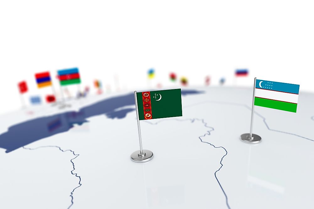
The border between Turkmenistan and Uzbekistan stretches for a length of 1,007.24 miles, making it the longest land border in Turkmenistan. It encompasses most of the northern border and all of the eastern border of this country. The entirety of this international border is marked by barbed wire fencing that is meant to prevent undocumented immigrants, drugs, and other illegal goods (like petroleum, for example) from illegally crossing the boundary. The government of Turkmenistan funded the construction of this barrier, which is disrupted by the Sarygamysh Lake. This body of water covers a surface area of 1,527 square miles, of which approximately 25% belongs to the territory of Uzbekistan. The portion of the lake located on the Turkmenistan side makes up part of the Kaplankyr Reserve.
Most reports suggest that the barrier between these two countries was completed in 2001, just one year before the President of Turkmenistan experienced an assassination attempt. The government of this country accused Uzbekistan of providing sanctuary to the guilty party. Until 2004, the governments of Turkmenistan and Uzbekistan remained in a dispute over the actual location of their international border, which largely continues to follow the state lines that were determined during the Soviet era. When Turkmenistan and Uzbekistan established their independence in 1991, any ethnic Uzbeks living on the Turkmenistan side of the border were relocated. This move, however, did little to prevent border disagreements.
These two countries share three roads, or border crossings: the Farap - Arat Highway, the Dashoguz - Shavat Highway, and the Kunya-Urgench - Khodjeily Highway.
Afghanistan
The border between Turkmenistan and Afghanistan runs for 462 miles along the southeastern edge of Turkmenistan. It separates this country from four of the provinces in Afghanistan: Faryab, Herat, Jowzjan, and Badghis. The first 62 miles of the eastern stretch of this boundary is marked by the Amu Darya River. Where this river takes a northern turn, the region between these two countries is primarily characterized by flat terrain, which gradually changes from what is known as the Karakum Desert of Turkmenistan to the plains area of Afghanistan. Another shorter section of this boundary is defined by the Murghab River.
These two countries once enjoyed a relatively peaceful relationship at the border. Today, however, the area between these two countries is experiencing some instability as the fighting and violence in Afghanistan continues to increase. Previously, these issues were concentrated in the central region of Afghanistan. Beginning in around 2013, the instability in Afghanistan has begun moving toward the border with Turkmenistan. In response, the government of Turkmenistan has acted to fund a number of border barrier projects between the two countries.
These two countries share one border crossing by roadway. It is located on the Serhetabat Highway of Turkmenistan, which becomes the Turgundi Highway in Afghanistan.
Kazakhstan
The border between Turkmenistan and Kazakhstan stretches for 235.5 miles along the western edge of the northern region of Turkmenistan. It represents the shortest land border in Turkmenistan. The boundary shared by these two countries extends into the Caspian Sea to the west of the two territories. Turkmenistan and Kazakhstan share a relatively peaceful international relationship. Unlike the situation in most post-Soviet era nations, these two countries have not reported any significant border conflicts. Since independence, both governments have maintained the previously established Soviet era borders.
In 2005, the governments of these two countries invested in projects to establish official border markers along the shared boundary. Once these markers were installed, neither of the governments believed it was necessary to continue funding border marking projects. The only section of the border that remained under minimal dispute was the exact location of the tri-point boundary between Turkmenistan, Kazakhstan, and Uzbekistan. Representatives of these three governments met in late 2017 to sign the official border agreement, known as the Treaty on the Junction Point on the State Border.
Turkmenistan and Kazakhstan share one border crossing highway between the Karakiya District of Turkmenistan and the Mangistau Region of Kazakhstan. It is known as the Temir Baba Highway on both sides of the border.
Iran
The border between Turkmenistan and Iran runs for a total length of 616.4 miles and is located along the southwestern region of Turkmenistan. This boundary represents the second longest land border for this country. The region between these two countries is characterized by rugged, granite mountain terrain with deep river valleys and arid mountain slopes. Most of the mountains in this area belong to the Turkmen-Khorasan Mountain range, which is also known as the Kopet Dag. The tallest peak in this range on the Turkmenistan side is Mount Rizeh, which stands at 9,646 feet above sea level to the southwest of the national capital. The area between these two countries is known for its seismic activity, which is caused by the tectonic movement under this mountain range. Additionally, this area experiences a cold desert climate, which means the winter season reaches colder than average temperatures.
These two countries share two border crossings along two highways: the Guadan - Badzhigiran Highway and the Serakhs Highway (known by the same name on both sides of the border).


