Which Countries Are Separated By The McMahon Line?
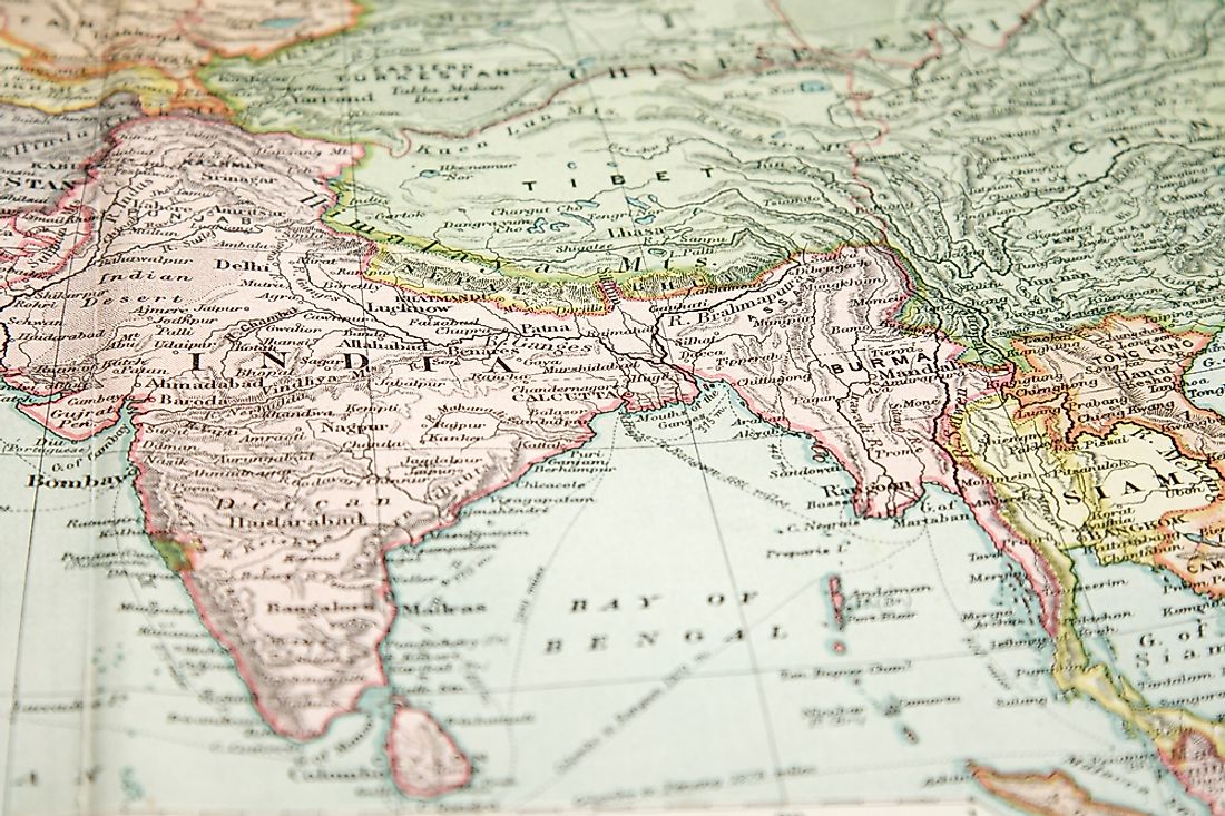
McMahon Line is the boundary between the Northeastern region of India and the Tibet (an autonomous region of China). The line stretches for 550 miles from Bhutan to 160 miles east of River Brahmaputra’s great bend along the Himalayas. India acknowledges the line as an international border while the Chinese government rejects it and the Simla Accord. China claims that Tibet was not an independent state and could not conclude any agreement.
History of the McMahon Line
The British’s effort to establish a border in this region was initiated by the discovery that Tawang was part of Tibet. Therefore they drew an Outer-Line which was to be the global border. The British finished all the agreements with Beijing regarding the Tibetan border with Sikkim and Burma, but Tibet rejects the border. The British invaded the region and forced the agreement on the Tibetans in 1904. However, they recognized China’s suzerainty over the territory and opted to negotiate with Tibet through a Chinese government mediator.
Britain renewed its interest in Tibet when China sent their soldiers to create an administration in the region. They responded by sending the British troops to the present-day Arunachal Pradesh in 1912, resulting in the Outer Line being moved towards the northern side, but Tawang remained in Tibet. Tibet declared their independence in 1913 after the fall of the Qing dynasty.
The representatives from Tibet, Britain, and China met at Simla and discussed the status of Tibet in 1913. The final Simla accord did not have any textual border description and only showed a map with lines separating Outer Tibet from Inner Tibet and Inner Tibet from China. The Chinese official did not sign the map although they had signed the earlier one that was agreed upon on April 27, 1914. The drafts stretched the line between China and Inner Tibet further to the southwestern side and elaborated the whole course of the Line. Only the British and Tibetan representatives signed a more detailed map.
The discussions of the detailed map and the line were done without China’s participation. After China rejected the Simla accord, the representatives from the two countries attached a note which denied the Chinese government rights in the treaty. The treaty had one condition which stipulated that Chinese government must acknowledge the Simla convention before Tibet accepted the boundary. Since China did not recognize the convention, the Tibetans consider the line to be illegal.
Countries Separated by the McMahon Line
China
China is an independent East Asian state and the most populous country on earth. It is one of the largest countries by area, whose territories include twenty-two provinces, four direct-controlled municipalities, and five autonomous provinces including Tibet. The McMahon Line separates Tibet from India. Tibet is the second biggest a provincial-level Autonomous area of the People’s Republic of China by area, occupying an area of about 460,000sq miles.
India
India is the most highly populated democracy on earth, the seventh biggest by area, and second most populous state right behind China. India is surrounded by Myanmar, China, Nepal, Bhutan, Bangladesh, and Pakistan. The McMahon line is on the northeastern part of India, and it separates Northeast India and China. Northeast India is the easternmost Indian region. The region shares over 3,220miles long international border with the neighboring countries including Tibet (867 miles), Myanmar (1,020 miles), Bhutan (283 miles), Nepal (60 miles) and Bangladesh (992 miles).


